


more stats
2.4 miles
Distance
132 ft
Climb
-1,520 ft
Descent
00:36:42
Avg time
-1,388 ft
Altitude change
4,278 ft
Altitude min
5,745 ft
Altitude max
5,666 ft
Altitude start
4,278 ft
Altitude end
-11.1%
Grade
-70.8%
Grade max
30.7%
Grade min
2,110 ft
Distance climb
2 miles
Distance down
118 ft
Distance flat
00:36:42
Avg time

Lockdown Details

  • Activities
    • Mountain Bike
    • E-Bike
    • Hike
    • Trail Running
  • Riding Area
  • Difficulty Rating
  • Voted Difficulty
    Red (4 votes)
  • Local Popularity
    90 in Mountain Biking heatmap [+]
    • 100 in E-Biking
    • 5 in Trail Running
    • 5 in Hiking
  • Global Ranking
    #131128 in Mountain Biking [+]
    • #52339 in E-Biking
    • #361869 in Trail Running
    • #351918 in Hiking
  • National Ranking
    #9,950 in Mountain Biking · Italy [+]
    • #6,309 in E-Biking
    • #14,095 in Trail Running
    • #13,724 in Hiking
  • Hiking SAC Scale
    T1 Hiking
  • Trail Type
    Singletrack
  • Bike Type
    DH, AM, Fat
  • Direction
    Downhill Only[+]
    Popular Direction Shown
    • Downhill Only for E-Biking
    • Downhill Only for Trail Running
    • Downhill Only for Hiking
  • Physical Rating
    Moderate
  • Season
    may-oct
  • Alpine Trail
    Yes
  • Dogs Allowed
    Yes
  • eBike Allowed
    Yes up to Class 1
  • TTFs on Trail
    Drop
  • Year Opened
    2020

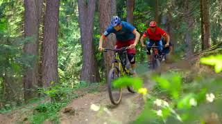
Natural trail from Piazzo Cavalli to Prabellino, 10 min. uphill from "Cappelletta Alpini" with italian flag, and after natural forest flow trail. You can found one drop with chicken line on the side.

Tags
AlpineDropsFlowy

Local Trail Association

Recent Activity on Trail

Past Week
  • 0 rides
  •  
6 Months
  • 9 rides
  • 22 miles avg distance
All
  • 20 rides
  • Last: Oct 16, 2026
update trails status or condition

Lockdown Trail Reports

Status:
on Nov 1, 2026
Variable
Avg: 4.22 (12 votes)
Your vote: 0

view (128)
close
      Directions to lockdown-321980 trailhead (46.249530, 9.871750)

      Photos

      5 more »
      mtb
      78 |
      Jul 3, 2023 @ 8:26am
      Jul 3, 2023
      report
      mtb
      87 |
      Nov 5, 2023 @ 9:12am
      Nov 5, 2023
      report
      mtb
      70 |
      Nov 5, 2023 @ 9:11am
      Nov 5, 2023
      report
      mtb
      82 |
      Nov 5, 2023 @ 9:10am
      Nov 5, 2023

      Videos

      1 more »
      Trail zone Caspoggio
      mtb
      0:35 | 213 | Jul 27, 2022 , Caspoggio

      Routes with this trail

      more »
      8 miles • 3,740 ft • 3 • Loop •
      Enduro Tour St.Antonio - Piazzo Cavalli.
      4.4 ★★★★★
      12 Ratings
      5 ★ 42%
      4 ★ 50%
      3 ★ 8%
      2 ★
      1 ★

      3 Reviews & Comments

      crisotop crisotop
      Some sections excellent, some bits in between a bit boring. Would rate „euro red“ with a couple of black bits. Hardest part is the climb to the start, after that it’s a great „enduro style“ trail with some rooty and rocky sections. Mellow gradient where you‘re able to ride with a bit of speed most of the time. Quite long and diverse - a cool ending to the alpe Prabello/Cavaglia traverse
      marionide marionide
      Molto bello. Il nome è lockdown in realta
      martiko
      Very nice alpine trail, a must in Caspoggio area. I suggest to start from the very top, even the connection to the proper descent is very enjoyable

      We hope you've been enjoying Trailforks!

      Create a FREE account to view all trail reviews and much more.

      • By bikeberninaasd BikeBernina & contributors
      • #321980 - 1,169 views

      Frequently Asked Questions

      ▼ Where is Lockdown located?
      Lockdown is located in Trail Zone Caspoggio, Caspoggio, Italy. It is part of the Trail Zone Caspoggio trail network. The trailhead is located at coordinates 46.24953, 9.87175.
      ▼ How hard is Lockdown?
      Lockdown is rated as Black difficulty. The physical rating is Moderate. The average grade is 11.1%.
      ▼ What is the elevation gain for Lockdown?
      Lockdown has 132 ft of elevation gain. The trail has 1,520 ft of elevation descent. The elevation ranges from 4,278 ft to 5,745 ft.
      ▼ Is Lockdown a point to point trail?
      Yes, Lockdown is a point to point trail. The direction is Downhill Only. The trail type is singletrack.
      ▼ How long is Lockdown?
      Lockdown is 2.4 miles long. The trail type is singletrack.
      ▼ Are dogs allowed on Lockdown?
      Yes, dogs are allowed on Lockdown. Please keep dogs on a leash where required and clean up after them.
      ▼ When is the best time of year to ride Lockdown?
      Lockdown is best visited during: may-oct.
      ▼ How do I access Lockdown? Where is the closest parking trailhead?
      The closest parking and trailhead locations to Lockdown are: View all parking locations in the area.
      ▼ How long does it take to ride Lockdown?
      Based on recorded activities, it takes an average of 37 minutes to ride Lockdown. The trail is 2.4 miles long. Actual times will vary based on fitness level, conditions, and pace. View recent activity logs for more details.
      ▼ How busy is Lockdown?
      Lockdown is a very popular trail. There have been 122 recorded activities on this trail. The trail has received 128 check-ins. View recent activity on this trail.

      Hit the Trail

      Open in App

      Get this trail on your phone instantly.

      open trail in app

      Download Trail

      Save to wishlist, Garmin & download.
      save the trail

      Find Related Routes

      Find routes and users activities that include this trail.
      find routes for this trail

      You must enter a description before submitting.

