


more stats
2.3 miles
Distance
65 ft
Climb
-846 ft
Descent
00:22:15
Avg time
-783 ft
Altitude change
4,627 ft
Altitude min
5,409 ft
Altitude max
5,409 ft
Altitude start
4,626 ft
Altitude end
-6.4%
Grade
-51.2%
Grade max
25.7%
Grade min
1,959 ft
Distance climb
2 miles
Distance down
427 ft
Distance flat
00:22:15
Avg time

Lower Stoney Details

  • Activities
    • Mountain Bike
    • Hike
    • Trail Running
  • Riding Area
    Banff National Park
    Banff, Alberta
  • Difficulty Rating
  • Voted Difficulty
    Blue (1 vote)
  • Local Popularity
    55 in Mountain Biking heatmap [+]
    • 50 in Trail Running
    • 20 in Hiking
  • Global Ranking
    #60476 in Mountain Biking [+]
    • #146517 in Trail Running
    • #158352 in Hiking
  • Provincial Ranking
    #945 in Mountain Biking · Alberta [+]
    • #2,791 in Trail Running
    • #2,963 in Hiking
  • Trail Type
    Singletrack
  • Bike Type
    AM, XC
  • Physical Rating
    Moderate
  • Dogs Allowed
    Yes
  • eBike Allowed
  • TTFs on Trail
    Jump
  • Land Owner
    Parks Canada

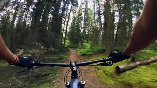
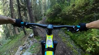
Starting from the Mt. Norquay ski hill, this fun rip is worth a look if you're in Banff. The trail is mostly a straight shot - it's fast and flows pretty well with a punchy short climb early on and a couple of pedaling sections to keep you on your toes, but generally it's a straight ripper downhill. Keep an eye out for a couple of jumps and lots of natural hits on the sides of the trail to jib off. It's Banff, so be aware of wildlife, hikers and other trail users.

Once you get down to the highway go through the gate and be sure to latch it tight behind you to keep wildlife off the highway. It's about a 5 minute pedal back along the highway to the Norquay Rd.

Access Info

From the Norquay main parking lot: ride northwest out of the parking lot past the day lodge, and follow a dirt/grass trail/road along the edge of the trees [trees are on your right] to the Cascade Amphitheatre Trail [turns right into the trees near the bottom of the Spirit chairlift]. The Cascade trail crosses Stoney - take a left.

Tags
Jumps

Recent Activity on Trail

Past Week
  • 0 rides
  •  
6 Months
  • 10 rides
  • 13 miles avg distance
All
  • 89 rides
  • Last: Oct 17, 2026
c1c2c3c4
January
February
March
April
May
June
July
August
September
October
November
December
update trails status or condition

Lower Stoney Trail Reports

statusdatedescription
Sep 13, 2026 @ 3:35pm (America/Creston)
Sep 13, 2026
Tree down at the beginning of the descent and another down near the first punchy climb early on.
Sep 13, 2026 @ 12:41pm (America/Creston)
Sep 13, 2026
A few trees are down, no muck at all. Good riding.
Sep 9, 2025 @ 10:33am
Sep 9, 2025
May 18, 2024 @ 5:09pm
May 18, 2024
Lower Stoney mostly good to go. About 11 trees down though, some pretty big ones. A few lingering snow patches at the top and the ski run descent...
Sep 13, 2023 @ 8:22am
Sep 13, 2023
Beautiful trail! Very flowy but with some decent chunk on it. Definitely has potential to catch you out with roots and rocks coming right after...
more »
Status:
on Sep 13, 2026
Ideal
Avg: 4.21 (18 votes)
Your vote: 0

view (781)
close
      Directions to lower-stoney trailhead (51.208190, -115.601480)

      Photos

      9 more »
      mtb
      231 |
      Sep 17, 2022 @ 1:33am
      Sep 17, 2022
      mtb
      193 |
      Jun 11, 2022 @ 8:33pm
      Jun 11, 2022
      mtb
      207 |
      Jun 11, 2022 @ 8:33pm
      Jun 11, 2022
      mtb
      245 |
      Jun 11, 2022 @ 8:33pm
      Jun 11, 2022

      Videos

      4 more »
      Banff’s Hidden Gem Trail | Lower Stoney
      mtb
      7:16 | 300 | Oct 5, 2025 , Banff
      MTB TRAIL  LOWER STONEY  // MT.NORQUAY - BANFF
      mtb
      14:45 | 798 | Jul 25, 2021 , Banff
      Lower Stoney Descent
      mtb
      8:52 | 762 | Sep 9, 2019 , Banff
      youtuber Biking Stoney Squaw in Banff National Park
      mtb
      21:47 | 1090 | Aug 13, 2018 , Banff

      Trail Lists

      Routes with this trail

      more »
      ★ 1.0 • 162 miles • 19,314 ft • 106 • Loop •
      Think you've got what it takes to tackle this monster ride? This is the ultimate link-up of single track...
      4.3 ★★★★★
      18 Ratings
      5 ★ 56%
      4 ★ 28%
      3 ★ 11%
      2 ★
      1 ★ 6%

      3 Reviews & Comments

      BrettU1971
      Rode today. Really enjoyed my mountain bike ride down the trail. At the spirit chairlift, there is a trail going to your left with a snow shoe sign on it. That isn't the trail. The name Lower Stoney doesn't appear, just an arrow pointing you to the trail saying TransCanada Highway that way.
      ryancartiers ryancartiers
      Initial short easy climb, continues along the outskirt of mountain side, exposure on left for much of trail, although appears to be a long narrow corridor with good forward visibility, the mountain side growth can reduce awareness to the mountain side you're running along - you'll notice several gaps in trees where there's nothing beyond trail edge.
      Lots of rocks, roots & root steps to navigate, nothing too challenging, most will likely enjoy.
      End of trail: stay right for an easier exit, left for steeper.
      Exit through fence, make sure to close & secure with chains.
      Deinarson Deinarson
      It's basically a straight rip down the mountain back to the highway. Theres very little modification, (berms, terrain features etc) done to the trail the make it mtb specific or extra fun. You mostly track in a straight line and out your suspension through it's paces. Go for the view from the Stoney Squaw summit and let this be the reward for all your hard work.

      We hope you've been enjoying Trailforks!

      Create a FREE account to view all trail reviews and much more.

      • By canadakaTF Pro Trailforks & contributors
      • #8570 - 12,290 views

      Frequently Asked Questions

      ▼ Where is Lower Stoney located?
      Lower Stoney is located in Banff National Park, Banff, Alberta, Canada. It is part of the Banff National Park trail network. The trailhead is located at coordinates 51.20819, -115.60148.
      ▼ How hard is Lower Stoney?
      Lower Stoney is rated as Blue difficulty. The physical rating is Moderate. The average grade is 6.4%.
      ▼ What is the elevation gain for Lower Stoney?
      Lower Stoney has 65 ft of elevation gain. The trail has 846 ft of elevation descent. The elevation ranges from 4,627 ft to 5,409 ft.
      ▼ How long is Lower Stoney?
      Lower Stoney is 2.3 miles long. The trail type is singletrack.
      ▼ Are dogs allowed on Lower Stoney?
      Yes, dogs are allowed on Lower Stoney. Please keep dogs on a leash where required and clean up after them.
      ▼ How do I access Lower Stoney? Where is the closest parking trailhead?
      The closest parking and trailhead locations to Lower Stoney are: View all parking locations in the area.
      ▼ How long does it take to ride Lower Stoney?
      Based on recorded activities, it takes an average of 22 minutes to ride Lower Stoney. The trail is 2.3 miles long. Actual times will vary based on fitness level, conditions, and pace. View recent activity logs for more details.
      ▼ How busy is Lower Stoney?
      Lower Stoney is a moderately popular trail. There have been 803 recorded activities on this trail. The trail has received 781 check-ins. View recent activity on this trail.

      Hit the Trail

      Open in App

      Get this trail on your phone instantly.

      open trail in app

      Download Trail

      Save to wishlist, Garmin & download.
      save the trail

      Find Related Routes

      Find routes and users activities that include this trail.
      find routes for this trail

      You must enter a description before submitting.

