



Open in App
Get this trail on your phone instantly.

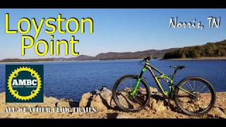
This 5.4 mile loop winds through the shoreline and ridges of Norris reservoir. Slope is gentle and trail was built to 48’’ wide to accommodate beginner bikers/hikers while still being very fun for advanced bikers/hikers. Trail surface drains quickly and can be ridden directly after and often during rain.
Hwy 61 E., left on Park Road, right on Forgerty, left on Fox-Mill Creek. Right on Ridge Circle, left on Loyston Point Road. Use Loyston Point Recreation Area in Google Maps.
| c1 | c2 | c3 | c4 |
|---|---|---|---|
January | February | March | April |
May | June | July | August |
September | October | November | December |


Service Road Atlas is a free to use, community-driven service for viewing and creating reports on the numerous back-country service roads around B.C. and Alberta.
Save the current map location and zoom level as your default home location whenever this page is loaded.
SaveWe hope you've been enjoying Trailforks!
Create a FREE account to view trail comments and much more.
You must enter a description before submitting.

