
more stats
1.3 miles
Distance
3 ft
Climb
-1,165 ft
Descent
00:21:35
Avg time
-1,162 ft
Altitude change
3 ft
Altitude min
1,166 ft
Altitude max
1,166 ft
Altitude start
3 ft
Altitude end
-17.3%
Grade
-66.9%
Grade max
6.9%
Grade min
171 ft
Distance climb
1 mile
Distance down
318 ft
Distance flat
00:21:35
Avg time

Lubenice DH Details

  • Activities
    • Mountain Bike
    • Hike
    • Trail Running
  • Riding Area
  • Difficulty Rating
  • Local Popularity
    5 in Mountain Biking heatmap [+]
    • 5 in Trail Running
    • 100 in Hiking
  • Global Ranking
    #144613 in Mountain Biking [+]
    • #315300 in Trail Running
    • #46689 in Hiking
  • National Ranking
    #446 in Mountain Biking · Croatia [+]
    • #733 in Trail Running
    • #99 in Hiking
  • Trail Type
    Mixed
  • Bike Type
    DH, AM
  • Direction
    Downhill Primary
  • Physical Rating
    Hard
  • Alpine Trail
    Yes
  • Dogs Allowed
    Yes
  • TTFs on Trail
    Rock Face, Rock Garden

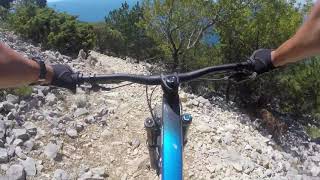
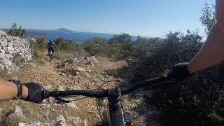
Rocky trail, hard and slippery.
Experienced riders only

This trail is unsanctioned.

Tags
AlpineRock gardensRock slabsRocky

Recent Activity on Trail

Past Week
  • 0 rides
  •  
6 Months
  • 0 rides
  •  
All
  • 1 rides
  • Last: Jun 24, 2023
update trails status or condition

Lubenice DH Trail Reports

statusdatedescription
Aug 8, 2025 @ 8:37am
Aug 8, 2025
Jul 14, 2025 @ 2:50pm
Jul 14, 2025
Rocky, steep, hikers, some markings not clear. Be aware the climb back is brutal as you’ll need to push your bike for 1h
Jun 24, 2021 @ 3:03am
Jun 24, 2021
Dry, rocky with few short unrideable sections, and many "trial" sections. Really black diamond:)especially way back haha.
more »
Status:
on Aug 8, 2025
Ideal
Avg: 3.98 (2 votes)
Your vote: 0

view (46)
close
      Directions to lubenice-dh trailhead (44.887340, 14.332150)

      Photos

      7 more »
      report
      mtb
      63 |
      Jul 14, 2025 @ 2:51pm
      Jul 14, 2025
      report
      mtb
      69 |
      Jul 14, 2025 @ 2:51pm
      Jul 14, 2025
      report
      mtb
      79 |
      Jul 14, 2025 @ 2:50pm
      Jul 14, 2025
      report
      mtb
      54 |
      Jul 14, 2025 @ 2:50pm
      Jul 14, 2025

      Videos

      3 more »
      Lubenice mtb
      mtb
      3:22 | 419 | Aug 23, 2022 , Cres
      20200719 Lubenice Sv. Ivan
      mtb
      11:50 | 667 | Feb 19, 2021 , Cres
      20200719 Lubenice Martinšćica
      mtb
      8:16 | 651 | Feb 19, 2021 , Cres
      4.0 ★★★★★
      2 Ratings
      5 ★
      4 ★ 100%
      3 ★
      2 ★
      1 ★

      1 Review & Comments

      Qwz662
      Tough and technical descent, but climb in summer with hot weather issues brutal.

      We hope you've been enjoying Trailforks!

      Create a FREE account to view all trail reviews and much more.

      • #341089 - 1,269 views

      Frequently Asked Questions

      ▼ Where is Lubenice DH located?
      Lubenice DH is located in Martinšćica, Cres, Croatia. It is part of the Martinšćica trail network. The trailhead is located at coordinates 44.88734, 14.33215.
      ▼ How hard is Lubenice DH?
      Lubenice DH is rated as Black difficulty. The physical rating is Hard. The average grade is 17.3%.
      ▼ What is the elevation gain for Lubenice DH?
      Lubenice DH has 3 ft of elevation gain. The trail has 1,165 ft of elevation descent. The elevation ranges from 3 ft to 1,166 ft.
      ▼ Is Lubenice DH a point to point trail?
      Lubenice DH is not a point to point trail. The direction is Downhill Primary. The trail type is mixed.
      ▼ How long is Lubenice DH?
      Lubenice DH is 1.3 miles long. The trail type is mixed.
      ▼ Are dogs allowed on Lubenice DH?
      Yes, dogs are allowed on Lubenice DH. Please keep dogs on a leash where required and clean up after them.
      ▼ How long does it take to ride Lubenice DH?
      The estimated time to ride Lubenice DH is approximately 22 minutes. The trail is 1.3 miles long. Actual times will vary based on fitness level, conditions, and pace.
      ▼ How busy is Lubenice DH?
      Lubenice DH is a less popular trail with lighter traffic. There have been 35 recorded activities on this trail. The trail has received 46 check-ins. View recent activity on this trail.

      Hit the Trail

      Open in App

      Get this trail on your phone instantly.

      open trail in app

      Download Trail

      Save to wishlist, Garmin & download.
      save the trail

      Find Related Routes

      Find routes and users activities that include this trail.
      find routes for this trail

      You must enter a description before submitting.

