


more stats
4,749 ft
Distance
7 ft
Climb
-529 ft
Descent
00:09:20
Avg time
-522 ft
Altitude change
943 ft
Altitude min
1,469 ft
Altitude max
1,469 ft
Altitude start
947 ft
Altitude end
-10.991%
Grade
-33.874%
Grade max
6.209%
Grade min
309 ft
Distance climb
3,910 ft
Distance down
515 ft
Distance flat
00:09:20
Avg time

M41 Bis Details

  • Activities
    • Mountain Bike
    • E-Bike
    • Hike
    • Trail Running
  • Riding Area
  • Difficulty Rating
  • Voted Difficulty
    Blue (4 votes)
  • Local Popularity
    80 in Mountain Biking heatmap [+]
    • 80 in E-Biking
    • 5 in Trail Running
    • 5 in Hiking
  • Global Ranking
    #33635 in Mountain Biking [+]
    • #28388 in E-Biking
    • #298045 in Trail Running
    • #290252 in Hiking
  • National Ranking
    #3,237 in Mountain Biking · Italy [+]
    • #3,267 in E-Biking
    • #9,985 in Trail Running
    • #9,895 in Hiking
  • Trail Type
    Singletrack
  • Bike Type
    AM, XC
  • Direction
    Downhill Only
    Popular Direction Shown
  • Physical Rating
    Moderate
  • Dogs Allowed
    Yes
  • eBike Allowed
  • TTFs on Trail
    Jump
  • Ride in Rain
    Yes

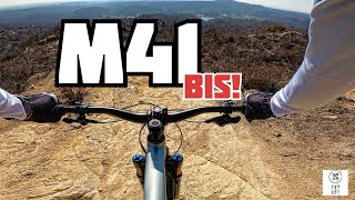
Rocky and sandy trail with some uphill section, but generally fast and flow.

Access Info

Madonna del Sabbione

Tags
JumpsSandy

Recent Activity on Trail

Past Week
  • 3 rides
  • 24.8 km average
6 Months
  • 16 rides
  • 26.5 km avg distance
All
  • 214 rides
  • Last: Nov 15, 2026
c1c2c3c4
January
February
March
April
May
June
July
August
September
October
November
December
update trails status or condition

M41 Bis Trail Reports

statusdatedescription
Nov 7, 2026 @ 9:26am (Europe/Vaduz)
Nov 7, 2026
Nov 7, 2026 @ 9:26am (Europe/Vaduz)
Nov 7, 2026
un po scavata ma pulita
Nov 1, 2026 @ 10:23am (Europe/Vaduz)
Nov 1, 2026
Qualche albero sul percorso da rimuovere, il primo da girarci intorno il secondo da passarci sotto.
Oct 31, 2026 @ 6:53pm (Europe/Rome)
Oct 31, 2026
Oct 4, 2026 @ 8:39am (Europe/Vaduz)
Oct 3, 2026
Tronchi caduti nella seconda parte
more »
Status:
on Nov 7, 2026
Variable
Avg: 4.46 (18 votes)
Your vote: 0

view (2,033)
close
      Directions to m41-bis trailhead (45.621930, 8.221130)

      Photos

      5 more »
      mtb
      78 |
      Jun 1, 2024 @ 12:42pm
      Jun 1, 2024
      mtb
      102 |
      Jun 1, 2024 @ 12:37pm
      Jun 1, 2024
      mtb
      124 |
      Jul 12, 2020 @ 6:39am
      Jul 12, 2020
      mtb
      115 |
      Jul 12, 2020 @ 6:38am
      Jul 12, 2020

      Videos

      3 more »
      Trail M41bis - Rive rosse (Biella)
      mtb
      5:04 | 125 | May 13, 2024 , My City
      ONE SHOT! M41BIS ✌️
      mtb
      7:15 | 168 | Nov 2, 2023 , My City
      L'ingrediente segreto che rende la MTB uno...
      mtb
      7:48 | 201 | Sep 21, 2022 , My City

      Routes with this trail

      more »
      22 miles • 3,663 ft • 5 •
      Percorso E-Enduro Rive Rosse 2021 del circuito 4Enduro
      4.6 ★★★★★
      18 Ratings
      5 ★ 72%
      4 ★ 17%
      3 ★ 11%
      2 ★
      1 ★

      2 Reviews & Comments

      marionide marionide
      Forse un po' meglio del M41. Per me finale immancabile di ogni giro alle Rive Rosse
      dave-82
      Interessante variante all'M41 "originale", ugualmente bello e di difficoltà equiparabile.

      We hope you've been enjoying Trailforks!

      Create a FREE account to view all trail reviews and much more.

      • By Ale-B-ITTF Pro & contributors
      • #131235 - 2,867 views

      Frequently Asked Questions

      ▼ Where is M41 Bis located?
      M41 Bis is located in Rive Rosse, Italy. It is part of the Rive Rosse trail network. The trailhead is located at coordinates 45.62193, 8.22113.
      ▼ How hard is M41 Bis?
      M41 Bis is rated as Blue difficulty. The physical rating is Moderate. The average grade is 10.991%.
      ▼ What is the elevation gain for M41 Bis?
      M41 Bis has 7 ft of elevation gain. The trail has 529 ft of elevation descent. The elevation ranges from 943 ft to 1,469 ft.
      ▼ Is M41 Bis a point to point trail?
      Yes, M41 Bis is a point to point trail. The direction is Downhill Only. The trail type is singletrack.
      ▼ How long is M41 Bis?
      M41 Bis is 4,749 ft long. The trail type is singletrack.
      ▼ Are dogs allowed on M41 Bis?
      Yes, dogs are allowed on M41 Bis. Please keep dogs on a leash where required and clean up after them.
      ▼ When is the best time of year to ride M41 Bis?
      Based on activity log data, the most popular months to ride M41 Bis are:
      • January (17 activities)
      • May (17 activities)
      • November (17 activities)
      Check the reports page for current trail conditions.
      ▼ How long does it take to ride M41 Bis?
      Based on recorded activities, it takes an average of 9 minutes to ride M41 Bis. The trail is 4,749 ft long. Actual times will vary based on fitness level, conditions, and pace. View recent activity logs for more details.
      ▼ How busy is M41 Bis?
      M41 Bis is a very popular trail. There have been 1,996 recorded activities on this trail. The trail has received 2,033 check-ins. View recent activity on this trail.

      Hit the Trail

      Open in App

      Get this trail on your phone instantly.

      open trail in app

      Download Trail

      Save to wishlist, Garmin & download.
      save the trail

      Find Related Routes

      Find routes and users activities that include this trail.
      find routes for this trail

      You must enter a description before submitting.

