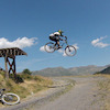
more stats
3,668 ft
Distance
6 ft
Climb
-762 ft
Descent
00:06:58
Avg time
-756 ft
Altitude change
1,869 ft
Altitude min
2,626 ft
Altitude max
2,626 ft
Altitude start
1,870 ft
Altitude end
-20.6%
Grade
-77.7%
Grade max
7.6%
Grade min
161 ft
Distance climb
3,320 ft
Distance down
187 ft
Distance flat
00:06:58
Avg time

Mascarell Details

  • Activities
    • Mountain Bike
    • E-Bike
    • Hike
    • Trail Running
  • Riding Area
    Trenkabikers La Pobla
    La Pobla de Segur
  • Difficulty Rating
  • Voted Difficulty
    Red (1 vote)
  • Local Popularity
    90 in Mountain Biking heatmap [+]
    • 95 in E-Biking
    • 5 in Trail Running
    • 5 in Hiking
  • Global Ranking
    #250 in Mountain Biking [+]
    • #157 in E-Biking
    • #216647 in Trail Running
    • #210073 in Hiking
  • National Ranking
    #9 in Mountain Biking · Spain [+]
    • #22 in E-Biking
    • #15,078 in Trail Running
    • #12,611 in Hiking
  • Trail Type
    Singletrack
  • Bike Type
    DH, AM
  • Direction
    Downhill Only
    Popular Direction Shown
  • Dogs Allowed
    Yes
  • eBike Allowed
    Yes up to Class 1

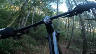
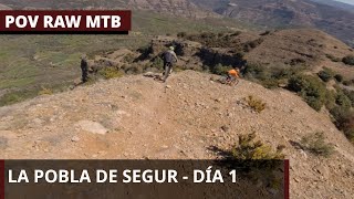
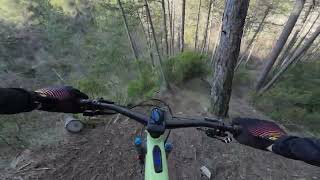
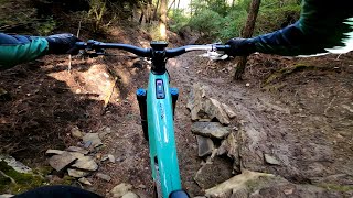
Senda que baixa per la vessant nord de Santa Magdalena fins al barranc de Mascarell.

Tags

Local Trail Association

Recent Activity on Trail

Past Week
  • 0 rides
  •  
6 Months
  • 21 rides
  • 19 miles avg distance
All
  • 82 rides
  • Last: Nov 9, 2026
c1c2c3c4
January
February
March
April
May
June
July
August
September
October
November
December
update trails status or condition

Mascarell Trail Reports

statusdatedescription
Nov 8, 2026 @ 9:48am (Europe/Andorra)
Nov 8, 2026
Oct 30, 2026 @ 10:35pm (Europe/Madrid)
Oct 30, 2026
Treball abans de bucardo a tot el corriol de inici a final.
Oct 10, 2026 @ 9:21pm (Europe/Madrid)
Oct 10, 2026
That's a really good trail ! Funny, "flow", tech and bit loamy ! Thanks for the job !
Oct 10, 2026 @ 10:06am (Europe/Andorra)
Oct 10, 2026
Dec 15, 2025 @ 11:04am (Europe/Madrid)
Dec 15, 2025
more »
Status:
on Nov 8, 2026
Variable
Avg: 4.7 (14 votes)
Your vote: 0

view (548)
close
      Directions to mascarell trailhead (42.249540, 0.948630)

      Photos

      7 more »
      mtb
      101 |
      Jun 30, 2024 @ 10:21am
      Jun 30, 2024
      mtb
      95 |
      Apr 22, 2024 @ 1:32pm
      Apr 22, 2024
      mtb
      98 |
      Apr 22, 2024 @ 8:27am
      Apr 22, 2024
      mtb
      91 |
      Mar 31, 2024 @ 6:47am
      Mar 31, 2024

      Videos

      5 more »
      Mascarell by Trenkabikers
      mtb
      5:38 | 189 | Oct 14, 2024 , La Pobla de Segur
      La Pobla de Segur Mountain Biking Trails Raw
      mtb
      18:50 | 172 | Apr 26, 2024 , La Pobla de Segur
      Mascarell
      mtb
      4:43 | 180 | Mar 21, 2024 , La Pobla de Segur
      MASCARELL DH
      mtb
      4:03 | 190 | Feb 27, 2024 , La Pobla de Segur
      5.0 ★★★★★
      14 Ratings
      5 ★ 100%
      4 ★
      3 ★
      2 ★
      1 ★

      11 Reviews & Comments

      lcoadik
      trail excellent, superbe utilisation du terrain dans un très joli bois.
      Iosgasi
      Bajadon!!! Todo y que hace días que no a llovido, la parte baja es arcillosa, y es resbaladiza.
      Brutal!!!!
      snaker4 snaker4
      Baixada guapíssima. Anar en compte perquè tot i que no hagi plogut fa dies pot haver fang com m'he trobat jo i rellisca força.

      We hope you've been enjoying Trailforks!

      Create a FREE account to view all trail reviews and much more.

      • By Pasta74TF Pro & contributors
      • #642197 - 1,520 views

      Frequently Asked Questions

      ▼ Where is Mascarell located?
      Mascarell is located in Trenkabikers La Pobla, La Pobla de Segur, Spain. It is part of the Trenkabikers La Pobla trail network. The trailhead is located at coordinates 42.24954, 0.94863.
      ▼ How hard is Mascarell?
      Mascarell is rated as Red difficulty. The average grade is 20.6%.
      ▼ What is the elevation gain for Mascarell?
      Mascarell has 6 ft of elevation gain. The trail has 762 ft of elevation descent. The elevation ranges from 1,869 ft to 2,626 ft.
      ▼ Is Mascarell a point to point trail?
      Yes, Mascarell is a point to point trail. The direction is Downhill Only. The trail type is singletrack.
      ▼ How long is Mascarell?
      Mascarell is 3,668 ft long. The trail type is singletrack.
      ▼ Are dogs allowed on Mascarell?
      Yes, dogs are allowed on Mascarell. Please keep dogs on a leash where required and clean up after them.
      ▼ How do I access Mascarell? Where is the closest parking trailhead?
      The closest parking and trailhead locations to Mascarell are: View all parking locations in the area.
      ▼ How long does it take to ride Mascarell?
      Based on recorded activities, it takes an average of 7 minutes to ride Mascarell. The trail is 3,668 ft long. Actual times will vary based on fitness level, conditions, and pace. View recent activity logs for more details.
      ▼ How busy is Mascarell?
      Mascarell is a very popular trail. There have been 524 recorded activities on this trail. The trail has received 548 check-ins. View recent activity on this trail.

      Hit the Trail

      Open in App

      Get this trail on your phone instantly.

      open trail in app

      Download Trail

      Save to wishlist, Garmin & download.
      save the trail

      Find Related Routes

      Find routes and users activities that include this trail.
      find routes for this trail

      You must enter a description before submitting.