
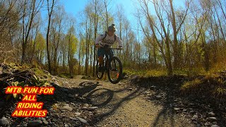
more stats
3.6 miles
Distance
160 ft
Climb
-141 ft
Descent
00:27:34
Avg time
20 ft
Altitude change
372 ft
Altitude min
423 ft
Altitude max
390 ft
Altitude start
410 ft
Altitude end
0.1%
Grade
-7.8%
Grade max
13%
Grade min
1 mile
Distance climb
1 mile
Distance down
1 mile
Distance flat
00:27:34
Avg time

McIndoe Track Details

  • Activities
    • Mountain Bike
    • Gravel Bike
    • Winter Fat Bike
    • Hike
    • Trail Running
  • Riding Area
    McLeans Forest
    Christchurch
  • AKA
    The Willows
  • Difficulty Rating
  • Local Popularity
    50 in Mountain Biking heatmap [+]
    • 5 in Trail Running
    • 5 in Hiking
    • 5 in Winter Fat Biking
    • 65 in Gravel Biking
  • Global Ranking
    #43290 in Mountain Biking [+]
    • #283875 in Trail Running
    • #289452 in Hiking
    • #31009 in Winter Fat Biking
    • #13409 in Gravel Biking
  • National Ranking
    #978 in Mountain Biking · New Zealand [+]
    • #3,489 in Trail Running
    • #3,059 in Hiking
    • #333 in Winter Fat Biking
    • #355 in Gravel Biking
  • Trail Type
    Machine Groomed
  • Bike Type
    AM, XC, Fat, CX, Gravel
  • Direction
    Both Directions
    Popular Direction Shown
  • Climb Difficulty
    Green
  • Physical Rating
    Easy
  • Trail Visibility
    Always easy to follow
  • Dogs Allowed
    Yes
  • Ride in Rain
    Yes
  • Land Owner

The Willows, at the end of Thompsons Road, off Old West Coast Road in West Melton, has been developed specifically for non-motorised recreation activities.

This development was driven by Environment Canterbury, along with the Selwyn District Council, to provide recreation and green space opportunities for the rapidly expanding population.

There are picnic and parking areas, fishing points, a New Zealand Motor Caravan Association parking area, walking and cycling trails, and a 4.3-hectare dog park with agility equipment, open spaces, and picnic areas. Dogs must be under effective control at all times.

source: ...
Access Info

McIndoe Trail at The Willows is at the end of Thompsons Road, off Old West Coast Road in West Melton.

Tags

Traditionally Indigenous Territory

Recent Activity on Trail

Past Week
  • 1 rides
  • 5 miles average
6 Months
  • 4 rides
  • 8 miles avg distance
All
  • 36 rides
  • Last: Nov 15, 2026
update trails status or condition

McIndoe Track Trail Reports

statusdatedescription
Oct 25, 2026 @ 5:50pm (Pacific/Auckland)
Oct 24, 2026
The trail is in great condition and easy to follow. Great for families.
Mar 30, 2026 @ 2:34pm (Pacific/Auckland)
Mar 29, 2026
Tracks dry & in good condition
Dec 2, 2025 @ 6:30pm (Pacific/Auckland)
Dec 1, 2025
Trails getting a little overgrown.
Jul 5, 2025 @ 10:31pm
Jul 5, 2025
Great ride to do with the kids. The trail is in the great condition despite of a couple of wet days before.
Jul 11, 2024 @ 7:52pm
Jul 11, 2024
Trail in excellent condition
more »
Status:
on Oct 25, 2026
Dry
Avg: 3.98 (1 votes)
Your vote: 0

view (217)
close
      Directions to mcindoe-track trailhead (-43.465300, 172.328770)

      Photos

      1 more »
      mtb
      134 |
      Oct 28, 2022 @ 9:35pm
      Oct 28, 2022

      Videos

      1 more »
      youtuber THE WILLOWS feat. MC INDOE TRACK a family...
      mtb
      13:32 | 928 | Sep 16, 2021 , Christchurch
      4.0 ★★★★★
      1 Ratings
      5 ★
      4 ★ 100%
      3 ★
      2 ★
      1 ★

      2 Reviews & Comments

      rustybalboa
      Great little track , was a lot more fun than I thought it would be ! Lost track of how many corners there were .
      Daisy my Labrador buddy loved it as well and had fun in the doggie park next door 👍

      We hope you've been enjoying Trailforks!

      Create a FREE account to view all trail reviews and much more.

      • By bluelinerider & contributors
      • #465408 - 2,796 views

      Frequently Asked Questions

      ▼ Where is McIndoe Track located?
      McIndoe Track is located in McLeans Forest, Christchurch, New Zealand. It is part of the McLeans Forest trail network. The trailhead is located at coordinates -43.4653, 172.32877.
      ▼ How hard is McIndoe Track?
      McIndoe Track is rated as Green difficulty. The physical rating is Easy. The average grade is 0.1%. The climb difficulty is rated Green.
      ▼ What is the elevation gain for McIndoe Track?
      McIndoe Track has 160 ft of elevation gain. The trail has 141 ft of elevation descent. The elevation ranges from 372 ft to 423 ft.
      ▼ Is McIndoe Track a point to point trail?
      McIndoe Track is not a point to point trail. The direction is Both Directions. The trail type is machine groomed.
      ▼ How long is McIndoe Track?
      McIndoe Track is 3.6 miles long. The trail type is machine groomed.
      ▼ Are dogs allowed on McIndoe Track?
      Yes, dogs are allowed on McIndoe Track. Please keep dogs on a leash where required and clean up after them.
      ▼ How long does it take to ride McIndoe Track?
      Based on recorded activities, it takes an average of 28 minutes to ride McIndoe Track. The trail is 3.6 miles long. Actual times will vary based on fitness level, conditions, and pace. View recent activity logs for more details.
      ▼ How busy is McIndoe Track?
      McIndoe Track is a moderately popular trail. There have been 195 recorded activities on this trail. The trail has received 217 check-ins. View recent activity on this trail.

      Hit the Trail

      Open in App

      Get this trail on your phone instantly.

      open trail in app

      Download Trail

      Save to wishlist, Garmin & download.
      save the trail

      Find Related Routes

      Find routes and users activities that include this trail.
      find routes for this trail

      You must enter a description before submitting.

