
more stats
1.1 miles
Distance
73 ft
Climb
-69 ft
Descent
00:10:38
Avg time
3 ft
Altitude change
674 ft
Altitude min
721 ft
Altitude max
684 ft
Altitude start
686 ft
Altitude end
0.1%
Grade
-10.5%
Grade max
8.5%
Grade min
2,106 ft
Distance climb
1,873 ft
Distance down
1,804 ft
Distance flat
00:10:38
Avg time

Mickey Details

  • Activities
    • Mountain Bike
    • E-Bike
    • Winter Fat Bike
  • Riding Area
    Barfield Crescent Park
    Murfreesboro, Tennessee
  • AKA
    Barfield Beginner 1
  • Difficulty Rating
  • Local Popularity
    80 in Mountain Biking heatmap [+]
    • 45 in E-Biking
    • 5 in Winter Fat Biking
  • Global Ranking
    #81021 in Mountain Biking [+]
    • #41790 in E-Biking
    • #7916 in Winter Fat Biking
  • State Ranking
    #430 in Mountain Biking · Tennessee [+]
    • #206 in E-Biking
    • #6 in Winter Fat Biking
  • Trail Type
    Singletrack
  • Bike Type
    AM, XC, Fat
  • Direction
    Both Directions
  • Climb Difficulty
    Blue
  • Physical Rating
    Moderate
  • Trail Visibility
    Always easy to follow
  • eBike Allowed
    Yes up to Class 1
  • TTFs on Trail
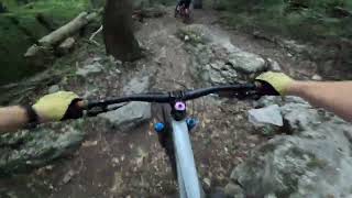
    Rock Face, Rock Garden
  • Land Owner

Going in to the right (Counter Clock Wise), the trail starts with a challenging technical climb as you approach the intermediate connector. But from there, the remainder of the route has more downhill. This might be easier for beginners as you can walk up the tough part, then have free energy to go down many other technical spots.

If you go in to the left (Clock Wise), the techy spots happen while climbing. Clearing everything - both ways would be a good task before riding the intermediate & advanced trails.

Tags
Rock gardensRock slabs

Local Trail Association

Recent Activity on Trail

Past Week
  • 1 rides
  • 9 miles average
6 Months
  • 5 rides
  • 4 miles avg distance
All
  • 140 rides
  • Last: Nov 15, 2026
c1c2c3c4
January
February
March
April
May
June
July
August
September
October
November
December
update trails status or condition

Mickey Trail Reports

statusdatedescription
Nov 15, 2026 @ 12:48pm (America/Chicago)
Nov 15, 2026
Nov 10, 2026 @ 4:36pm (America/Chicago)
Nov 10, 2026
reporter Med tree down
Aug 11, 2026 @ 5:47pm (America/Chicago)
Aug 11, 2026
reporter Sm tree down
Jun 2, 2026 @ 2:13pm (America/Chicago)
Jun 2, 2026
Mickey has been trimmed and trees cleared. A little damp but should be good after some dryness.
May 30, 2026 @ 9:23am (America/Chicago)
May 30, 2026
reporter Large tree blocking most of the trail. Requires chainsaw
more »
Status:
on Nov 15, 2026
Dry
Avg: 3.65 (3 votes)
Your vote: 0

view (493)
close
      Directions to mickey-184524 trailhead (35.762320, -86.406440)

      Photos

      16 more »
      mtb
      99 |
      Jun 9, 2023 @ 3:46pm
      Jun 9, 2023
      mtb
      80 |
      May 24, 2020 @ 4:38pm
      May 24, 2020
      mtb
      136 |
      May 24, 2020 @ 4:38pm
      May 24, 2020
      report
      mtb
      15 |
      Nov 10, 2026 @ 2:36pm
      Nov 10, 2026

      Videos

      2 more »
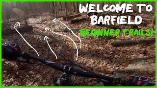
      featured Welcome to Barfield - Beginner Trails
      mtb
      19:03 | 430 | Apr 5, 2022 , Murfreesboro
      Thunderlips back to parking lot via Mickey
      mtb
      0:59 | 106 | Sep 2, 2024 , Murfreesboro

      Trail Lists

      Routes with this trail

      more »
      8 miles • 679 ft • 11 • Loop •
      Clockwise route of the entire trail system. CW is the intended direction for: Monday, Wednesday, Friday...

      Trail Events

      3.0 ★★★★★
      3 Ratings
      5 ★
      4 ★ 67%
      3 ★
      2 ★
      1 ★ 33%

      1 Review & Comments

      Shagp
      Not a beginner trail. I’ve nearly went OTB on this trail because of the rocks.

      We hope you've been enjoying Trailforks!

      Create a FREE account to view all trail reviews and much more.

      • By oneasterisk1840 & contributors
      • #184524 - 1,411 views

      Frequently Asked Questions

      ▼ Where is Mickey located?
      Mickey is located in Barfield Crescent Park, Murfreesboro, Tennessee, United States. It is part of the Barfield Crescent Park trail network. The trailhead is located at coordinates 35.76232, -86.40644.
      ▼ How hard is Mickey?
      Mickey is rated as Blue difficulty. The physical rating is Moderate. The average grade is 0.1%. The climb difficulty is rated Blue.
      ▼ What is the elevation gain for Mickey?
      Mickey has 73 ft of elevation gain. The trail has 69 ft of elevation descent. The elevation ranges from 674 ft to 721 ft.
      ▼ Is Mickey a point to point trail?
      Mickey is not a point to point trail. The direction is Both Directions. The trail type is singletrack.
      ▼ How long is Mickey?
      Mickey is 1.1 miles long. The trail type is singletrack.
      ▼ Are dogs allowed on Mickey?
      There is no information about dogs being allowed on Mickey. Check with local trail managers or the trail page for the latest access rules.
      ▼ When is the best time of year to ride Mickey?
      Based on activity log data, the most popular months to ride Mickey are:
      • April (8 activities)
      • December (7 activities)
      • July (6 activities)
      Check the reports page for current trail conditions.
      ▼ How do I access Mickey? Where is the closest parking trailhead?
      The closest parking and trailhead locations to Mickey are: View all parking locations in the area.
      ▼ How long does it take to ride Mickey?
      Based on recorded activities, it takes an average of 11 minutes to ride Mickey. The trail is 1.1 miles long. Actual times will vary based on fitness level, conditions, and pace. View recent activity logs for more details.
      ▼ How busy is Mickey?
      Mickey is a very popular trail. There have been 433 recorded activities on this trail. The trail has received 493 check-ins. View recent activity on this trail.

      Hit the Trail

      Open in App

      Get this trail on your phone instantly.

      open trail in app

      Download Trail

      Save to wishlist, Garmin & download.
      save the trail

      Find Related Routes

      Find routes and users activities that include this trail.
      find routes for this trail

      You must enter a description before submitting.

