

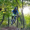
more stats
1,883 ft
Distance
-274 ft
Descent
00:04:40
Avg time
-274 ft
Altitude change
1,185 ft
Altitude min
1,459 ft
Altitude max
1,459 ft
Altitude start
1,184 ft
Altitude end
-14.5%
Grade
-33.8%
Grade max
-2.2%
Grade min
1,883 ft
Distance down
00:04:40
Avg time

Monkey Trail Details

  • Activities
    • Mountain Bike
    • E-Bike
  • Riding Area
  • Difficulty Rating
  • Local Popularity
    95 in Mountain Biking heatmap [+]
    • 90 in E-Biking
  • Global Ranking
    #42517 in Mountain Biking [+]
    • #18853 in E-Biking
  • National Ranking
    #3,995 in Mountain Biking · Italy [+]
    • #2,192 in E-Biking
  • Trail Type
    Singletrack
  • Bike Type
    DH, AM
  • Direction
    Downhill Primary
    Popular Direction Shown
  • Climb Difficulty
    Blue
  • Physical Rating
    Moderate
  • Trail Visibility
    Always easy to follow
  • Dogs Allowed
    Yes
  • eBike Allowed
  • TTFs on Trail
    Berm, Drop, Jump, Gap Jump
  • Land Owner
    Municipality of Trieste

Nice trail with many jumps: some easy/low but a couple are only for experts Pay attention!
It's always possible to avoid the jumps following the chicken line aside.

Tags
BermsDropsJumps

Recent Activity on Trail

Past Week
  • 0 rides
  •  
6 Months
  • 1 rides
  • 19.1 km avg distance
All
  • 72 rides
  • Last: Nov 18, 2026
c1c2c3c4
January
February
March
April
May
June
July
August
September
October
November
December
update trails status or condition

Monkey Trail Trail Reports

statusdatedescription
Oct 30, 2026 @ 6:38pm (Europe/Rome)
Oct 30, 2026
Dec 6, 2025 @ 9:12am (Europe/Ljubljana)
Dec 6, 2025
Oct 28, 2025 @ 11:19am (Europe/Ljubljana)
Oct 28, 2025
Apr 28, 2024 @ 2:35am
Apr 28, 2024
Fallen tree at the start of the trail, a ramp added to jump around the tree but is too steep and there is no enough space to take correct speed....
Mar 18, 2024 @ 9:38am
Mar 18, 2024
more »
Status:
on Oct 30, 2026
Ideal
Avg: 4.08 (6 votes)
Your vote: 0

view (1,148)
close
      Directions to monkey-trail-222277 trailhead (45.666250, 13.812900)

      Photos

      16 more »
      mtb
      114 |
      Jun 27, 2020 @ 5:45am
      Jun 27, 2020
      mtb
      209 |
      May 12, 2020 @ 12:18pm
      May 12, 2020
      mtb
      136 |
      Apr 20, 2020 @ 1:16pm
      Apr 20, 2020
      mtb
      131 |
      Apr 20, 2020 @ 1:16pm
      Apr 20, 2020

      Videos

      3 more »
      ENDURATA A CAMPO CARRI E CASCATELLE - Trieste MTB
      mtb
      6:21 | 499 | Feb 2, 2021 , Trieste
      Monkey trail
      mtb
      2:22 | 386 | Nov 4, 2020 , Trieste
      Campo Carri - Monkey Trail, Mountainbiking in...
      mtb
      6:20 | 897 | Jun 11, 2020 , Trieste

      Routes with this trail

      more »
      10 miles • 2,437 ft • 8 •
      da i campi da golf fino a campocarri e ritorno
      4.2 ★★★★★
      6 Ratings
      5 ★ 33%
      4 ★ 50%
      3 ★ 17%
      2 ★
      1 ★

      4 Reviews & Comments

      StefanSalv StefanSalv
      Old but gold trail, check also the new trail! (A local)
      The trail condition now is a bit wet but still fun.
      pb-ita
      Molto bello e divertente, peccato che è corto. C'è un drop molto alto oltre un metro che non si può copiare, ma c'è la chicken-line, per il resto tutto fattibile in tranquillità anche con il fango di questi giorni.
      sexste
      Due tracce parallele bellissime... In un km scarso di traccia tantissimi spunti per imparare a girare bene su tutte le situazioni... Salti e drop più o meno impegnativi, spondine, radici, sassi, piccole compressioni ecc...

      We hope you've been enjoying Trailforks!

      Create a FREE account to view all trail reviews and much more.

      • By G-Force58 & contributors
      • #222277 - 4,487 views

      Frequently Asked Questions

      ▼ Where is Monkey Trail located?
      Monkey Trail is located in Basovìzza - Bazovica, Trieste, Italy. It is part of the Basovìzza - Bazovica trail network. The trailhead is located at coordinates 45.66625, 13.8129.
      ▼ How hard is Monkey Trail?
      Monkey Trail is rated as Blue difficulty. The physical rating is Moderate. The average grade is 14.5%. The climb difficulty is rated Blue.
      ▼ What is the elevation gain for Monkey Trail?
      The trail has 274 ft of elevation descent. The elevation ranges from 1,185 ft to 1,459 ft.
      ▼ Is Monkey Trail a point to point trail?
      Monkey Trail is not a point to point trail. The direction is Downhill Primary. The trail type is singletrack.
      ▼ How long is Monkey Trail?
      Monkey Trail is 1,883 ft long. The trail type is singletrack.
      ▼ Are dogs allowed on Monkey Trail?
      Yes, dogs are allowed on Monkey Trail. Please keep dogs on a leash where required and clean up after them.
      ▼ How do I access Monkey Trail? Where is the closest parking trailhead?
      The closest parking and trailhead locations to Monkey Trail are: View all parking locations in the area.
      ▼ How long does it take to ride Monkey Trail?
      Based on recorded activities, it takes an average of 5 minutes to ride Monkey Trail. The trail is 1,883 ft long. Actual times will vary based on fitness level, conditions, and pace. View recent activity logs for more details.
      ▼ How busy is Monkey Trail?
      Monkey Trail is a very popular trail. There have been 571 recorded activities on this trail. The trail has received 1,148 check-ins. View recent activity on this trail.

      Hit the Trail

      Open in App

      Get this trail on your phone instantly.

      open trail in app

      Download Trail

      Save to wishlist, Garmin & download.
      save the trail

      Find Related Routes

      Find routes and users activities that include this trail.
      find routes for this trail

      You must enter a description before submitting.

