
more stats
2.3 miles
Distance
147 ft
Climb
-1,364 ft
Descent
00:16:54
Avg time
-1,216 ft
Altitude change
3,343 ft
Altitude min
4,563 ft
Altitude max
4,563 ft
Altitude start
3,346 ft
Altitude end
-9.8%
Grade
-47.3%
Grade max
40.1%
Grade min
1,837 ft
Distance climb
2 miles
Distance down
1,440 ft
Distance flat
00:16:54
Avg time

Monti-Trail Details

  • Activities
    • Mountain Bike
    • E-Bike
  • Riding Area
    Bike-Circus - Saalbach Hinterglemm
    Saalbach Hinterglemm
  • Ref Number
    SH02
  • Difficulty Rating
  • Voted Difficulty
    Green (7 votes)
  • Local Popularity
    95 in Mountain Biking heatmap [+]
    • 95 in E-Biking
  • Global Ranking
    #60606 in Mountain Biking [+]
    • #701 in E-Biking
  • National Ranking
    #464 in Mountain Biking · Austria [+]
    • #4 in E-Biking
  • Trail Type
    Machine Groomed
  • Bike Type
    DH, AM, XC
  • Direction
    Downhill Only
    Popular Direction Shown
  • Family Friendly
    Yes
  • Dogs Allowed
    Yes
  • eBike Allowed
    Yes up to Class 1
  • TTFs on Trail
    Bridge
  • Land Owner

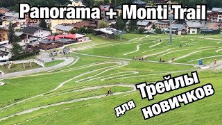
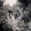
The Milka Line on the Kohlmais is a beginner-friendly freeride trail for all ages. Thanks to its flow and the magnificent view over Saalbach Hinterglemm, it’s also great for soulriders. Generous berms, wide bends, small wood elements, and a gentle gradient offer an easy, fun introduction to free riding.

This 2,9 km trail takes you from the mid station of the Kohlmais lift across open alpine meadows, past woodland, and ends right at the valley station of the Kohlmais lift. There you will also find a Snapshot-Station where you can get a quick souvenir photo. This relatively easy route promises maximum biking pleasure with minimal difficulty. Even so, you should still wear the necessary safety equipment (full-face helmet and protectors).

Bike Park

Recent Activity on Trail

Past Week
  • 0 rides
  •  
6 Months
  • 390 rides
  • 29 miles avg distance
All
  • 1,293 rides
  • Last: Jul 23, 2019
c1c2c3c4
January
February
March
April
May
June
July
August
September
October
November
December
Status:
on Aug 14, 2026
Very Dry
Avg: 3.33 (53 votes)
Your vote: 0

view (10,214)
close
      Directions to montitrail trailhead (47.401230, 12.646610)

      Photos

      12 more »
      mtb
      218 |
      Jul 12, 2019 @ 10:15pm
      Jul 12, 2019
      mtb
      368 |
      Jan 18, 2017 @ 8:21pm
      Jan 18, 2017
      mtb
      342 |
      Jun 22, 2016 @ 8:15am
      Jun 22, 2016
      mtb
      384 |
      Oct 30, 2015 @ 12:08pm
      Oct 30, 2015

      Videos

      23 more »
      youtuber Monti Trail | SH02 - Bike Circus Saalbach...
      mtb
      8:21 | 80 | Jun 10, 2026 , Saalbach Hinterglemm
      SAALBACH-HINTERGLEMM! Monti Trail
      mtb
      19:55 | 75 | May 6, 2025 , Saalbach Hinterglemm
      Saalbach Bikepark - Blue Trail \ Monti-Line - SH02
      mtb
      7:31 | 92 | Dec 13, 2024 , Saalbach Hinterglemm
      Saalbach Bikepark - Blue Trail / Monti-Line SH02
      mtb
      8:07 | 43 | Dec 2, 2024 , Saalbach Hinterglemm

      Routes with this trail

      more »
      ★ 4.5 • 38 miles • 12,614 ft • 14 • Loop •
      Maximales Enduro-Feeling bei der BIG-5 Bike Challenge (ehemalige 5-Gondeltour) rund um Saalbach...
      ★ 2.0 • 57 miles • 16,295 ft • 12 • Loop •
      „THE CHALLENGE – Bike your limit“ heißt die neue Herausforderung in Österreichs größter...
      41 miles • 14,180 ft • 8 • Loop • Race •
      UCI Enduro World Cup COURSE STATS Length: 66.79 km +1000m Pedal +4120m Gondola -5030m Stages S1 Bergstadl...
      3.3 ★★★★★
      53 Ratings
      5 ★ 13%
      4 ★ 30%
      3 ★ 34%
      2 ★ 13%
      1 ★ 9%

      3 Reviews & Comments

      cdir cdir
      Bottom middle section has a new line of berms and curves in the last couple days, much better!
      surreyhillstrailco surreyhillstrailco
      Not as good unfortunately as the Panoramic trail, the bottom of this one needs some work to make it fun and not just a straight line. It's got potential.
      crisotop crisotop
      New name, but the same milka-chocolate underneath. Blown out and flat-ish corners and weird jumps. Hope it gets reworked in the same style as the upper panorama trail

      We hope you've been enjoying Trailforks!

      Create a FREE account to view all trail reviews and much more.

      Frequently Asked Questions

      ▼ Where is Monti-Trail located?
      Monti-Trail is located in Bike-Circus - Saalbach Hinterglemm, Saalbach Hinterglemm, Austria. It is part of the Bike-Circus - Saalbach Hinterglemm trail network. The trailhead is located at coordinates 47.40123, 12.64661.
      ▼ How hard is Monti-Trail?
      Monti-Trail is rated as Blue difficulty. The average grade is 9.8%.
      ▼ What is the elevation gain for Monti-Trail?
      Monti-Trail has 147 ft of elevation gain. The trail has 1,364 ft of elevation descent. The elevation ranges from 3,343 ft to 4,563 ft.
      ▼ Is Monti-Trail a point to point trail?
      Yes, Monti-Trail is a point to point trail. The direction is Downhill Only. The trail type is machine groomed.
      ▼ How long is Monti-Trail?
      Monti-Trail is 2.3 miles long. The trail type is machine groomed.
      ▼ Are dogs allowed on Monti-Trail?
      Yes, dogs are allowed on Monti-Trail. Please keep dogs on a leash where required and clean up after them.
      ▼ How do I access Monti-Trail? Where is the closest parking trailhead?
      The closest parking and trailhead locations to Monti-Trail are: View all parking locations in the area.
      ▼ How long does it take to ride Monti-Trail?
      Based on recorded activities, it takes an average of 17 minutes to ride Monti-Trail. The trail is 2.3 miles long. Actual times will vary based on fitness level, conditions, and pace. View recent activity logs for more details.
      ▼ How busy is Monti-Trail?
      Monti-Trail is a very popular trail. There have been 8,138 recorded activities on this trail. The trail has received 10,214 check-ins. View recent activity on this trail.

      Hit the Trail

      Open in App

      Get this trail on your phone instantly.

      open trail in app

      Download Trail

      Save to wishlist, Garmin & download.
      save the trail

      Find Related Routes

      Find routes and users activities that include this trail.
      find routes for this trail

      You must enter a description before submitting.

