

more stats
3.4 miles
Distance
5 ft
Climb
-2,716 ft
Descent
00:23:06
Avg time
-2,710 ft
Altitude change
4,527 ft
Altitude min
7,243 ft
Altitude max
7,243 ft
Altitude start
4,534 ft
Altitude end
-15.1%
Grade
-76.4%
Grade max
9.9%
Grade min
138 ft
Distance climb
3 miles
Distance down
46 ft
Distance flat
00:23:06
Avg time

Never End Trail Details

  • Activities
    • Mountain Bike
    • E-Bike
  • Riding Area
  • Ref Number
    695T
  • Difficulty Rating
  • Trail Style
    Technical
  • Voted Difficulty
    Red (12 votes)
  • Local Popularity
    90 in Mountain Biking heatmap [+]
    • 85 in E-Biking
  • Global Ranking
    #10897 in Mountain Biking [+]
    • #3156 in E-Biking
  • National Ranking
    #173 in Mountain Biking · Switzerland [+]
    • #66 in E-Biking
  • Trail Type
    Singletrack
  • Bike Type
    DH, AM
  • Direction
    Downhill Only[+]
    Popular Direction Shown
    • Downhill Only for E-Biking
  • Alpine Trail
    Yes
  • eBike Allowed

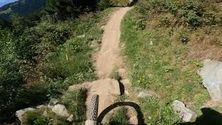
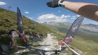
Action pur bietet die Freeride-Strecke vom Crap Sogn Gion (2228 m) nach Laax (1020 m). Die 7 km lange Strecke ist fahrtechnisch anspruchsvoll und bietet von Steilkurve zu Steilkurve ein absolutes Flow-Erlebnis.

source: Flims Resort
Tags
Alpine

Trail Supporters

Bike Park

Recent Activity on Trail

Past Week
  • 0 rides
  •  
6 Months
  • 123 rides
  • 29 miles avg distance
All
  • 349 rides
  • Last: Jul 22, 2026
c1c2c3c4
January
February
March
April
May
June
July
August
September
October
November
December
Status:
on Aug 23, 2026
Ideal
Avg: 4.41 (50 votes)
Your vote: 0

view (2,525)
close
      Directions to never-end-trail trailhead (46.835030, 9.214970)

      Photos

      52 more »
      mtb
      501 |
      Aug 11, 2020 @ 8:42am
      Aug 11, 2020
      mtb
      1,399 |
      Jul 14, 2015 @ 9:10am
      Jul 14, 2015
      mtb
      746 |
      Jul 14, 2015 @ 9:06am
      Jul 14, 2015
      mtb
      528 |
      Jan 15, 2018 @ 6:46am
      Jan 15, 2018

      Videos

      19 more »
      youtuber Exploring the Never End Trail - Flims/Laax...
      mtb
      4:55 | 683 | Sep 28, 2021 , Flims LAAX
      Never End Trail in Laax 4K
      mtb
      17:18 | 354 | Aug 21, 2023 , Flims LAAX
      FLIMS / LAAX - NEVER END TRAIL
      mtb
      16:47 | 407 | Aug 25, 2022 , Flims LAAX
      Swiss Enduro Series 2022 - Laax - Stage 4
      mtb
      10:47 | 367 | Jun 13, 2022 , Flims LAAX

      Routes with this trail

      more »
      7 miles • 2,292 ft • 4 • Shuttled •
      Laax is not only in winter the meeting point of freeriders and park lovers. Fat kickers and unique...
      4.5 ★★★★★
      50 Ratings
      5 ★ 64%
      4 ★ 22%
      3 ★ 10%
      2 ★ 4%
      1 ★

      9 Reviews & Comments

      mcharza mcharza
      Probably the best trail in the area. I've been riding this for five years in a row and it always feels great. The trail crew has done a great job and I don't think the changes have been bad. Or maybe I'm just getting older, haha.
      a4ZW
      Sehr einfach zu fahren, kein Bergtrail, eher wie ein bikepark Trail . Eine Kurve nach der anderen, wird irgendwann langweilig. Schwierigkeit zwischen blau und rot.
      sagognripper
      Biketrails Laax is in the process of removing all the rocks from this trail. They have already removed the rocks from the first 800 meters of this trail and are continuing. It's a dirt track now instead of chunky downhill. I'm a bit lost why they would do this. The black rating is not warranted anymore. When they completed the rock removal this will likely be a blue trail.

      We hope you've been enjoying Trailforks!

      Create a FREE account to view all trail reviews and much more.

      Frequently Asked Questions

      ▼ Where is Never End Trail located?
      Never End Trail is located in Biketrails Flims Laax, Flims LAAX, Switzerland. It is part of the Biketrails Flims Laax trail network. The trailhead is located at coordinates 46.83503, 9.21497.
      ▼ How hard is Never End Trail?
      Never End Trail is rated as Red difficulty. The average grade is 15.1%.
      ▼ What is the elevation gain for Never End Trail?
      Never End Trail has 5 ft of elevation gain. The trail has 2,716 ft of elevation descent. The elevation ranges from 4,527 ft to 7,243 ft.
      ▼ Is Never End Trail a point to point trail?
      Yes, Never End Trail is a point to point trail. The direction is Downhill Only. The trail type is singletrack.
      ▼ How long is Never End Trail?
      Never End Trail is 3.4 miles long. The trail type is singletrack.
      ▼ Are dogs allowed on Never End Trail?
      There is no information about dogs being allowed on Never End Trail. Check with local trail managers or the trail page for the latest access rules.
      ▼ How do I access Never End Trail? Where is the closest parking trailhead?
      The closest parking and trailhead locations to Never End Trail are: View all parking locations in the area.
      ▼ How long does it take to ride Never End Trail?
      Based on recorded activities, it takes an average of 23 minutes to ride Never End Trail. The trail is 3.4 miles long. Actual times will vary based on fitness level, conditions, and pace. View recent activity logs for more details.
      ▼ How busy is Never End Trail?
      Never End Trail is a very popular trail. There have been 1,936 recorded activities on this trail. The trail has received 2,525 check-ins. View recent activity on this trail.

      Hit the Trail

      Open in App

      Get this trail on your phone instantly.

      open trail in app

      Download Trail

      Save to wishlist, Garmin & download.
      save the trail

      Find Related Routes

      Find routes and users activities that include this trail.
      find routes for this trail

      You must enter a description before submitting.