more stats
5,200 ft
Distance
63 ft
Climb
-328 ft
Descent
00:05:39
Avg time
-265 ft
Altitude change
6,907 ft
Altitude min
7,172 ft
Altitude max
7,171 ft
Altitude start
6,907 ft
Altitude end
-5.087%
Grade
-25.08%
Grade max
14.781%
Grade min
1,002 ft
Distance climb
3,696 ft
Distance down
502 ft
Distance flat
00:05:39
Avg time

Ocelot Details

  • Activities
    • Mountain Bike
    • Gravel Bike
    • Horse
    • Hike
    • Trail Running
  • Riding Area
    Tahoe Cross Country
    Tahoe City, California
  • Difficulty Rating
  • Voted Difficulty
    Blue (1 vote)
  • Local Popularity
    95 in Mountain Biking heatmap [+]
    • 90 in Trail Running
    • 70 in Hiking
    • 5 in Horseback
    • 5 in Gravel Biking
  • Global Ranking
    #44717 in Mountain Biking [+]
    • #84224 in Trail Running
    • #118401 in Hiking
    • #3173 in Horseback
    • #6512 in Gravel Biking
  • State Ranking
    #1,289 in Mountain Biking · California [+]
    • #4,105 in Trail Running
    • #6,593 in Hiking
    • #253 in Horseback
    • #537 in Gravel Biking
  • Hiking SAC Scale
    T2 Mountain Hiking
  • Trail Type
    Mixed
  • Bike Type
    AM, XC, Fat, CX, Gravel
  • Direction
    Both Directions
  • Climb Difficulty
    Blue
  • Physical Rating
    Moderate
  • Trail Visibility
    Always easy to follow
  • Family Friendly
    Yes
  • Dogs Allowed
    Yes
  • eBike Allowed
  • Land Owner

great modern single track purpose built for MTB

Tags
Family friendly

Trail Supporters

Local Trail Association

Traditionally Indigenous Territory

Recent Activity on Trail

Past Week
  • 4 rides
  • 21 miles average
6 Months
  • 220 rides
  • 15 miles avg distance
All
  • 1,347 rides
  • Last: Nov 12, 2026
update trails status or condition

Ocelot Trail Reports

statusdatedescription
Jul 10, 2026 @ 8:29am (America/Boise)
Jul 10, 2026
Apr 30, 2026 @ 11:55am (America/Los_Angeles)
Apr 30, 2026
Ocelot is largely clear with the exception of snow patches near the top, and one mid way. When pushing your bike through the snow, please stay on...
Dec 2, 2025 @ 9:30pm (America/Los_Angeles)
Dec 2, 2025
No snow, little damp in places but mostly perfect.
Oct 23, 2025 @ 11:50am (America/Los_Angeles)
Oct 23, 2025
Sep 9, 2025 @ 9:46am
Sep 9, 2025
more »
Status:
on Jul 10, 2026
Dry
Avg: 4.16 (12 votes)
Your vote: 0

view (5,840)
close
      Directions to ocelot-105313 trailhead (39.191840, -120.160952)

      Photos

      5 more »
      report
      mtb
      51 |
      May 8, 2025 @ 12:58pm
      May 8, 2025
      report
      mtb
      50 |
      Nov 7, 2024 @ 5:09pm
      Nov 7, 2024
      report
      mtb
      65 |
      Jun 3, 2023 @ 8:36pm
      Jun 3, 2023
      report
      mtb
      61 |
      Aug 16, 2022 @ 8:14pm
      Aug 16, 2022

      Videos

      2 more »
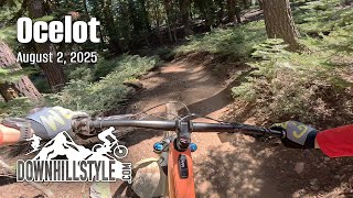
      youtuber Ocelot & Angry Bear / Tahoe City, CA / MTB
      mtb
      7:48 | 236 | Sep 27, 2024 , Tahoe City
      Ocelot - Tahoe City - Downhillstyle.com
      mtb
      4:18 | 71 | Dec 19, 2025 , Tahoe City

      Routes with this trail

      more »
      13 miles • 1,553 ft • 12 •
      evo Trailgate - advanced route
      10 miles • 1,323 ft • 6 • Loop •
      This is a great Tahoe City Loop, starting with Jackpine makes for a great varied loop with Ocelot,...
      26 miles • 3,008 ft • 20 •
      eBike route for EVO Trailgate party
      4.3 ★★★★★
      12 Ratings
      5 ★ 42%
      4 ★ 42%
      3 ★ 17%
      2 ★
      1 ★

      6 Reviews & Comments

      windsurfsf windsurfsf
      Fun medium speed flowing trail with a few fun hops. One of the few trails I enjoy uphill almost as much as downhill.
      djtahoe
      Still unusable at this stage. Totally covered in sno. Had to stick to the fire roads
      mtbflauto
      And now this says mixed, it’s just singletrack

      We hope you've been enjoying Trailforks!

      Create a FREE account to view all trail reviews and much more.

      • By TheAngryTomato TRAILFORKS & contributors
      • #105313 - 4,046 views

      Frequently Asked Questions

      ▼ Where is Ocelot located?
      Ocelot is located in Tahoe Cross Country, Tahoe City, California, United States. It is part of the Tahoe Cross Country trail network. The trailhead is located at coordinates 39.19184, -120.16095.
      ▼ How hard is Ocelot?
      Ocelot is rated as Blue difficulty. The physical rating is Moderate. The average grade is 5.087%. The climb difficulty is rated Blue.
      ▼ What is the elevation gain for Ocelot?
      Ocelot has 63 ft of elevation gain. The trail has 328 ft of elevation descent. The elevation ranges from 6,907 ft to 7,172 ft.
      ▼ Is Ocelot a point to point trail?
      Ocelot is not a point to point trail. The direction is Both Directions. The trail type is mixed.
      ▼ How long is Ocelot?
      Ocelot is 5,200 ft long. The trail type is mixed.
      ▼ Are dogs allowed on Ocelot?
      Yes, dogs are allowed on Ocelot. Please keep dogs on a leash where required and clean up after them.
      ▼ How do I access Ocelot? Where is the closest parking trailhead?
      The closest parking and trailhead locations to Ocelot are: View all parking locations in the area.
      ▼ How long does it take to ride Ocelot?
      Based on recorded activities, it takes an average of 6 minutes to ride Ocelot. The trail is 5,200 ft long. Actual times will vary based on fitness level, conditions, and pace. View recent activity logs for more details.
      ▼ How busy is Ocelot?
      Ocelot is a very popular trail. There have been 5,745 recorded activities on this trail. The trail has received 5,840 check-ins. View recent activity on this trail.

      Hit the Trail

      Open in App

      Get this trail on your phone instantly.

      open trail in app

      Download Trail

      Save to wishlist, Garmin & download.
      save the trail

      Find Related Routes

      Find routes and users activities that include this trail.
      find routes for this trail

      You must enter a description before submitting.