
more stats
2.6 miles
Distance
17 ft
Climb
-17 ft
Descent
00:22:08
Avg time
0 ft
Altitude change
7 ft
Altitude min
21 ft
Altitude max
19 ft
Altitude start
20 ft
Altitude end
-2.8%
Grade max
3.1%
Grade min
2,379 ft
Distance climb
2,644 ft
Distance down
1 mile
Distance flat
00:22:08
Avg time

Outer Loop Details

  • Activities
    • Mountain Bike
    • E-Bike
    • Hike
    • Trail Running
  • Riding Area
    Indian River Park
    Chesapeake, Virginia
  • Difficulty Rating
  • Local Popularity
    80 in Mountain Biking heatmap [+]
    • 50 in E-Biking
    • 5 in Trail Running
    • 5 in Hiking
  • Global Ranking
    #62869 in Mountain Biking [+]
    • #127976 in E-Biking
    • #216428 in Trail Running
    • #207642 in Hiking
  • State Ranking
    #402 in Mountain Biking · Virginia [+]
    • #444 in E-Biking
    • #2,146 in Trail Running
    • #2,224 in Hiking
  • Hiking SAC Scale
    T1 Hiking
  • Trail Exposure
    Normal
  • Trail Type
    Singletrack
  • Bike Type
    XC
  • Direction
    Both Directions[+]
    • Both Directions for E-Biking
    • Both Directions for Trail Running
    • Both Directions for Hiking
  • Climb Difficulty
    Green
  • Physical Rating
    Easy
  • Trail Visibility
    Always easy to follow
  • Dogs Allowed
    Yes
  • eBike Allowed
    Yes up to Class 1
  • TTFs on Trail
    Bridge, Ladder Bridge
  • Ride in Rain
    Yes
  • Lighting
    No

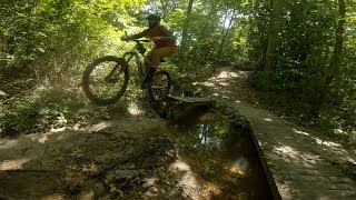
Easy riding dirt singletrack with occasional wooden bridges over wet zones. Popular for walkers, cyclists and runners. Lots of criss-crossing pathways for plenty of exploration in the park. Some sandy corners to challenge handling. A couple of small wooden features and access to dirt jumps offer enjoyment for advanced riders.

source: Park website
Access Info

Good parking at the north end on Rokeby or on the street at the south end on Paramont Ave. Open from sunrise to sunset.

Tags

Local Trail Association

Traditionally Indigenous Territory

Recent Activity on Trail

Past Week
  • 0 rides
  •  
6 Months
  • 19 rides
  • 5 miles avg distance
All
  • 218 rides
  • Last: Nov 19, 2026
c1c2c3c4
January
February
March
April
May
June
July
August
September
October
November
December
update trails status or condition

Outer Loop Trail Reports

Status:
on Sep 20, 2026
Ideal
Avg: 3.81 (5 votes)
Your vote: 0

view (1,803)
close
      Directions to outer-loop-120968 trailhead (36.794970, -76.214570)

      Photos

      11 more »
      mtb
      62 |
      Sep 20, 2026 @ 8:15am
      Sep 20, 2026
      mtb
      74 |
      Sep 20, 2026 @ 8:14am
      Sep 20, 2026
      mtb
      68 |
      Sep 20, 2026 @ 8:14am
      Sep 20, 2026
      mtb
      62 |
      Sep 20, 2026 @ 8:11am
      Sep 20, 2026

      Videos

      1 more »
      Wanna MTB in VA Beach? - Indian River Park...
      mtb
      20:53 | 1575 | Mar 6, 2020 , Chesapeake
      3.6 ★★★★★
      5 Ratings
      5 ★
      4 ★ 60%
      3 ★ 40%
      2 ★
      1 ★

      7 Reviews & Comments

      BenLow2019 BenLow2019
      Really big gap jumps!! Mostly a flat, forest trail with decent bridges over the wet zones. Watch out for the sandy spots.
      RossVsC3VK
      Top part is extremely muddy. The rest is OK, even after all of the recent rain.
      Bear1977 Bear1977
      yesterday was 99% dry. two trees down evma has been notified

      We hope you've been enjoying Trailforks!

      Create a FREE account to view all trail reviews and much more.

      • By tallboyc & contributors
      • #120968 - 1,942 views

      Frequently Asked Questions

      ▼ Where is Outer Loop located?
      Outer Loop is located in Indian River Park, Chesapeake, Virginia, United States. It is part of the Indian River Park trail network. The trailhead is located at coordinates 36.79497, -76.21457.
      ▼ How hard is Outer Loop?
      Outer Loop is rated as Green difficulty. The physical rating is Easy. The climb difficulty is rated Green.
      ▼ What is the elevation gain for Outer Loop?
      Outer Loop has 17 ft of elevation gain. The trail has 17 ft of elevation descent. The elevation ranges from 7 ft to 21 ft.
      ▼ Is Outer Loop a point to point trail?
      Outer Loop is not a point to point trail. The direction is Both Directions. The trail type is singletrack.
      ▼ How long is Outer Loop?
      Outer Loop is 2.6 miles long. The trail type is singletrack.
      ▼ Are dogs allowed on Outer Loop?
      Yes, dogs are allowed on Outer Loop. Please keep dogs on a leash where required and clean up after them.
      ▼ How do I access Outer Loop? Where is the closest parking trailhead?
      The closest parking and trailhead locations to Outer Loop are: View all parking locations in the area.
      ▼ How long does it take to ride Outer Loop?
      Based on recorded activities, it takes an average of 22 minutes to ride Outer Loop. The trail is 2.6 miles long. Actual times will vary based on fitness level, conditions, and pace. View recent activity logs for more details.
      ▼ How busy is Outer Loop?
      Outer Loop is a very popular trail. There have been 1,126 recorded activities on this trail. The trail has received 1,803 check-ins. View recent activity on this trail.

      Hit the Trail

      Open in App

      Get this trail on your phone instantly.

      open trail in app

      Download Trail

      Save to wishlist, Garmin & download.
      save the trail

      Find Related Routes

      Find routes and users activities that include this trail.
      find routes for this trail

      You must enter a description before submitting.