

Open in App
Get this trail on your phone instantly.

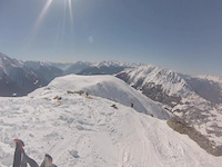
From the top of the round trip (Pianaccio), you can admire the beautiful view of Valcamonica and the Adamello range. The trail start on the left side looking the mountain (Monte Pagano)... This tract is a typical alpine trail with rhododendrons and larches, with bright and warm colors. Then enter in the denser wood and find this very fast and flow tract, with 1 or 2 natural beautiful drops. At this point make attention to the gps track: keep the left at the trail detour (slightly uphill for few meters). Then another time in the coniferous wood: BEAUTIFUL! Full of good natural stuff. Pity only that for a quite long tract the trail is interrupted by a dirt road (IF SOMEONE KNOW A GOOD DEVIATION ON SINGLETRACK, PLEASE CORRECT ME)... Anyway the major part of the trail is very very good: grippy ground and pine needles  Finally you arrive at Incudine little town where you supposedly had parked your car
MAYBE ONE OF THE BEST CLIMB OF VALCAMONICA! Very good views and quite regular to be done in mtb. From Incudine, pedal Mortirolo Pass. I suggest you to do the "direttissima" uphill at the tarmac detour: go left. It's quite steep but really gorgeous. Then at the Albergo Passo Mortirolo keep your right a the turning (instead of going to the pass) and follow this route until you reach the Pianaccio zone.
| c1 | c2 | c3 | c4 |
|---|---|---|---|
January | February | March | April |
May | June | July | August |
September | October | November | December |

Service Road Atlas is a free to use, community-driven service for viewing and creating reports on the numerous back-country service roads around B.C. and Alberta.
Save the current map location and zoom level as your default home location whenever this page is loaded.
Save
No reviews yet, be the first to write a review or ask a question.
Use trail reports to comment on trail conditions.
We hope you've been enjoying Trailforks!
Create a FREE account to view all trail reviews and much more.
You must enter a description before submitting.

