more stats
3,235 ft
Distance
234 ft
Climb
00:11:39
Avg time
232 ft
Altitude change
2,530 ft
Altitude min
2,764 ft
Altitude max
2,530 ft
Altitude start
2,762 ft
Altitude end
7.2%
Grade
-5.2%
Grade max
34.6%
Grade min
2,936 ft
Distance climb
39 ft
Distance down
259 ft
Distance flat
00:11:39
Avg time

Partara Superior Details

  • Activities
    • Mountain Bike
    • E-Bike
    • Winter Fat Bike
    • Hike
    • Trail Running
  • Riding Area
  • Difficulty Rating
  • Local Popularity
    100 in Mountain Biking heatmap [+]
    • 100 in E-Biking
    • 100 in Trail Running
    • 100 in Hiking
    • 5 in Winter Fat Biking
  • Global Ranking
    #116823 in Mountain Biking [+]
    • #69328 in E-Biking
    • #86620 in Trail Running
    • #91931 in Hiking
    • #31819 in Winter Fat Biking
  • National Ranking
    #9,374 in Mountain Biking · Spain [+]
    • #9,702 in E-Biking
    • #7,377 in Trail Running
    • #6,007 in Hiking
    • #416 in Winter Fat Biking
  • Hiking SAC Scale
    T2 Mountain Hiking
  • Trail Type
    Singletrack
  • Bike Type
    AM, XC, Fat
  • Direction
    Both Directions
    Popular Direction Shown
  • Climb Difficulty
    Blue
  • Physical Rating
    Hard
  • Trail Visibility
    Always easy to follow
  • Dogs Allowed
    Yes
  • eBike Allowed
    Yes up to Class 1
  • TTFs on Trail
    Rock Face, Rock Garden
  • Ride in Rain
    Yes

Subida por sendero hasta la cima de Partara y su famoso banco. Hay tramos exigentes por la fuerte pendiente. No obstante el terreno es noble y ofrece buen grip. Continuos escalones rocosos que obligan a llevar cierta inercia

Tags
Rock gardensRock slabs

Trail Supporters

Local Trail Association

Recent Activity on Trail

Past Week
  • 1 rides
  • 8 miles average
6 Months
  • 37 rides
  • 15 miles avg distance
All
  • 416 rides
  • Last: Nov 20, 2026
c1c2c3c4
January
February
March
April
May
June
July
August
September
October
November
December
Status:
on Nov 20, 2026
Wet
Avg: 3.5 (18 votes)
Your vote: 0

view (2,365)
close
      Directions to partara-superior trailhead (42.394540, 0.126470)

      Photos

      10 more »
      mtb
      36 |
      Apr 6, 2026 @ 3:21am
      Apr 6, 2026
      mtb
      35 |
      Apr 6, 2026 @ 3:21am
      Apr 6, 2026
      mtb
      68 |
      Feb 2, 2022 @ 3:14am
      Feb 2, 2022
      mtb
      56 |
      Feb 2, 2022 @ 3:14am
      Feb 2, 2022

      Videos

      2 more »
      Subida a Partarra
      mtb
      5:29 | 65 | May 11, 2022 , Ainsa
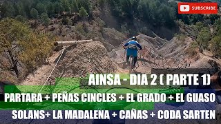
      AINSA -Dia 2 (1/2)  partara +peñas Cincles...
      ebike
      28:44 | 364 | Aug 16, 2022 , Ainsa

      Routes with this trail

      more »
      ★ 5.0 • 13 miles • 2,449 ft • 5 • Loop •
      TIEMPO: 3h. - 3:30h. h CON BARRO: Poco recomendable BALIZADA: SI ZONA: Centro SALIDA: Aínsa río Ara y...
      ★ 5.0 • 10 miles • 1,888 ft • 5 • Loop •
      DESCRIPCIÓN Una de las rutas estrella del Centro BTT Zona Zero Pirineos. No es excesivamente larga, pero...
      ★ 5.0 • 12 miles • 3,329 ft • 16 • Loop •
      Ruta Extrem sobre otro clásico de Zona Zero: La Sierra de Partara. Todo van a ser nuevas experiencias....
      3.4 ★★★★★
      18 Ratings
      5 ★ 11%
      4 ★ 28%
      3 ★ 50%
      2 ★ 6%
      1 ★ 6%

      3 Reviews & Comments

      trailaddicted
      Technical Uphill. Must be fun with th3le E-MTB, but with the accustic Bike its quite a challange and we had ti push our bikes a lot.
      Angelreing Angelreing
      Esta como senda azul pero para subirla montado se necesita fuerza y tecnica
      Monipe Monipe
      Bastante acondicionado por zona zero. Siempre que visito Aínsa no suele fallar que suba por este sendero. Es exigente pero muy divertido

      We hope you've been enjoying Trailforks!

      Create a FREE account to view all trail reviews and much more.

      • By boltranger & contributors
      • #93132 - 1,921 views

      Frequently Asked Questions

      ▼ Where is Partara Superior located?
      Partara Superior is located in Zona Zero Centro, Ainsa, Spain. It is part of the Zona Zero Centro trail network. The trailhead is located at coordinates 42.39454, 0.12647.
      ▼ How hard is Partara Superior?
      Partara Superior is rated as Blue difficulty. The physical rating is Hard. The average grade is 7.2%. The climb difficulty is rated Blue.
      ▼ What is the elevation gain for Partara Superior?
      Partara Superior has 234 ft of elevation gain. The elevation ranges from 2,530 ft to 2,764 ft.
      ▼ Is Partara Superior a point to point trail?
      Partara Superior is not a point to point trail. The direction is Both Directions. The trail type is singletrack.
      ▼ How long is Partara Superior?
      Partara Superior is 3,235 ft long. The trail type is singletrack.
      ▼ Are dogs allowed on Partara Superior?
      Yes, dogs are allowed on Partara Superior. Please keep dogs on a leash where required and clean up after them.
      ▼ How do I access Partara Superior? Where is the closest parking trailhead?
      The closest parking and trailhead locations to Partara Superior are: View all parking locations in the area.
      ▼ How long does it take to ride Partara Superior?
      Based on recorded activities, it takes an average of 12 minutes to ride Partara Superior. The trail is 3,235 ft long. Actual times will vary based on fitness level, conditions, and pace. View recent activity logs for more details.
      ▼ How busy is Partara Superior?
      Partara Superior is a very popular trail. There have been 2,422 recorded activities on this trail. The trail has received 2,365 check-ins. View recent activity on this trail.

      Hit the Trail

      Open in App

      Get this trail on your phone instantly.

      open trail in app

      Download Trail

      Save to wishlist, Garmin & download.
      save the trail

      Find Related Routes

      Find routes and users activities that include this trail.
      find routes for this trail

      You must enter a description before submitting.