


Open in App
Get this trail on your phone instantly.

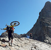
Tratto alto scorrevole e panoramico, scendendo verso valle ed entrando nel bosco la difficoltà aumenta progressivamente, con la presenza di gradoni e tratti esposti.
| c1 | c2 | c3 | c4 |
|---|---|---|---|
January | February | March | April |
May | June | July | August |
September | October | November | December |

Service Road Atlas is a free to use, community-driven service for viewing and creating reports on the numerous back-country service roads around B.C. and Alberta.
Save the current map location and zoom level as your default home location whenever this page is loaded.
SaveWe hope you've been enjoying Trailforks!
Create a FREE account to view all trail reviews and much more.
 & contributors
You must enter a description before submitting.

