

more stats
1,818 ft
Distance
-250 ft
Descent
00:02:23
Avg time
-250 ft
Altitude change
1,383 ft
Altitude min
1,635 ft
Altitude max
1,635 ft
Altitude start
1,385 ft
Altitude end
-13.8%
Grade
-35%
Grade max
1.5%
Grade min
20 ft
Distance climb
1,598 ft
Distance down
154 ft
Distance flat
00:02:23
Avg time

Project Mushroom Details

  • Activities
    • Mountain Bike
    • E-Bike
  • Riding Area
  • Difficulty Rating
  • Trail Style
    Technical
  • Voted Difficulty
    Red (1 vote)
  • Local Popularity
    80 in Mountain Biking heatmap [+]
    • 80 in E-Biking
  • Global Ranking
    #9610 in Mountain Biking [+]
    • #29219 in E-Biking
  • National Ranking
    #277 in Mountain Biking · United Kingdom [+]
    • #1,633 in E-Biking
  • Trail Exposure
    Normal
  • Trail Type
    Singletrack
  • Bike Type
    AM
  • Direction
    Downhill Only[+]
    Popular Direction Shown
    • Downhill Only for E-Biking
  • Climb Difficulty
    Green
  • Physical Rating
    Easy
  • Trail Visibility
    Always easy to follow
  • Dogs Allowed
    Yes
  • eBike Allowed
    Yes up to Class 1
  • TTFs on Trail
    Berm, Jump, Rock Garden
  • Ride in Rain
    Yes
  • Lighting
    No
  • Year Opened
    2025
  • Land Owner
    MacRobert Trust

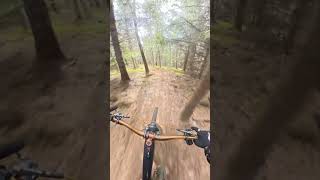
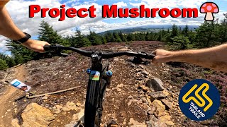
Project Mushroom is a hand-finished, technical trail winding through dense woods, packed with roots, rocks, tight turns, and natural features for skilled riders seeking flow and challenge.

Tags

Local Trail Association

Recent Activity on Trail

Past Week
  • 0 rides
  •  
6 Months
  • 86 rides
  • 14 miles avg distance
All
  • 196 rides
  • Last: Nov 11, 2026
c1c2c3c4
January
February
March
April
May
June
July
August
September
October
November
December
Status:
on Aug 29, 2026
Ideal
Avg: 4.13 (3 votes)
Your vote: 0

view (1,423)
close
      Directions to project-mushroom trailhead (57.159060, -2.833950)

      Photos

      15 more »
      mtb
      100 |
      Aug 3, 2025 @ 8:09am
      Aug 3, 2025
      mtb
      94 |
      Aug 3, 2025 @ 8:09am
      Aug 3, 2025
      mtb
      90 |
      Aug 3, 2025 @ 8:09am
      Aug 3, 2025
      mtb
      106 |
      Aug 3, 2025 @ 8:08am
      Aug 3, 2025

      Videos

      5 more »
      new tarland trail project mushroom
      mtb
      0:52 | 147 | Aug 10, 2025 , Tarland
      youtuber Project Mushroom - Brand New Trail - Tarland...
      mtb
      2:09 | 153 | Aug 3, 2025 , Tarland
      Project Mushroom - Opening
      mtb
      3:40 | 51 | Aug 3, 2025 , Tarland
      Project Mushroom - March Progress Update
      mtb
      5:55 | 82 | Apr 4, 2025 , Tarland

      Routes with this trail

      more »
      15 miles • 2,819 ft • 32 • Out & Back • Race •
      Race course for the full route of the Tarland Enduro - Round #1 - Tartan Enduro Series 2025 run by...
      5.0 ★★★★★
      3 Ratings
      5 ★ 100%
      4 ★
      3 ★
      2 ★
      1 ★

      2 Reviews & Comments

      Woody407
      Rode this today, it's much more of a natural feeling trail other than a couple of built rock features at the start. Hopefully Tarland will get more of this type of trail, more typical of the Aberdeenshire scene. It's a great location - I just need to volunteer for a dig day now.
      BrianTg2vIQ
      Great grafting has produced a hybrid trail with rock, trail centre and natural features. It needs to bed-in due to the dry conditions during the build.

      We hope you've been enjoying Trailforks!

      Create a FREE account to view all trail reviews and much more.

      • By eastfyfesTF Pro TARLAND ENMBC & contributors
      • #788968 - 1,470 views

      Frequently Asked Questions

      ▼ Where is Project Mushroom located?
      Project Mushroom is located in Tarland Trails - Pittenderich, Tarland, United Kingdom. It is part of the Tarland Trails - Pittenderich trail network. The trailhead is located at coordinates 57.15906, -2.83395.
      ▼ How hard is Project Mushroom?
      Project Mushroom is rated as Red difficulty. The physical rating is Easy. The average grade is 13.8%. The climb difficulty is rated Green.
      ▼ What is the elevation gain for Project Mushroom?
      The trail has 250 ft of elevation descent. The elevation ranges from 1,383 ft to 1,635 ft.
      ▼ Is Project Mushroom a point to point trail?
      Yes, Project Mushroom is a point to point trail. The direction is Downhill Only. The trail type is singletrack.
      ▼ How long is Project Mushroom?
      Project Mushroom is 1,818 ft long. The trail type is singletrack.
      ▼ Are dogs allowed on Project Mushroom?
      Yes, dogs are allowed on Project Mushroom. Please keep dogs on a leash where required and clean up after them.
      ▼ How do I access Project Mushroom? Where is the closest parking trailhead?
      The closest parking and trailhead locations to Project Mushroom are: View all parking locations in the area.
      ▼ How long does it take to ride Project Mushroom?
      Based on recorded activities, it takes an average of 2 minutes to ride Project Mushroom. The trail is 1,818 ft long. Actual times will vary based on fitness level, conditions, and pace. View recent activity logs for more details.
      ▼ How busy is Project Mushroom?
      Project Mushroom is a very popular trail. There have been 1,146 recorded activities on this trail. The trail has received 1,422 check-ins. View recent activity on this trail.

      Hit the Trail

      Open in App

      Get this trail on your phone instantly.

      open trail in app

      Download Trail

      Save to wishlist, Garmin & download.
      save the trail

      Find Related Routes

      Find routes and users activities that include this trail.
      find routes for this trail

      You must enter a description before submitting.