
more stats
3.2 miles
Distance
162 ft
Climb
-209 ft
Descent
00:24:47
Avg time
-47 ft
Altitude change
3,198 ft
Altitude min
3,342 ft
Altitude max
3,338 ft
Altitude start
3,291 ft
Altitude end
-0.3%
Grade
-17.9%
Grade max
12.6%
Grade min
1 mile
Distance climb
2 miles
Distance down
2,526 ft
Distance flat
00:24:47
Avg time

Trail Details

  • Activities
    • Mountain Bike
    • Horse
    • Hike
    • Trail Running
  • Riding Area
  • Difficulty Rating
  • Local Popularity
    95 in Mountain Biking [+]
    • 85 in Trail Running
    • 75 in Hiking
    • 5 in Horseback
  • Global Ranking
    #44703 in Mountain Biking [+]
    • #97388 in Trail Running
    • #107847 in Hiking
    • #3168 in Horseback
  • State Ranking
    #843 in Mountain Biking · Utah [+]
    • #2,101 in Trail Running
    • #2,389 in Hiking
    • #67 in Horseback
  • Hiking SAC Scale
    T1 Hiking
  • Trail Type
    Singletrack
  • Direction
    Both Directions
  • Climb Difficulty
    Blue
  • Physical Rating
    Moderate
  • Dogs Allowed
    Yes

Can be a fast and flowing trail in both directions, mostly desert and sandy terrain with some climbs and mild rocky sections

Tags
DesertFlowyRockySandy

Trail Supporters

  • BLM
    BLM
    Land Manager

Traditionally Indigenous Territory

Recent Activity on Trail

Past Week
  • 5 rides
  • 12 miles average
6 Months
  • 73 rides
  • 13 miles avg distance
All
  • 1,281 rides
  • Last: Nov 2, 2026
c1c2c3c4
January
February
March
April
May
June
July
August
September
October
November
December
update trails status or condition

Prospector Trail... Trail Reports

statusdatedescription
Apr 7, 2026 @ 1:47pm (America/Denver)
Apr 7, 2026
Feb 6, 2026 @ 3:08pm (America/Denver)
Feb 6, 2026
Nov 12, 2025 @ 11:24am (America/Denver)
Nov 12, 2025
Oct 15, 2025 @ 11:25am (America/Phoenix)
Oct 15, 2025
Not alot of downhill is more level
Aug 13, 2025 @ 10:37am
Aug 13, 2025
Perfect trail conditions after the rains. Only a couple of puddles here and there. Great ride!
more »
Status:
on Apr 7, 2026
Dry
Avg: 4 (29 votes)
Your vote: 0

view (9,962)
close
      Directions to prospector-trail-church-rocks-to-cottonwood trailhead (37.186680, -113.422990)

      Photos

      27 more »
      mtb
      652 |
      Dec 20, 2017 @ 1:31pm
      Dec 20, 2017
      mtb
      562 |
      Sep 26, 2014 @ 9:41am
      Sep 26, 2014
      mtb
      114 |
      Feb 17, 2025 @ 10:43pm
      Feb 17, 2025
      mtb
      182 |
      Mar 19, 2022 @ 8:16am
      Mar 19, 2022

      Videos

      3 more »
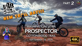
      youtuber MTB Riding Prospector, Washington, UT,...
      mtb
      20:48 | 127 | Oct 10, 2025 , Hurricane
      youtuber Prospector and Church Rocks
      mtb
      12:46 | 377 | May 23, 2023 , Hurricane
      prospector trail
      mtb
      0:19 | 655 | Sep 28, 2014 , Hurricane

      Routes with this trail

      ★ 5.0 • 8 miles • 557 ft • 7 • Out & Back •
      Ride Prospector (a portion of it) to Church Rocks then back out.
      16 miles • 1,193 ft • 9 • Out & Back •
      This is my favorite Prospector-Church Rocks loop when I am just rolling into town, and want to get to some...
      9 miles • 605 ft • 4 •
      fda;jfdklja;fkdsja;fdskafjdskajfdkslajf;kdsj;afdl;sajfskldaf
      4.0 ★★★★★
      29 Ratings
      5 ★ 31%
      4 ★ 41%
      3 ★ 24%
      2 ★ 3%
      1 ★

      10 Reviews & Comments

      reedrunner92 reedrunner92
      Basic flow trail running parallel to the interstate. Lots of car noise detracting from the vibe. Handy if you want to add a couple more miles to your Church Rocks ride as an out and back
      Galldredge
      The trail runs across a large portion of the burn area but still as fast and easy as ever. A few sandy spots and a couple of technical rock options. For the most part any rider can have fun here if they try. No shade and very dry.
      RyanS13
      Trail is good to go- just have to access from Church rocks, not the Cottonwood trailhead.

      We hope you've been enjoying Trailforks!

      Create a FREE account to view all trail reviews and much more.

      • By toddTF Pro Trailforks & contributors
      • #9147 - 7,112 views

      Frequently Asked Questions

      ▼ Where is Prospector Trail (Church Rocks to Cottonwood) located?
      Prospector Trail (Church Rocks to Cottonwood) is located in Red Cliffs BLM National Conservation Area, Hurricane, Utah, United States. It is part of the Red Cliffs BLM National Conservation Area trail network. The trailhead is located at coordinates 37.18668, -113.42299.
      ▼ How hard is Prospector Trail (Church Rocks to Cottonwood)?
      Prospector Trail (Church Rocks to Cottonwood) is rated as Blue difficulty. The physical rating is Moderate. The average grade is 0.3%. The climb difficulty is rated Blue.
      ▼ What is the elevation gain for Prospector Trail (Church Rocks to Cottonwood)?
      Prospector Trail (Church Rocks to Cottonwood) has 162 ft of elevation gain. The trail has 209 ft of elevation descent. The elevation ranges from 3,198 ft to 3,342 ft.
      ▼ Is Prospector Trail (Church Rocks to Cottonwood) a point to point trail?
      Prospector Trail (Church Rocks to Cottonwood) is not a point to point trail. The direction is Both Directions. The trail type is singletrack.
      ▼ How long is Prospector Trail (Church Rocks to Cottonwood)?
      Prospector Trail (Church Rocks to Cottonwood) is 3.2 miles long. The trail type is singletrack.
      ▼ Are dogs allowed on Prospector Trail (Church Rocks to Cottonwood)?
      Yes, dogs are allowed on Prospector Trail (Church Rocks to Cottonwood). Please keep dogs on a leash where required and clean up after them.
      ▼ How do I access Prospector Trail (Church Rocks to Cottonwood)? Where is the closest parking trailhead?
      The closest parking and trailhead locations to Prospector Trail (Church Rocks to Cottonwood) are: View all parking locations in the area.
      ▼ How long does it take to ride Prospector Trail (Church Rocks to Cottonwood)?
      Based on recorded activities, it takes an average of 25 minutes to ride Prospector Trail (Church Rocks to Cottonwood). The trail is 3.2 miles long. Actual times will vary based on fitness level, conditions, and pace. View recent activity logs for more details.
      ▼ How busy is Prospector Trail (Church Rocks to Cottonwood)?
      Prospector Trail (Church Rocks to Cottonwood) is a very popular trail. There have been 7,165 recorded activities on this trail. The trail has received 9,962 check-ins. View recent activity on this trail.

      Hit the Trail

      Open in App

      Get this trail on your phone instantly.

      open trail in app

      Download Trail

      Save to wishlist, Garmin & download.
      save the trail

      Find Related Routes

      Find routes and users activities that include this trail.
      find routes for this trail

      You must enter a description before submitting.