
more stats
1.4 miles
Distance
111 ft
Climb
-264 ft
Descent
00:17:32
Avg time
-153 ft
Altitude change
3,926 ft
Altitude min
4,184 ft
Altitude max
4,079 ft
Altitude start
3,927 ft
Altitude end
-2.1%
Grade
-39.9%
Grade max
27.3%
Grade min
1,854 ft
Distance climb
4,331 ft
Distance down
1,004 ft
Distance flat
00:17:32
Avg time

Razorback Details

  • Activities
    • Mountain Bike
    • E-Bike
    • Horse
    • Hike
    • Trail Running
    • Snowshoe
  • Riding Area
    Pyramid Bench
    Jasper, Alberta
  • Ref Number
    8f
  • Difficulty Rating
  • Local Popularity
    85 in Mountain Biking heatmap [+]
    • 95 in E-Biking
    • 90 in Trail Running
    • 70 in Hiking
    • 5 in Horseback
    • 5 in Snowshoeing
  • Global Ranking
    #57980 in Mountain Biking [+]
    • #103350 in E-Biking
    • #101333 in Trail Running
    • #130967 in Hiking
    • #21653 in Horseback
    • #18164 in Snowshoeing
  • Provincial Ranking
    #907 in Mountain Biking · Alberta [+]
    • #926 in E-Biking
    • #1,834 in Trail Running
    • #2,350 in Hiking
    • #263 in Horseback
    • #564 in Snowshoeing
  • Hiking SAC Scale
    T2 Mountain Hiking
  • Blaze Color
  • Trail Type
    Singletrack
  • Bike Type
    AM, XC
  • Direction
    Downhill Primary
    Popular Direction Shown
  • Climb Difficulty
    Black Diamond
  • Physical Rating
    Hard
  • Trail Visibility
    Always easy to follow
  • Season
    May - Oct
  • Dogs Allowed
    Yes
  • eBike Allowed
    Yes up to Class 1
  • Ride in Rain
    Yes
  • Land Owner

Steep continuous sustained climb to the summit, technical fall line back to the Cabin Lake Fire Road or continue on all the way to town via the Pyramid Lake road.

Access Info

From town take Trail 8 just past Mina lake. Well worn climb trail starts ~100m past the lake.

Tags
LakeSummit

Recent Activity on Trail

Past Week
  • 0 rides
  •  
6 Months
  • 14 rides
  • 11 miles avg distance
All
  • 98 rides
  • Last: Nov 9, 2026
c1c2c3c4
January
February
March
April
May
June
July
August
September
October
November
December
Status:
on Jul 23, 2026
Avg: 4.23 (11 votes)
Your vote: 0

view (711)
close
      Directions to razorback-34993 trailhead (52.885530, -118.123110)

      Photos

      14 more »
      mtb
      522 |
      Sep 1, 2017 @ 7:22am
      Sep 1, 2017
      mtb
      436 |
      Sep 1, 2017 @ 7:21am
      Sep 1, 2017
      mtb
      122 |
      Nov 2, 2026 @ 2:04pm
      Nov 2, 2026
      mtb
      54 |
      May 18, 2024 @ 8:03pm
      May 18, 2024

      Videos

      2 more »
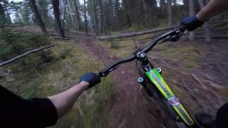
      Riding Razorback in Jasper AB
      mtb
      3:33 | 709 | Aug 6, 2020 , Jasper
      RazorkBack trail Aug 2020, full video
      mtb
      19:43 | 206 | Sep 2, 2020 , Jasper

      Routes with this trail

      more »
      ★ 1.0 • 11 miles • 1,275 ft • 5 •
      Climb up to pyramid lake from the aquatics center parking lot, cross over by the bungalows then drop down...
      4.4 ★★★★★
      11 Ratings
      5 ★ 73%
      4 ★ 9%
      3 ★ 9%
      2 ★
      1 ★ 9%

      2 Reviews & Comments

      AchillesRider
      Steep climb in the beginning, already thought I am on an XC track. Nice DH, but the climb is the part which makes this track black, not the DH
      Patbike27
      Steepest climb I ever did but the descent was worth it a hundred times.

      We hope you've been enjoying Trailforks!

      Create a FREE account to view all trail reviews and much more.

      • By edvostuk & contributors
      • #34993 - 6,301 views

      Frequently Asked Questions

      ▼ Where is Razorback located?
      Razorback is located in Pyramid Bench, Jasper, Alberta, Canada. It is part of the Pyramid Bench trail network. The trailhead is located at coordinates 52.88553, -118.12311.
      ▼ How hard is Razorback?
      Razorback is rated as Black Diamond difficulty. The physical rating is Hard. The average grade is 2.1%. The climb difficulty is rated Black Diamond.
      ▼ What is the elevation gain for Razorback?
      Razorback has 111 ft of elevation gain. The trail has 264 ft of elevation descent. The elevation ranges from 3,926 ft to 4,184 ft.
      ▼ Is Razorback a point to point trail?
      Razorback is not a point to point trail. The direction is Downhill Primary. The trail type is singletrack.
      ▼ How long is Razorback?
      Razorback is 1.4 miles long. The trail type is singletrack.
      ▼ Are dogs allowed on Razorback?
      Yes, dogs are allowed on Razorback. Please keep dogs on a leash where required and clean up after them.
      ▼ When is the best time of year to ride Razorback?
      Based on activity log data, the most popular months to ride Razorback are:
      • July (7 activities)
      • August (6 activities)
      • May (5 activities)
      Check the reports page for current trail conditions.
      ▼ How do I access Razorback? Where is the closest parking trailhead?
      The closest parking and trailhead locations to Razorback are: View all parking locations in the area.
      ▼ How long does it take to ride Razorback?
      Based on recorded activities, it takes an average of 18 minutes to ride Razorback. The trail is 1.4 miles long. Actual times will vary based on fitness level, conditions, and pace. View recent activity logs for more details.
      ▼ How busy is Razorback?
      Razorback is a very popular trail. There have been 747 recorded activities on this trail. The trail has received 711 check-ins. View recent activity on this trail.

      Hit the Trail

      Open in App

      Get this trail on your phone instantly.

      open trail in app

      Download Trail

      Save to wishlist, Garmin & download.
      save the trail

      Find Related Routes

      Find routes and users activities that include this trail.
      find routes for this trail

      You must enter a description before submitting.

