
more stats
2.0 miles
Distance
9 ft
Climb
-1,115 ft
Descent
00:12:12
Avg time
-1,106 ft
Altitude change
4,560 ft
Altitude min
5,666 ft
Altitude max
5,666 ft
Altitude start
4,560 ft
Altitude end
-10.5%
Grade
-58.3%
Grade max
5.7%
Grade min
568 ft
Distance climb
2 miles
Distance down
262 ft
Distance flat
00:12:12
Avg time

RedRock Details

  • Activities
    • Mountain Bike
    • E-Bike
  • Riding Area
    BikerBerg Flumserberg
    Flumserberg
  • Ref Number
    331T
  • Difficulty Rating
  • Voted Difficulty
    Blue (7 votes)
  • Local Popularity
    80 in Mountain Biking heatmap [+]
    • 100 in E-Biking
  • Global Ranking
    #51812 in Mountain Biking [+]
    • #3091 in E-Biking
  • National Ranking
    #1,207 in Mountain Biking · Switzerland [+]
    • #62 in E-Biking
  • Trail Type
    Machine Groomed
  • Bike Type
    AM, XC
  • Climb Difficulty
    Green
  • Physical Rating
    Moderate
  • Trail Visibility
    Always easy to follow
  • Dogs Allowed
    Yes
  • eBike Allowed
    Yes up to Class 1
  • TTFs on Trail
    Berm, Jump, Ladder Bridge

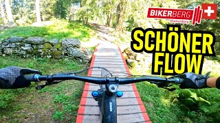
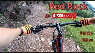
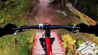
BikerTrail RedRock Der BikerTrail RedRock zweigt bei Twärchamm vom RedFox ab und führt mit viel Abwechslung durch Alpwiesen, über kleine Brücken, vorbei an der roten Felswand zum Chrüz und von da weiter durch den Wald nach Tannenboden.
Sie erreichen die Prodalp ab Tannenheim mit der 12er-Gondelbahn Prodalp-Express. Auf Prodalp steigen Sie in die 8er Sesselbahn Prodkamm, welche Sie zum Startpunkt des RedFox BikerTrails bringt. Bis zur Abzweigung auf Twärchamm fahren Sie auf dem RedFox..

Access Info

Via Tannenheim mit Gondel Prodalp und Sessellift Prodkamm

Tags
BermsJumpsSkinnies

Bike Park

Recent Activity on Trail

Past Week
  • 0 rides
  •  
6 Months
  • 111 rides
  • 26 miles avg distance
All
  • 241 rides
  • Last: Oct 18, 2026
c1c2c3c4
January
February
March
April
May
June
July
August
September
October
November
December
Status:
on Sep 22, 2026
Ideal
Avg: 3.88 (20 votes)
Your vote: 0

view (1,263)
close
      Directions to redrock-144981 trailhead (47.079170, 9.274470)

      Photos

      7 more »
      mtb
      50 |
      Sep 7, 2026 @ 2:09am
      Sep 7, 2026
      mtb
      53 |
      Sep 7, 2026 @ 2:08am
      Sep 7, 2026
      mtb
      67 |
      Jul 30, 2025 @ 12:51pm
      Jul 30, 2025
      mtb
      102 |
      Jun 19, 2025 @ 11:02am
      Jun 19, 2025

      Videos

      7 more »
      youtuber BIKERBERG FLUMSERBERG Red Rock Trail  First...
      mtb
      9:57 | 376 | Apr 4, 2025 , Flumserberg
      youtuber Flumserberg saved our day!
      mtb
      14:08 | 250 | Jul 8, 2024 , Flumserberg
      Red Rock Trail @ Bikerberg Flumserberg | POV |...
      mtb
      19:54 | 218 | Jul 29, 2023 , Flumserberg
      Flumserberg Biketrail Redrock und Redfox in...
      mtb
      10:07 | 1010 | Nov 23, 2019 , Flumserberg
      3.9 ★★★★★
      20 Ratings
      5 ★ 25%
      4 ★ 50%
      3 ★ 20%
      2 ★
      1 ★ 5%

      2 Reviews & Comments

      MarkosdkW2TG
      Best trail on flumserberg, the others are very crowded on weekends
      5BNEv8
      It’s blue, sometimes even green. In this bike park there are no technical trails, just very flowy stuff and long, which is fun to train your endurance and the technique in berms.

      We hope you've been enjoying Trailforks!

      Create a FREE account to view all trail reviews and much more.

      Frequently Asked Questions

      ▼ Where is RedRock located?
      RedRock is located in BikerBerg Flumserberg, Flumserberg, Switzerland. It is part of the BikerBerg Flumserberg trail network. The trailhead is located at coordinates 47.07917, 9.27447.
      ▼ How hard is RedRock?
      RedRock is rated as Red difficulty. The physical rating is Moderate. The average grade is 10.5%. The climb difficulty is rated Green.
      ▼ What is the elevation gain for RedRock?
      RedRock has 9 ft of elevation gain. The trail has 1,115 ft of elevation descent. The elevation ranges from 4,560 ft to 5,666 ft.
      ▼ How long is RedRock?
      RedRock is 2.0 miles long. The trail type is machine groomed.
      ▼ Are dogs allowed on RedRock?
      Yes, dogs are allowed on RedRock. Please keep dogs on a leash where required and clean up after them.
      ▼ When is the best time of year to ride RedRock?
      Based on activity log data, the most popular months to ride RedRock are:
      • June (47 activities)
      • July (37 activities)
      • September (33 activities)
      Check the reports page for current trail conditions.
      ▼ How do I access RedRock? Where is the closest parking trailhead?
      The closest parking and trailhead locations to RedRock are: View all parking locations in the area.
      ▼ How long does it take to ride RedRock?
      Based on recorded activities, it takes an average of 12 minutes to ride RedRock. The trail is 2.0 miles long. Actual times will vary based on fitness level, conditions, and pace. View recent activity logs for more details.
      ▼ How busy is RedRock?
      RedRock is a very popular trail. There have been 1,045 recorded activities on this trail. The trail has received 1,263 check-ins. View recent activity on this trail.

      Hit the Trail

      Open in App

      Get this trail on your phone instantly.

      open trail in app

      Download Trail

      Save to wishlist, Garmin & download.
      save the trail

      Find Related Routes

      Find routes and users activities that include this trail.
      find routes for this trail

      You must enter a description before submitting.