

more stats
1.8 miles
Distance
500 ft
Climb
-800 ft
Descent
00:49:11
Avg time
-299 ft
Altitude change
3,929 ft
Altitude min
4,677 ft
Altitude max
4,228 ft
Altitude start
3,930 ft
Altitude end
-3.2%
Grade
-83.5%
Grade max
70.4%
Grade min
3,878 ft
Distance climb
5,118 ft
Distance down
285 ft
Distance flat
00:49:11
Avg time

Retrocorchia Details

  • Activities
    • Mountain Bike
    • E-Bike
    • Hike
    • Trail Running
  • Riding Area
    Alpi Apuane
    Seravezza
  • Ref Number
    CAI129
  • Difficulty Rating
  • Local Popularity
    40 in Mountain Biking [+]
    • 30 in E-Biking
    • 5 in Trail Running
    • 95 in Hiking
  • Global Ranking
    #316527 in Mountain Biking [+]
    • #134404 in E-Biking
    • #330061 in Trail Running
    • #46363 in Hiking
  • National Ranking
    #20,475 in Mountain Biking · Italy [+]
    • #12,883 in E-Biking
    • #12,239 in Trail Running
    • #813 in Hiking
  • Hiking SAC Scale
    T2 Mountain Hiking
  • Trail Type
    Wilderness Trail
  • Bike Type
    AM
  • Direction
    Downhill Primary
    Popular Direction Shown
  • Climb Difficulty
    Blue
  • Physical Rating
    Moderate
  • Trail Visibility
    Always easy to follow
  • Alpine Trail
    Yes
  • Family Friendly
    Yes
  • Dogs Allowed
    Yes
  • eBike Allowed
    Yes up to Class 1
  • TTFs on Trail
    Berm, Rock Garden, Roller Coaster
  • Year Opened
    2021

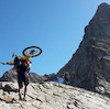
Retrocorchia (CAI 129) is a wild naturnal trail in the woods starts deviating from the main Corchia peak access road and ends to shelter "Del Freo" and "Foce di Mosceta" point crosses a lot of trails.
It starts uphill, with a couple of short insidious climb, and then at 2/3 it starts downhill to the end, with a couple of hard technical point

source: ...

Recent Activity on Trail

Past Week
  • 0 rides
  •  
6 Months
  • 3 rides
  • 21 miles avg distance
All
  • 10 rides
  • Last: Jul 4, 2026
c1c2c3c4
January
February
March
April
May
June
July
August
September
October
November
December
update trails status or condition

Retrocorchia Trail Reports

statusdatedescription
Aug 31, 2026 @ 12:06pm (Europe/Rome)
Aug 31, 2026
sentiero tecnico, erba alta nel tratto finale ma percorribile
Sep 8, 2025 @ 5:57am
Sep 8, 2025
Tutto ok. Erba tagliata nel tratto ripido finale
Aug 16, 2025 @ 11:05am
Aug 16, 2025
Apr 3, 2025 @ 1:49am
Apr 3, 2025
Niente neve, in ottime condizioni, pur con le difficolta dovute all'erosione dell'ultimo km, in prossimità del Rifugio Del Freo. No snow, in...
Mar 1, 2025 @ 1:52am
Mar 1, 2025
Tratti a Nord parzialmente innevati. Altri tratti scivolosi. Trail complessivamente percorribile con fatica. La parte finale verso Rifugio Del...
more »
Status:
on Aug 31, 2026
Ideal
no votes yet
Your vote: 0

view (99)
close
      Directions to retrocorchia trailhead (44.043840, 10.284340)

      Photos

      6 more »
      mtb
      65 |
      Mar 4, 2025 @ 11:53am
      Mar 4, 2025
      mtb
      56 |
      Mar 4, 2025 @ 11:53am
      Mar 4, 2025
      mtb
      65 |
      Mar 4, 2025 @ 11:53am
      Mar 4, 2025
      mtb
      66 |
      Mar 4, 2025 @ 11:53am
      Mar 4, 2025

      Videos

      1 more »
      the 'Retrocorchia' trail is from the beginning...
      mtb
      6:57 | 177 | Dec 1, 2021 , Seravezza

      1 Review & Comments

      barolo71 barolo71
      Molto bello in foresta suggestiva. La prima parte ha due o tre brevi salite da spingere, poi percorso molto divertente con finale tecnico

      We hope you've been enjoying Trailforks!

      Create a FREE account to view all trail reviews and much more.

      • By gianb86 & contributors
      • #488880 - 426 views

      Frequently Asked Questions

      ▼ Where is Retrocorchia located?
      Retrocorchia is located in Alpi Apuane, Seravezza, Italy. It is part of the Alpi Apuane trail network. The trailhead is located at coordinates 44.04384, 10.28434.
      ▼ How hard is Retrocorchia?
      Retrocorchia is rated as Black difficulty. The physical rating is Moderate. The average grade is 3.2%. The climb difficulty is rated Blue.
      ▼ What is the elevation gain for Retrocorchia?
      Retrocorchia has 500 ft of elevation gain. The trail has 800 ft of elevation descent. The elevation ranges from 3,929 ft to 4,677 ft.
      ▼ Is Retrocorchia a point to point trail?
      Retrocorchia is not a point to point trail. The direction is Downhill Primary. The trail type is wilderness trail.
      ▼ How long is Retrocorchia?
      Retrocorchia is 1.8 miles long. The trail type is wilderness trail.
      ▼ Are dogs allowed on Retrocorchia?
      Yes, dogs are allowed on Retrocorchia. Please keep dogs on a leash where required and clean up after them.
      ▼ How do I access Retrocorchia? Where is the closest parking trailhead?
      The closest parking and trailhead locations to Retrocorchia are: View all parking locations in the area.
      ▼ How long does it take to ride Retrocorchia?
      The estimated time to ride Retrocorchia is approximately 49 minutes. The trail is 1.8 miles long. Actual times will vary based on fitness level, conditions, and pace.
      ▼ How busy is Retrocorchia?
      Retrocorchia is a moderately popular trail. There have been 85 recorded activities on this trail. The trail has received 99 check-ins. View recent activity on this trail.

      Hit the Trail

      Open in App

      Get this trail on your phone instantly.

      open trail in app

      Download Trail

      Save to wishlist, Garmin & download.
      save the trail

      Find Related Routes

      Find routes and users activities that include this trail.
      find routes for this trail

      You must enter a description before submitting.


