more stats
1.3 miles
Distance
232 ft
Climb
-279 ft
Descent
00:13:52
Avg time
-48 ft
Altitude change
2,369 ft
Altitude min
2,556 ft
Altitude max
2,435 ft
Altitude start
2,388 ft
Altitude end
-0.7%
Grade
-21.6%
Grade max
39.4%
Grade min
2,270 ft
Distance climb
3,360 ft
Distance down
1,414 ft
Distance flat
00:13:52
Avg time

Roadlflow-Trail Details

  • Activities
    • Mountain Bike
    • E-Bike
    • Gravel Bike
    • Winter Fat Bike
    • Hike
    • Trail Running
  • Riding Area
  • Ref Number
    OT98
  • Difficulty Rating
  • Local Popularity
    90 in Mountain Biking [+]
    • 60 in E-Biking
    • 5 in Trail Running
    • 5 in Hiking
    • 5 in Winter Fat Biking
    • 5 in Gravel Biking
  • Global Ranking
    #6034 in Mountain Biking [+]
    • #41541 in E-Biking
    • #355960 in Trail Running
    • #344458 in Hiking
    • #7289 in Winter Fat Biking
    • #3018 in Gravel Biking
  • National Ranking
    #67 in Mountain Biking · Austria [+]
    • #285 in E-Biking
    • #712 in Trail Running
    • #776 in Hiking
    • #25 in Winter Fat Biking
    • #14 in Gravel Biking
  • Trail Exposure
    High Risk
  • Trail Type
    Singletrack
  • Bike Type
    AM, XC
  • Climb Difficulty
    Green
  • Physical Rating
    Easy
  • Trail Visibility
    Always easy to follow
  • Family Friendly
    Yes
  • eBike Allowed
    Yes up to Class 1
  • TTFs on Trail
    Berm, Jump, Roller Coaster
  • Year Opened
    2023
  • Land Owner

Genaue Infos zu den Roadlberg-Trails unter:
https://mtblinz.at/trails/roadlberg-trails/

Bitte haltet euch an die Regeln:
Öffnungszeiten:
1. Mai – 30. September: 8:00 bis 20:00 Uhr
1. Oktober – 30. April: 9:00 bis 17:00 Uhr

Die Benützung ist kostenlos. Gewerbliche Angebote sind strengstens untersagt und müssen via MTB Linz bei Wegerhalter und Grundeigentümer angefragt werden.

Nightrides sind grundsätzlich verboten und wir bitten um strikte Einhaltung – für ein funktionierendes Miteinander von Mountainbikern, Jagd und Forstwirtschaft. Im Gegenzug gibt es keine Wintersperre, bzw. sind auch Befahrungen bei feuchten und gatschigen Bedingungen erlaubt.

Die aktuellen Nutzungsbedingungen und Verhaltenregeln sind hier einsehbar:
www.mtblinz.at/bike-fairplay-roadlberg/

Um die Wegerhaltung der Trails und Mountainbikerouten kümmert sich die Mountainbike-Initiative Linz (MTB-Linz). Dorthin kannst Du dich auch bei Fragen, Wünschen oder Problemen wenden.
MTB-Linz ist über www.mtblinz.at erreichbar.

Disclaimer

Absolute Helmpflicht! Die Benützung erfolgt auf eigene Gefahr!

Trail Supporters

Local Trail Association

Recent Activity on Trail

Past Week
  • 1 rides
  • 17 miles average
6 Months
  • 21 rides
  • 11 miles avg distance
All
  • 78 rides
  • Last: Oct 24, 2026
c1c2c3c4
January
February
March
April
May
June
July
August
September
October
November
December
update trails status or condition

Roadlflow-Trail Trail Reports

statusdatedescription
Oct 18, 2026 @ 8:27am (Europe/Vienna)
Oct 17, 2026
alles bestens und teilweise neu beschildert
Oct 11, 2026 @ 2:40pm (Europe/Vienna)
Oct 11, 2026
alles bestens, hero-dirt
Oct 3, 2026 @ 2:57pm (Europe/Vienna)
Oct 3, 2026
perfekte bedingungen, im mittelteil kleine ausbesserungsarbeiten
Oct 1, 2026 @ 4:54pm (Europe/Vienna)
Oct 1, 2026
perfekt
Sep 26, 2026 @ 2:29pm (Europe/Vienna)
Sep 26, 2026
perfekt und frisch auskehrt im letzten abschnitt. uphill alles bestens, lediglich im oberen mittelteil etwas nadeln von den forstarbeiten aber...
more »
Status:
on Oct 18, 2026
Ideal
Avg: 4.13 (2 votes)
Your vote: 0

view (734)
close
      Directions to roadlflowtrail trailhead (48.432880, 14.397410)

      Photos

      29 more »
      mtb
      274 |
      May 31, 2023 @ 12:00am
      May 31, 2023
      mtb
      106 |
      Jun 19, 2026 @ 3:57am
      Jun 19, 2026
      mtb
      74 |
      Aug 21, 2025 @ 5:02am
      Aug 21, 2025
      mtb
      74 |
      Aug 21, 2025 @ 5:02am
      Aug 21, 2025

      Videos

      5 more »
      youtuber Herbstlich, frisch & knackig - Roadlberg...
      mtb
      13:36 | 227 | Oct 25, 2025 , Linz
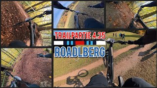
      Trailpartie 4.25 - Roadlberg
      mtb
      9:07 | 31 | Oct 24, 2025 , Linz
      RUND UMS RAD - Roadlberg - TvSalon
      mtb
      0:49 | 87 | Mar 30, 2025 , Linz
      Location Check Roadlberg | Santa Cruz Bullit
      mtb
      5:32 | 307 | Jun 14, 2023 , Linz
      5.0 ★★★★★
      2 Ratings
      5 ★ 100%
      4 ★
      3 ★
      2 ★
      1 ★

      2 Reviews & Comments

      ktm-boy-69 ktm-boy-69
      Trail wurde 2025 wesentlich erweitert. Erster Teil ist ein Uphill-Trail, der direkt beim Roadlhof startet und auch als Zubringer für die anderen Trails dient. Auch nach hinten hin wurde der Trail mehr oder weniger verdoppelt.
      flowchi
      Sehr cooler Einsteigertrail mit lustigen Sprüngen.

      We hope you've been enjoying Trailforks!

      Create a FREE account to view all trail reviews and much more.

      Frequently Asked Questions

      ▼ Where is Roadlflow-Trail located?
      Roadlflow-Trail is located in Roadlberg-Trails, Linz, Austria. It is part of the Roadlberg-Trails trail network. The trailhead is located at coordinates 48.43288, 14.39741.
      ▼ How hard is Roadlflow-Trail?
      Roadlflow-Trail is rated as Blue difficulty. The physical rating is Easy. The average grade is 0.7%. The climb difficulty is rated Green.
      ▼ What is the elevation gain for Roadlflow-Trail?
      Roadlflow-Trail has 232 ft of elevation gain. The trail has 279 ft of elevation descent. The elevation ranges from 2,369 ft to 2,556 ft.
      ▼ How long is Roadlflow-Trail?
      Roadlflow-Trail is 1.3 miles long. The trail type is singletrack.
      ▼ Are dogs allowed on Roadlflow-Trail?
      There is no information about dogs being allowed on Roadlflow-Trail. Check with local trail managers or the trail page for the latest access rules.
      ▼ When is the best time of year to ride Roadlflow-Trail?
      Based on activity log data, the most popular months to ride Roadlflow-Trail are:
      • October (20 activities)
      • August (13 activities)
      • May (8 activities)
      Check the reports page for current trail conditions.
      ▼ How do I access Roadlflow-Trail? Where is the closest parking trailhead?
      The closest parking and trailhead locations to Roadlflow-Trail are: View all parking locations in the area.
      ▼ How long does it take to ride Roadlflow-Trail?
      Based on recorded activities, it takes an average of 14 minutes to ride Roadlflow-Trail. The trail is 1.3 miles long. Actual times will vary based on fitness level, conditions, and pace. View recent activity logs for more details.
      ▼ How busy is Roadlflow-Trail?
      Roadlflow-Trail is a very popular trail. There have been 376 recorded activities on this trail. The trail has received 734 check-ins. View recent activity on this trail.

      Hit the Trail

      Open in App

      Get this trail on your phone instantly.

      open trail in app

      Download Trail

      Save to wishlist, Garmin & download.
      save the trail

      Find Related Routes

      Find routes and users activities that include this trail.
      find routes for this trail

      You must enter a description before submitting.