

more stats
1.1 miles
Distance
72 ft
Climb
-867 ft
Descent
00:34:28
Avg time
-795 ft
Altitude change
1,349 ft
Altitude min
2,146 ft
Altitude max
2,145 ft
Altitude start
1,348 ft
Altitude end
-13.4%
Grade
-55.3%
Grade max
15.6%
Grade min
1,296 ft
Distance climb
4,465 ft
Distance down
125 ft
Distance flat
00:34:28
Avg time

Rocche Gianche Details

  • Activities
    • Mountain Bike
    • E-Bike
    • Hike
    • Trail Running
  • Riding Area
    Finale Outdoor Region
    Finale Ligure
  • Ref Number
    #133
  • Difficulty Rating
  • Voted Difficulty
    Proline (6 votes)
  • Local Popularity
    50 in Mountain Biking [+]
    • 40 in E-Biking
    • 5 in Trail Running
    • 5 in Hiking
  • Global Ranking
    #36641 in Mountain Biking [+]
    • #62564 in E-Biking
    • #125605 in Trail Running
    • #119096 in Hiking
  • Hiking SAC Scale
    T2 Mountain Hiking
  • Trail Type
    Singletrack
  • Bike Type
    AM, XC
  • Direction
    Downhill Only
    Popular Direction Shown
  • Climb Difficulty
    Green
  • Physical Rating
    Moderate
  • Trail Visibility
    Sometimes hard to follow
  • Season
    All-year round
  • Dogs Allowed
    Yes
  • eBike Allowed
    Yes up to Class 1
  • TTFs on Trail
    Berm, Rock Face, Rock Garden
  • Year Opened
    2016
  • Land Owner
    Finale Outdoor Region

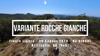
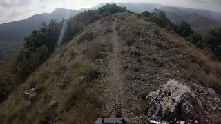
This icon offers on of the most beautiful views of the whole Region. The trail features a very rocky and exposed first half that requires a pretty high technical level. It was used twice as an EWS stage also because it changes to a faster and easier second half after a few minutes of riding.
After joining a narrow gravel road for the last section, it merges onto a tarmac road in Vezzi.

source: ...
Access Info

The trails of the Orco-Vezzi area are best reachable either by bike from Nato Base or from the town of Orco.
Getting to Nato Base: reachable from the E80 highway accessing Orco Feglino, then drive north on the SP23 until the windmills under the Base.

Getting to Orco: reachable from the E80 highway accessing Orco Feglino, then drive south on the SP27 and then on the Via Provinciale Regione Brea.

Disclaimer

Given its nature, the trail can change after weather happenings and season changes. Always pay attention.

Trail Supporters
Local Trail Association

Recent Activity on Trail

Past Week
  • 2 rides
  • 46.9 km average
6 Months
  • 29 rides
  • 43.9 km avg distance
All
  • 209 rides
  • Last: Sep 23, 2026
c1c2c3c4
January
February
March
April
May
June
July
August
September
October
November
December
update trails status or condition

Rocche Gianche Trail Reports

statusdatedescription
Apr 26, 2026 @ 9:42am (Europe/Monaco)
Apr 26, 2026
Jan 2, 2026 @ 4:32pm (Europe/Rome)
Jan 2, 2026
Top section is Prime, couple of loose rocks after the first crux, otherwise clean. Lower section has a lot of leaves, but still grippy
Nov 30, 2025 @ 11:08am (Europe/Monaco)
Nov 30, 2025
Oct 12, 2025 @ 4:42pm (Europe/Rome)
Oct 12, 2025
Oct 9, 2025 @ 9:56am (Europe/Rome)
Oct 9, 2025
start wahnsinnig schwierig für normalsterbliche
more »
Status:
on Apr 26, 2026
Dry
Avg: 4.04 (42 votes)
Your vote: 0

view (1,111)
close
      Directions to rocche-gianche trailhead (44.251950, 8.336040)

      Photos

      117 more »
      mtb
      36 |
      Jun 12, 2026 @ 1:06am
      Jun 12, 2026
      mtb
      34 |
      Jun 12, 2026 @ 1:06am
      Jun 12, 2026
      mtb
      39 |
      Jun 12, 2026 @ 1:06am
      Jun 12, 2026
      mtb
      134 |
      Apr 23, 2025 @ 10:44pm
      Apr 23, 2025

      Videos

      7 more »
      Finale Ligure eMTBing - Variante Rocche Gianche
      mtb
      9:57 | 42 | Sep 11, 2026 , Finale Ligure
      Rocche Gianche -EWS Finale Ligure ST5
      mtb
      7:37 | 719 | Nov 1, 2023 , Finale Ligure
      Finale Ligure - Rocche Gianche (Stage 5 EWS 2016)
      mtb
      1898 | Apr 14, 2017 , Finale Ligure
      EWS FinalEnduro - #5 Rocche Gianche
      mtb
      1922 | Oct 7, 2016 , Finale Ligure

      Routes with this trail

      2.0 19 miles 1,407 ft 5 Shuttled
      All mountain trip starting at nato base and finishing at the level of the sea!
      5.0 27 miles 6,715 ft 51
      feglino tour in feline city epic ride
      20 miles 2,569 ft 9
      Finale Ligure, erste Option im November/Dezember 25
      4.1
      42 Ratings
      5 48%
      4 29%
      3 10%
      2 10%
      1 5%

      7 Reviews & Comments

      Angelo7787643 Angelo7787643
      This trail has 3 sections:

      Section 1: This is double black. Janky, rocky, awkward, some steep stuff, exposed, and sure to break some things on your bike (or you) if you take a tumble. The view is incredible.

      Section 2: Right where the trail meets the blue ride-around trail, it turns into a blue as you go down and into the forest switchbacks. Flowy, easy, no problem.

      Section 3: When you get to the next little "trail crossing" it turns light black/Dark blue. This section takes you down to the road. It has some steeper parts with some tighter steeper turns and a couple of drops. Its pretty fun.

      Because of the top section, this trail should be a double black.
      saltire saltire
      Lovely technical trail. First section Rocks are a real challenge at the top (double black), pick your lines carefully , after that is black as you progress down. Allot of fun. Highly recommended for anyone who likes natural unmanicured tech trails.
      alexandraw alexandraw
      Got quite a bit of work done in the lower bit which is super fun… top bit is still gnarly as…

      We hope you've been enjoying Trailforks!

      Create a FREE account to view all trail reviews and much more.

      • By kaiser81TF Pro & contributors
      • #69329 - 13,138 views

      Frequently Asked Questions

      Where is Rocche Gianche located?
      Rocche Gianche is located in Finale Outdoor Region, Finale Ligure, Italy. It is part of the Finale Outdoor Region trail network. The trailhead is located at coordinates 44.25195, 8.33604.
      How hard is Rocche Gianche?
      Rocche Gianche is rated as Black difficulty. The physical rating is Moderate. The average grade is 13.4%. The climb difficulty is rated Green.
      What is the elevation gain for Rocche Gianche?
      Rocche Gianche has 72 ft of elevation gain. The trail has 867 ft of elevation descent. The elevation ranges from 1,349 ft to 2,146 ft.
      Is Rocche Gianche a point to point trail?
      Yes, Rocche Gianche is a point to point trail. The direction is Downhill Only. The trail type is singletrack.
      How long is Rocche Gianche?
      Rocche Gianche is 1.1 miles long. The trail type is singletrack.
      Are dogs allowed on Rocche Gianche?
      Yes, dogs are allowed on Rocche Gianche. Please keep dogs on a leash where required and clean up after them.
      When is the best time of year to ride Rocche Gianche?
      Based on activity log data, the most popular months to ride Rocche Gianche are:
      • May (26 activities)
      • April (24 activities)
      • March (12 activities)
      Check the reports page for current trail conditions.
      How do I access Rocche Gianche? Where is the closest parking trailhead?
      The closest parking and trailhead locations to Rocche Gianche are: View all parking locations in the area.
      How long does it take to ride Rocche Gianche?
      Based on recorded activities, it takes an average of 28 minutes to ride Rocche Gianche. The trail is 1.1 miles long. Actual times will vary based on fitness level, conditions, and pace. View recent activity logs for more details.
      How busy is Rocche Gianche?
      Rocche Gianche is a moderately popular trail. There have been 1,158 recorded activities on this trail. The trail has received 1,111 check-ins. View recent activity on this trail.

      Hit the Trail

      Open in App

      Get this trail on your phone instantly.

      open trail in app

      Download Trail

      Save to wishlist, Garmin & download.
      save the trail

      Find Related Routes

      Find routes and users activities that include this trail.
      find routes for this trail

      You must enter a description before submitting.