
more stats
2,270 ft
Distance
6 ft
Climb
-115 ft
Descent
00:07:36
Avg time
-108 ft
Altitude change
6,364 ft
Altitude min
6,483 ft
Altitude max
6,481 ft
Altitude start
6,375 ft
Altitude end
-4.7%
Grade
-16.5%
Grade max
4.4%
Grade min
479 ft
Distance climb
1,795 ft
Distance down
00:07:36
Avg time

Rodeline Middle2 Section Details

  • Activities
    • Mountain Bike
    • E-Bike
    • Hike
    • Trail Running
  • Riding Area
  • Difficulty Rating
  • Voted Difficulty
    Red (3 votes)
  • Local Popularity
    75 in Mountain Biking [+]
    • 80 in E-Biking
    • 5 in Trail Running
    • 40 in Hiking
  • Global Ranking
    #43398 in Mountain Biking [+]
    • #89475 in E-Biking
    • #308460 in Trail Running
    • #154608 in Hiking
  • National Ranking
    #4,067 in Mountain Biking · Italy [+]
    • #10,018 in E-Biking
    • #10,619 in Trail Running
    • #4,828 in Hiking
  • Hiking SAC Scale
    T2 Mountain Hiking
  • Trail Type
    Singletrack
  • Bike Type
    DH, AM
  • Direction
    Both Directions
    Popular Direction Shown
  • Climb Difficulty
    Blue
  • Physical Rating
    Moderate
  • Trail Visibility
    Always easy to follow
  • Alpine Trail
    Yes
  • Dogs Allowed
    Yes
  • eBike Allowed

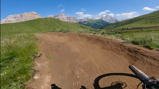
After the ski slope connector (Rodeline Middle2 Connector), a short but steep climp gives access to a very fun mid-slope natural trail.

CAUTION: This segmet is OPEN TO HIKERS in both directions

Tags
Alpine

Bike Park

Recent Activity on Trail

Past Week
  • 0 rides
  •  
6 Months
  • 121 rides
  • 28 miles avg distance
All
  • 437 rides
  • Last: Sep 27, 2026
c1c2c3c4
January
February
March
April
May
June
July
August
September
October
November
December
update trails status or condition

Rodeline Middle2... Trail Reports

Status:
on Oct 12, 2026
Avg: 3.76 (16 votes)
Your vote: 0

view (2,925)
close
      Directions to rodeline-middle2-section trailhead (46.493640, 11.770310)

      Photos

      2 more »
      mtb
      47 |
      Jul 26, 2025 @ 1:28pm
      Jul 26, 2025
      mtb
      57 |
      Dec 28, 2023 @ 5:26am
      Dec 28, 2023

      Videos

      2 more »
      youtuber Rodeline - Fassa Bike District | Sellaronda...
      mtb
      6:05 | 232 | Aug 23, 2023 , Canazei
      youtuber MTB Dolomiti 13.08.2022 sentiero RODELINE
      mtb
      3:11 | 380 | Aug 14, 2022 , Canazei

      Routes with this trail

      10 miles • 3,373 ft • 8 • Loop •
      Use this route to follow by bike Loop 1 of the UCI ENDURO World Cup Val di Fassa Trentino 2026
      21 miles • 6,956 ft • 11 • Race •
      This is the official race course for the 2024 UCI Enduro World Championships in Canazei, Italy.
      14 miles • 3,743 ft • 9 • Loop • Race •
      ENDURO WORLD CUP DAY 1 - 1103m Ascending+ (pedal climbing), 1108m Descending- Start to S1 - pedal liaison...
      3.5 ★★★★★
      16 Ratings
      5 ★ 38%
      4 ★ 19%
      3 ★ 13%
      2 ★ 19%
      1 ★ 13%

      2 Reviews & Comments

      dopingrolf dopingrolf
      The facts about uphill are wring. You have to do a lot of uphills in this Trail. This is at lebst a red uphill trail. Nothing for beginners.
      ScottVxsnb
      Gnarly. Lots of technical uphill roots and rocks at the beginning. Gets more friendly later on

      We hope you've been enjoying Trailforks!

      Create a FREE account to view all trail reviews and much more.

      • By WindfinderTF Pro & contributors
      • #473538 - 1,239 views

      Frequently Asked Questions

      ▼ Where is Rodeline Middle2 Section located?
      Rodeline Middle2 Section is located in Fassa Bike District, Canazei, Italy. It is part of the Fassa Bike District trail network. The trailhead is located at coordinates 46.49364, 11.77031.
      ▼ How hard is Rodeline Middle2 Section?
      Rodeline Middle2 Section is rated as Blue difficulty. The physical rating is Moderate. The average grade is 4.7%. The climb difficulty is rated Blue.
      ▼ What is the elevation gain for Rodeline Middle2 Section?
      Rodeline Middle2 Section has 6 ft of elevation gain. The trail has 115 ft of elevation descent. The elevation ranges from 6,364 ft to 6,483 ft.
      ▼ Is Rodeline Middle2 Section a point to point trail?
      Rodeline Middle2 Section is not a point to point trail. The direction is Both Directions. The trail type is singletrack.
      ▼ How long is Rodeline Middle2 Section?
      Rodeline Middle2 Section is 2,270 ft long. The trail type is singletrack.
      ▼ Are dogs allowed on Rodeline Middle2 Section?
      Yes, dogs are allowed on Rodeline Middle2 Section. Please keep dogs on a leash where required and clean up after them.
      ▼ How do I access Rodeline Middle2 Section? Where is the closest parking trailhead?
      The closest parking and trailhead locations to Rodeline Middle2 Section are: View all parking locations in the area.
      ▼ How long does it take to ride Rodeline Middle2 Section?
      Based on recorded activities, it takes an average of 8 minutes to ride Rodeline Middle2 Section. The trail is 2,270 ft long. Actual times will vary based on fitness level, conditions, and pace. View recent activity logs for more details.
      ▼ How busy is Rodeline Middle2 Section?
      Rodeline Middle2 Section is a very popular trail. There have been 2,511 recorded activities on this trail. The trail has received 2,925 check-ins. View recent activity on this trail.

      Hit the Trail

      Open in App

      Get this trail on your phone instantly.

      open trail in app

      Download Trail

      Save to wishlist, Garmin & download.
      save the trail

      Find Related Routes

      Find routes and users activities that include this trail.
      find routes for this trail

      You must enter a description before submitting.