
more stats
2,182 ft
Distance
31 ft
Climb
-148 ft
Descent
00:10:05
Avg time
-119 ft
Altitude change
963 ft
Altitude min
1,100 ft
Altitude max
1,100 ft
Altitude start
981 ft
Altitude end
-5.4%
Grade
-27.4%
Grade max
18.5%
Grade min
469 ft
Distance climb
1,594 ft
Distance down
30 ft
Distance flat
00:10:05
Avg time

Rolling the Coal Details

  • Activities
    • Mountain Bike
    • E-Bike
    • Hike
    • Trail Running
    • Snowshoe
  • Riding Area
    Wood Buffalo Bike Park
    Fort McMurray, Alberta
  • Difficulty Rating
  • Local Popularity
    60 in Mountain Biking heatmap [+]
    • 65 in E-Biking
    • 5 in Trail Running
    • 5 in Hiking
    • 5 in Snowshoeing
  • Global Ranking
    #212887 in Mountain Biking [+]
    • #51392 in E-Biking
    • #372627 in Trail Running
    • #342014 in Hiking
    • #25175 in Snowshoeing
  • Provincial Ranking
    #2,726 in Mountain Biking · Alberta [+]
    • #610 in E-Biking
    • #5,406 in Trail Running
    • #4,929 in Hiking
    • #837 in Snowshoeing
  • Hiking SAC Scale
    T2 Mountain Hiking
  • Trail Type
    Singletrack
  • Bike Type
    DH
  • Direction
    Both Directions
    Popular Direction Shown
  • Climb Difficulty
    Double Black Diamond
  • Physical Rating
    Moderate
  • Trail Visibility
    Always easy to follow
  • Dogs Allowed
    Yes
  • eBike Allowed
    Yes up to Class 1
  • TTFs on Trail
    Berm, Bridge, Jump, Skinny
  • Year Opened
    2021

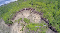
A redone trail that has landslide area's, work has been done and different routes to go around bad area .still under construction but should be finish by summer of 2021..enjoy ride at own risk ,,Rock n roll .

Access Info

starts at the end of swoopy or aka mullet or the start of coor light the silver bullet ( beer run) Aka I.P.A.

This trail is unsanctioned.

Disclaimer

ride at own risk

Tags
BermsBridgesJumpsSkinnies

Recent Activity on Trail

Past Week
  • 0 rides
  •  
6 Months
  • 5 rides
  • 12 miles avg distance
All
  • 26 rides
  • Last: Sep 8, 2026
c1c2c3c4
January
February
March
April
May
June
July
August
September
October
November
December
update trails status or condition

Rolling the Coal Trail Reports

statusdatedescription
Aug 21, 2026 @ 9:47pm (America/Edmonton)
Aug 21, 2026
trails is decent for riding. be cautious throughout the first portion of the trails as it has a steep downhill. trails keeps going up and down...
Jun 18, 2026 @ 2:37pm (America/Edmonton)
Jun 18, 2026
landslide near end fix thing all trees cut
Jun 13, 2026 @ 10:01am (America/Edmonton)
Jun 13, 2026
landslides and tree down ..try get in a fix comming weeks
Aug 15, 2025 @ 8:56am
Aug 15, 2025
not sure if bear or man throwing big rock off hill landing ner bottom ,,look out
Jul 21, 2025 @ 10:25am
Jul 21, 2025
some one digging hole on trail build up my jump but make ride around dangour like common fashion for fas suffing idipots here
more »
Status:
on Aug 21, 2026
Variable
no votes yet
Your vote: 0

view (112)
close
      Directions to rolling-the-coal trailhead (56.724580, -111.426310)

      Photos

      5 more »
      mtb
      103 |
      Jun 29, 2021 @ 1:01pm
      Jun 29, 2021
      mtb
      89 |
      Jun 5, 2021 @ 9:15am
      Jun 5, 2021
      mtb
      101 |
      Feb 25, 2021 @ 2:54pm
      Feb 25, 2021
      mtb
      132 |
      Feb 25, 2021 @ 2:54pm
      Feb 25, 2021

      Videos

      1 more »
      rolling the coal
      mtb
      0:07 | 21 | May 17, 2026 , Fort McMurray

      Reviews / Comments

      No reviews yet, be the first to write a review or ask a question.
      Use trail reports to comment on trail conditions.


      We hope you've been enjoying Trailforks!

      Create a FREE account to view all trail reviews and much more.

      • #395004 - 833 views

      Frequently Asked Questions

      ▼ Where is Rolling the Coal located?
      Rolling the Coal is located in Wood Buffalo Bike Park, Fort McMurray, Alberta, Canada. It is part of the Wood Buffalo Bike Park trail network. The trailhead is located at coordinates 56.72458, -111.42631.
      ▼ How hard is Rolling the Coal?
      Rolling the Coal is rated as Blue difficulty. The physical rating is Moderate. The average grade is 5.4%. The climb difficulty is rated Double Black Diamond.
      ▼ What is the elevation gain for Rolling the Coal?
      Rolling the Coal has 31 ft of elevation gain. The trail has 148 ft of elevation descent. The elevation ranges from 963 ft to 1,100 ft.
      ▼ Is Rolling the Coal a point to point trail?
      Rolling the Coal is not a point to point trail. The direction is Both Directions. The trail type is singletrack.
      ▼ How long is Rolling the Coal?
      Rolling the Coal is 2,182 ft long. The trail type is singletrack.
      ▼ Are dogs allowed on Rolling the Coal?
      Yes, dogs are allowed on Rolling the Coal. Please keep dogs on a leash where required and clean up after them.
      ▼ How long does it take to ride Rolling the Coal?
      Based on recorded activities, it takes an average of 10 minutes to ride Rolling the Coal. The trail is 2,182 ft long. Actual times will vary based on fitness level, conditions, and pace. View recent activity logs for more details.
      ▼ How busy is Rolling the Coal?
      Rolling the Coal is a moderately popular trail. There have been 111 recorded activities on this trail. The trail has received 112 check-ins. View recent activity on this trail.

      Hit the Trail

      Open in App

      Get this trail on your phone instantly.

      open trail in app

      Download Trail

      Save to wishlist, Garmin & download.
      save the trail

      Find Related Routes

      Find routes and users activities that include this trail.
      find routes for this trail

      You must enter a description before submitting.

