more stats
4.6 miles
Distance
422 ft
Climb
-1,533 ft
Descent
00:39:38
Avg time
-1,111 ft
Altitude change
3,433 ft
Altitude min
4,575 ft
Altitude max
4,575 ft
Altitude start
3,465 ft
Altitude end
-4.5%
Grade
-54.3%
Grade max
31.9%
Grade min
1 mile
Distance climb
3 miles
Distance down
1,870 ft
Distance flat
00:39:38
Avg time

Second Divide Details

  • Activities
    • Mountain Bike
    • E-Bike
    • Horse
    • Hike
    • Trail Running
    • Dirtbike/Moto
  • Riding Area
    Downieville Trail Network
    Downieville, California
  • Ref Number
    #11E33
  • Difficulty Rating
  • Voted Difficulty
    Black Diamond (2 votes)
  • Local Popularity
    90 in Mountain Biking [+]
    • 90 in E-Biking
    • 90 in Trail Running
    • 75 in Hiking
    • 5 in Dirtbiking
    • 5 in Horseback
  • Global Ranking
    #46938 in Mountain Biking [+]
    • #24310 in E-Biking
    • #35513 in Trail Running
    • #130557 in Hiking
    • #3266 in Dirtbiking
    • #1414 in Horseback
  • Trail Type
    Singletrack
  • Bike Type
    AM, XC
  • Direction
    Both Directions
    Popular Direction Shown
  • Climb Difficulty
    Black Diamond
  • Physical Rating
    Moderate
  • Trail Visibility
    Always easy to follow
  • Season
    Spring, Summer, Fall
  • Dogs Allowed
    Yes
  • eBike Allowed
    Yes up to Class 3
  • Land Owner
    USFS

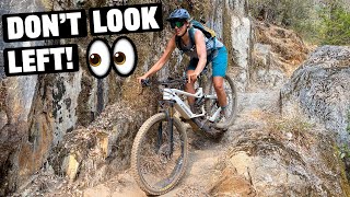
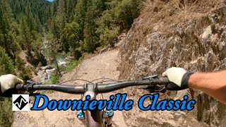
Most often used as an alternate descent to Third Divide when riding the classic Downieville downhill. Slightly longer than Third Divide, it starts as a smooth and flowy downhill through an amazing old growth forest. The descent breaks up a couple of times with short climbs. After the westbound turn, the trail follows Pauley Creek and gets more technical with rolling up & down sections. There are great views and lots of exposure in spots.

Access Info

For access from Butcher Ranch trail, look for trail splitting off left, with a sign on a tree. Start looking after crossing Pauley Creek bridge and climbing uphill for a few minutes. From Lavezzola Rd, the trail entrance is marked clearly.

Trail Supporters
Local Trail Association
Traditionally Indigenous Territory

Recent Activity on Trail

Past Week
  • 0 rides
  •  
6 Months
  • 4 rides
  • 19 miles avg distance
All
  • 210 rides
  • Last: Jun 1, 2026
c1c2c3c4
January
February
March
April
May
June
July
August
September
October
November
December
Status:
on May 22, 2026
Ideal
Avg: 4.26 (13 votes)
Your vote: 0

view (1,307)
close
3D
Trail Conditions
  • Unknown
  • Snow Groomed
  • Snow Packed
  • Snow Covered
  • Snow Cover Partial
  • Freeze/thaw Cycle
  • Icy
  • Prevalent Mud
  • Wet
  • Variable
  • Ideal
  • Dry
  • Very Dry
Trail Flow (Ridden Direction)
Trailforks scans users ridelogs to determine the most popular direction each trail is ridden. A good flowing trail network will have most trails flowing in a single direction according to their intension.
The colour categories are based on what percentage of riders are riding a trail in its intended direction.
  • > 96%
  • > 90%
  • > 80%
  • > 70%
  • > 50%
  • < 50%
  • bi-directional trail
  • no data
Trail Last Ridden
Trailforks scans ridelogs to determine the last time a trail was ridden.
  • < 2 days
  • < 1 week
  • < 2 weeks
  • < 1 month
  • < 6 months
  • > 6 months
Trail Ridden Direction
The intended direction a trail should be ridden.
  • Downhill Only
  • Downhill Primary
  • Both Directions
  • Uphill Primary
  • Uphill Only
  • One Direction
Contribute Details
Colors indicate trail is missing specified detail.
  • Description
  • Photos
  • Description & Photos
  • Videos
Trail Popularity ?
Trailforks scans ridelogs to determine which trails are ridden the most in the last 9 months. Trails are compared with nearby trails in the same city region with a possible 25 colour shades. Think of this as a heatmap, more rides = more kinetic energy = warmer colors.
  • most popular
  • popular
  • less popular
  • not popular
ATV/ORV/OHV Filter
Max Vehicle Width
inches
US Cell Coverage
Legend
cell carrier legend

Radar Time
Activity Recordings
Trailforks uses anonymized public activity data. ?
Activity Recordings
Trailforks uses anonymized public activity data. ?
Personal Heatmap
Activity Types
all / none
Options
2
Date range month
Winter Trails
Warning A routing network for winter maps does not exist. Selecting trails using the winter trails layer has been disabled.
Missing Trails
Most Popular
Least Popular
Trails are colored based on popularity. The more popular a trail is, the more red. Less popular trails trend towards green.
Jump Magnitude Heatmap
Heatmap of where riders jump on trails. Zoom in to see individual jumps, click circles to view jump details.
BC Backroad Status

Service Road Atlas is a free to use, community-driven service for viewing and creating reports on the numerous back-country service roads around B.C. and Alberta.

map legend
Slope Aspect
Direction the slope faces
Flat N NE E SE S SW W NW
Trails Deemphasized
Trails are shown in grey.
disable
Only show trails with no bike usage.
Enable
Suggested Layers
Based on selected activity type

    Save the current map location and zoom level as your default home location whenever this page is loaded.

    Save
        Directions to second-divide trailhead (39.611810, -120.750630)

        Photos

        14 more »
        252 |
        Jul 26, 2019 @ 9:07pm
        Jul 26, 2019
        477 |
        Oct 7, 2013 @ 1:29pm
        Oct 7, 2013
        132 |
        Jul 26, 2019 @ 9:07pm
        Jul 26, 2019
        143 |
        Jul 26, 2019 @ 9:07pm
        Jul 26, 2019

        Videos

        3 more »
        youtuber Must Ride Trail In Downiville! (Second Divide)
        9:26 | 557 | Oct 4, 2020 , Downieville
        youtuber Second Divide (Downieville, CA) Mountain Biking
        920 | Jul 31, 2017 , Downieville
        youtuber Downieville Classic - Second Divide
        14:53 | 371 | Aug 20, 2023 , Downieville

        Trail Lists

        Routes with this trail

        5.0 20 miles 1,836 ft 11 Shuttled
        This is a pretty burly all-mountain/"down country" ride that incorporates the new (and beautiful) off of...
        16 miles 1,000 ft 4 Shuttled
        From the Saddle down the classic singletrack with the as the option over .
        28 miles 3,888 ft 13 Shuttled
        This is the longest hardest way from the top of the mountain to town. Starting at the shuttle drop off at...

        5 Reviews & Comments


        We hope you've been enjoying Trailforks!

        Create a FREE account to view trail comments and much more.

        • By FRguild & contributors
        • #7670 - 5,268 views

        Frequently Asked Questions About Second Divide

        Where is Second Divide located?
        Second Divide is located in Downieville Trail Network, Downieville, California, United States. It is part of the Downieville Trail Network trail network. The trailhead is located at coordinates 39.61181, -120.75063.
        How hard is Second Divide?
        Second Divide is rated as Black Diamond difficulty. The physical rating is Moderate. The average grade is 4.5%. The climb difficulty is rated Black Diamond.
        What is the elevation gain for Second Divide?
        Second Divide has 422 ft of elevation gain. The trail has 1,533 ft of elevation descent. The elevation ranges from 3,433 ft to 4,575 ft.
        Is Second Divide a point to point trail?
        Second Divide is not a point to point trail. The direction is Both Directions. The trail type is singletrack.

        Hit the Trail

        Open in App

        Get this trail on your phone instantly.
        open trail in app

        Download Trail

        Save to wishlist, Garmin & download.
        save the trail

        Find Related Routes

        Find routes and users activities that include this trail.
        find routes for this trail

        You must enter a description before submitting.