
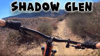
more stats
1.9 miles
Distance
214 ft
Climb
-488 ft
Descent
00:19:34
Avg time
-276 ft
Altitude change
1,892 ft
Altitude min
2,347 ft
Altitude max
2,168 ft
Altitude start
1,893 ft
Altitude end
-2.8%
Grade
-28.8%
Grade max
36.8%
Grade min
2,812 ft
Distance climb
1 mile
Distance down
1,204 ft
Distance flat
00:19:34
Avg time

Shadow Glen Trail Details

  • Activities
    • Mountain Bike
    • Hike
    • Trail Running
  • Riding Area
    Golden Valley Ranch Trails
    Santa Clarita, California
  • Difficulty Rating
  • Local Popularity
    80 in Mountain Biking heatmap [+]
    • 95 in Trail Running
    • 95 in Hiking
  • Global Ranking
    #42431 in Mountain Biking [+]
    • #101686 in Trail Running
    • #104088 in Hiking
  • State Ranking
    #1,230 in Mountain Biking · California [+]
    • #4,955 in Trail Running
    • #5,811 in Hiking
  • Trail Type
    Singletrack
  • Bike Type
    AM
  • Direction
    Both Directions
  • Climb Difficulty
    Blue
  • Physical Rating
    Moderate
  • Dogs Allowed
    Yes
  • Land Owner

This is an enjoyable climb from Placerita Canyon Road to the Placerita Trail on the ridgeline. It meanders through oak groves and grassy open spaces, with some great views near the top. Combine it with the Uncle Remi Trail for a great, short loop.

It was constructed in 2018/2019 by CORBA/SCVTU volunteers with a grant from REI.

Tags
RidgelineViews

Traditionally Indigenous Territory

Recent Activity on Trail

Past Week
  • 0 rides
  •  
6 Months
  • 7 rides
  • 13 miles avg distance
All
  • 128 rides
  • Last: Nov 10, 2026
update trails status or condition

Shadow Glen Trail Trail Reports

statusdatedescription
Mar 30, 2025 @ 10:20am
Mar 30, 2025
Great condition, super fun trail!
Mar 2, 2025 @ 6:05am
Mar 2, 2025
Trail in great condition, scenic with lush greens at this time
Aug 21, 2024 @ 5:32pm
Aug 21, 2024
Aug 18, 2024 @ 5:55am
Aug 18, 2024
Trail is surprisingly in good shape, lots of holes and poop from critters though but it's clear.
Jan 14, 2024 @ 2:07am
Jan 14, 2024
Still some mud on the shaded northen slopes.
more »
Status:
on Mar 30, 2025
Dry
Avg: 4.35 (8 votes)
Your vote: 0

view (1,208)
close
      Directions to shadow-glen-trail trailhead (34.387760, -118.436720)

      Photos

      15 more »
      mtb
      68 |
      Mar 30, 2025 @ 10:21am
      Mar 30, 2025
      mtb
      97 |
      Dec 23, 2020 @ 4:15pm
      Dec 23, 2020
      mtb
      98 |
      Dec 23, 2020 @ 4:15pm
      Dec 23, 2020
      mtb
      104 |
      Sep 25, 2020 @ 7:32am
      Sep 25, 2020

      Videos

      1 more »
      youtuber Shadow Glen Trail - Mountain Biking - Santa...
      mtb
      8:21 | 589 | Dec 5, 2021 , Santa Clarita
      4.7 ★★★★★
      8 Ratings
      5 ★ 63%
      4 ★ 38%
      3 ★
      2 ★
      1 ★

      1 Review & Comments

      doublenickelsclub
      From Uncle Remi, it follows the ridge line for some nice views. On the way down it’s pretty ruddy in some parts and the trail is very cozy. I faced a few grumpy hikers toward the bottom. Fun to explore but easy on the speed because of hikers.

      We hope you've been enjoying Trailforks!

      Create a FREE account to view all trail reviews and much more.

      • By markdochtermannTF Pro & contributors
      • #323999 - 1,917 views

      Frequently Asked Questions

      ▼ Where is Shadow Glen Trail located?
      Shadow Glen Trail is located in Golden Valley Ranch Trails, Santa Clarita, California, United States. It is part of the Golden Valley Ranch Trails trail network. The trailhead is located at coordinates 34.38776, -118.43672.
      ▼ How hard is Shadow Glen Trail?
      Shadow Glen Trail is rated as Blue difficulty. The physical rating is Moderate. The average grade is 2.8%. The climb difficulty is rated Blue.
      ▼ What is the elevation gain for Shadow Glen Trail?
      Shadow Glen Trail has 214 ft of elevation gain. The trail has 488 ft of elevation descent. The elevation ranges from 1,892 ft to 2,347 ft.
      ▼ Is Shadow Glen Trail a point to point trail?
      Shadow Glen Trail is not a point to point trail. The direction is Both Directions. The trail type is singletrack.
      ▼ How long is Shadow Glen Trail?
      Shadow Glen Trail is 1.9 miles long. The trail type is singletrack.
      ▼ Are dogs allowed on Shadow Glen Trail?
      Yes, dogs are allowed on Shadow Glen Trail. Please keep dogs on a leash where required and clean up after them.
      ▼ How do I access Shadow Glen Trail? Where is the closest parking trailhead?
      The closest parking and trailhead locations to Shadow Glen Trail are: View all parking locations in the area.
      ▼ How long does it take to ride Shadow Glen Trail?
      Based on recorded activities, it takes an average of 20 minutes to ride Shadow Glen Trail. The trail is 1.9 miles long. Actual times will vary based on fitness level, conditions, and pace. View recent activity logs for more details.
      ▼ How busy is Shadow Glen Trail?
      Shadow Glen Trail is a very popular trail. There have been 976 recorded activities on this trail. The trail has received 1,208 check-ins. View recent activity on this trail.

      Hit the Trail

      Open in App

      Get this trail on your phone instantly.

      open trail in app

      Download Trail

      Save to wishlist, Garmin & download.
      save the trail

      Find Related Routes

      Find routes and users activities that include this trail.
      find routes for this trail

      You must enter a description before submitting.

