

more stats
3.4 miles
Distance
10 ft
Climb
-1,924 ft
Descent
00:24:14
Avg time
-1,914 ft
Altitude change
1,070 ft
Altitude min
2,984 ft
Altitude max
2,984 ft
Altitude start
1,070 ft
Altitude end
-10.5%
Grade
-32.4%
Grade max
4.3%
Grade min
436 ft
Distance climb
3 miles
Distance down
131 ft
Distance flat
00:24:14
Avg time

Snyder Trail Details

  • Activities
    • Mountain Bike
    • Hike
    • Trail Running
  • Riding Area
    Santa Ynez Recreation Area
    Santa Barbara, California
  • AKA
    Knapps Castle DH
  • Difficulty Rating
  • Voted Difficulty
    Black Diamond (5 votes)
  • Local Popularity
    60 in Mountain Biking heatmap [+]
    • 5 in Trail Running
    • 5 in Hiking
  • Global Ranking
    #125521 in Mountain Biking [+]
    • #342804 in Trail Running
    • #326446 in Hiking
  • State Ranking
    #4,639 in Mountain Biking · California [+]
    • #13,956 in Trail Running
    • #13,985 in Hiking
  • Trail Type
    Mixed
  • Bike Type
    AM, XC
  • Direction
    Both Directions[+]
    • Both Directions for Trail Running
    • Both Directions for Hiking
  • Climb Difficulty
    Blue
  • Physical Rating
    Hard
  • Dogs Allowed
    Yes
  • TTFs on Trail
    Rock Garden
  • Land Owner
    Los Padres National Forest

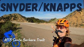
This trail is most often ridden as a shuttle, but is climbable from the base. Smooth tread and some fun turns make up the lower portion, the upper is double track. There are many hikers, especially on the weekend.

Disclaimer

All RIDERS MUST WEAR A BELL

Tags
Rock gardensShuttle access

Local Trail Association

Traditionally Indigenous Territory

Recent Activity on Trail

Past Week
  • 0 rides
  •  
6 Months
  • 2 rides
  • 21.2 km avg distance
All
  • 34 rides
  • Last: Nov 8, 2026
c1c2c3c4
January
February
March
April
May
June
July
August
September
October
November
December
update trails status or condition

Snyder Trail Trail Reports

statusdatedescription
Oct 27, 2026 @ 6:20pm (America/Los_Angeles)
Oct 27, 2026
Trail is in excellent condition with hero dirt following last week's rain. Fortunately rain damage (i.e. rutting) was very minimal. Thanks to...
May 14, 2026 @ 12:41pm (America/Los_Angeles)
May 14, 2026
reporter
Trail recently brushed by the Forest Service, and tread is in great shape after a SAGE volunteer event in February
Jul 27, 2025 @ 2:10pm
Jul 27, 2025
reporter
SAGE volunteer event finished up weed whacking started by USFS. Thanks to the SB Ranger District Employees for the help!
Dec 26, 2024 @ 9:17pm
Dec 26, 2024
Jun 22, 2024 @ 2:17pm
Jun 22, 2024
Main trail has been nicely brushed. Single track alternative near the bottom needs some brushing. The long steep downhill alternative below the...
more »
Status:
on Oct 27, 2026
Ideal
Avg: 3.61 (8 votes)
Your vote: 0

view (409)
close
      Directions to snyder-trail trailhead (34.518410, -119.793380)

      Photos

      3 more »
      mtb
      167 |
      Dec 7, 2020 @ 10:50am
      Dec 7, 2020
      mtb
      212 |
      Dec 7, 2020 @ 10:50am
      Dec 7, 2020
      mtb
      357 |
      Jan 26, 2018 @ 1:23am
      Jan 26, 2018

      Videos

      4 more »
      Snyder - Knapps Trail -MTB-   Santa Barbara, CA
      mtb
      15:18 | 448 | Apr 17, 2022 , Santa Barbara
      Knapps Castle DH - Santa Barbara, CA
      mtb
      12:54 | 911 | Nov 14, 2018 , Santa Barbara
      Shuttle Hot Lap - Mountain Biking Santa...
      mtb
      893 | Jun 18, 2017 , Santa Barbara
      Knapps Castle DH
      mtb
      12:53 | 404 | Oct 26, 2014 , Santa Barbara
      3.3 ★★★★★
      8 Ratings
      5 ★ 13%
      4 ★ 13%
      3 ★ 63%
      2 ★ 13%
      1 ★

      4 Reviews & Comments

      forevertwosix forevertwosix
      You descent about a 800 feet of fire road before hitting the single track. The trail it’s self if fun once you get to it, but arroyo burro is has a better bang for your buck.
      mountainbagger mountainbagger
      Top half is fire road, bottom half is single track. NOT really worth the shuttle but might be a good climb back up if youre looping arroyo burro.
      smgishot13 smgishot13
      This is called Knapps. Not Snyder. No one calls it Snyder.

      We hope you've been enjoying Trailforks!

      Create a FREE account to view all trail reviews and much more.

      • By mtbcommunity-comTF Pro & contributors
      • #45137 - 5,335 views

      Frequently Asked Questions

      ▼ Where is Snyder Trail located?
      Snyder Trail is located in Santa Ynez Recreation Area, Santa Barbara, California, United States. It is part of the Santa Ynez Recreation Area trail network. The trailhead is located at coordinates 34.51841, -119.79338.
      ▼ How hard is Snyder Trail?
      Snyder Trail is rated as Blue difficulty. The physical rating is Hard. The average grade is 10.5%. The climb difficulty is rated Blue.
      ▼ What is the elevation gain for Snyder Trail?
      Snyder Trail has 10 ft of elevation gain. The trail has 1,924 ft of elevation descent. The elevation ranges from 1,070 ft to 2,984 ft.
      ▼ Is Snyder Trail a point to point trail?
      Snyder Trail is not a point to point trail. The direction is Both Directions. The trail type is mixed.
      ▼ How long is Snyder Trail?
      Snyder Trail is 3.4 miles long. The trail type is mixed.
      ▼ Are dogs allowed on Snyder Trail?
      Yes, dogs are allowed on Snyder Trail. Please keep dogs on a leash where required and clean up after them.
      ▼ How do I access Snyder Trail? Where is the closest parking trailhead?
      The closest parking and trailhead locations to Snyder Trail are: View all parking locations in the area.
      ▼ How long does it take to ride Snyder Trail?
      Based on recorded activities, it takes an average of 24 minutes to ride Snyder Trail. The trail is 3.4 miles long. Actual times will vary based on fitness level, conditions, and pace. View recent activity logs for more details.
      ▼ How busy is Snyder Trail?
      Snyder Trail is a moderately popular trail. There have been 378 recorded activities on this trail. The trail has received 409 check-ins. View recent activity on this trail.

      Hit the Trail

      Open in App

      Get this trail on your phone instantly.

      open trail in app

      Download Trail

      Save to wishlist, Garmin & download.
      save the trail

      Find Related Routes

      Find routes and users activities that include this trail.
      find routes for this trail

      You must enter a description before submitting.