
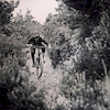
more stats
3,727 ft
Distance
3 ft
Climb
-644 ft
Descent
00:11:56
Avg time
-641 ft
Altitude change
107 ft
Altitude min
748 ft
Altitude max
748 ft
Altitude start
108 ft
Altitude end
-17.2%
Grade
-56.6%
Grade max
10.9%
Grade min
39 ft
Distance climb
3,553 ft
Distance down
135 ft
Distance flat
00:11:56
Avg time

Squadretta Details

  • Activities
    • Mountain Bike
    • E-Bike
    • Hike
    • Trail Running
  • Riding Area
  • Ref Number
    #14
  • Difficulty Rating
  • Local Popularity
    30 in Mountain Biking [+]
    • 50 in E-Biking
    • 5 in Trail Running
    • 55 in Hiking
  • Global Ranking
    #114315 in Mountain Biking [+]
    • #57420 in E-Biking
    • #309210 in Trail Running
    • #146962 in Hiking
  • National Ranking
    #8,793 in Mountain Biking · Italy [+]
    • #6,877 in E-Biking
    • #10,706 in Trail Running
    • #4,698 in Hiking
  • Trail Type
    Singletrack
  • Bike Type
    DH, AM
  • Direction
    Downhill Primary
    Popular Direction Shown
  • Climb Difficulty
    Blue
  • Physical Rating
    Moderate
  • Family Friendly
    Yes
  • Dogs Allowed
    Yes
  • eBike Allowed
    Yes up to Class 1
  • TTFs on Trail
    Rock Garden, Skinny
  • Ride in Rain
    Yes
  • Land Owner

classic good toscany singletrack ,so good for enduro and allmountain but ridable with hardtale bikes , so good flow here
RIDE ANDCHILL

Tags

Recent Activity on Trail

Past Week
  • 0 rides
  •  
6 Months
  • 7 rides
  • 16 miles avg distance
All
  • 61 rides
  • Last: Oct 3, 2026
c1c2c3c4
January
February
March
April
May
June
July
August
September
October
November
December
update trails status or condition

Squadretta Trail Reports

statusdatedescription
Sep 27, 2026 @ 12:48pm (Europe/Rome)
Sep 27, 2026
Plenty of ruts, loose stones and rocks and a couple of steep technical bits. Compared to others around Massa Marittima for example, this is...
May 9, 2026 @ 9:07am (Europe/San_Marino)
May 9, 2026
Jan 17, 2026 @ 6:00pm (Europe/Rome)
Jan 17, 2026
Tecnicamente blu, ma più dura della media per via che è scavata e piena di radici. Quando è anche molle, come quando sono passato, diventa un...
Jul 2, 2025 @ 3:43pm
Jul 2, 2025
molti canali e troppe radici la rendono poco piacevole
Apr 17, 2025 @ 6:11am
Apr 17, 2025
Deep ruts. Not fun at all. Poor condition and partly unrideable…
more »
Status:
on Sep 27, 2026
Very Dry
Avg: 4.14 (9 votes)
Your vote: 0

view (461)
close
      Directions to squadretta trailhead (42.957890, 10.501540)

      Photos

      2 more »
      mtb
      228 |
      Sep 6, 2022 @ 12:41pm
      Sep 6, 2022
      mtb
      202 |
      Sep 6, 2022 @ 12:41pm
      Sep 6, 2022

      Videos

      7 more »
      youtuber Piombino - Toscano Enduro Series 2024 | Gara
      mtb
      15:11 | 321 | Mar 13, 2024 , Piombino
      youtuber Piombino - Squadretta + Le Croste + Buca Delle...
      mtb
      9:25 | 201 | Apr 24, 2024 , Piombino
      youtuber MTB Piombino 16.03.2024 sentiero SQUADRETTA
      mtb
      4:06 | 203 | Mar 16, 2024 , Piombino
      youtuber Squadretta  Piombino Tuscany Italy  Trail...
      mtb
      4:09 | 91 | Mar 16, 2026 , Piombino

      Routes with this trail

      18 miles • 3,800 ft • 9 •
      first ride attempt Piombino area
      4.6 ★★★★★
      9 Ratings
      5 ★ 78%
      4 ★ 11%
      3 ★
      2 ★ 11%
      1 ★

      5 Reviews & Comments

      RomanosX
      Trail itself is great!

      Unfortunately is damaged after heavy rain 😢
      It needs maintenance!
      PhileasTiggerAndI
      Ist in gar keinem guten Zustand. Braucht dringend Maintenance. Hat an sehr vielen Stellen, insbesondere im oberen Bereich einen tiefe Furche in die man automatisch rutscht und durch die man nicht mehr selbst das Rad unter Kontrolle hat.
      Der Trail könnte schön sein, man sieht wie er gebaut ist. Aber im Moment nicht zu empfehlen. Schade.
      crisotop crisotop
      @its-all-about-bikes. This is an imba rated blue trail, which roughly translates to euro-red. Try some greens first and book some coaching from Markus @bikeschool-pekoll and you’ll be ripping those blues faster than you think Razz

      We hope you've been enjoying Trailforks!

      Create a FREE account to view all trail reviews and much more.

      Nearby Trails

      • By piombino-mtb-area & contributors
      • #123897 - 1,417 views

      Frequently Asked Questions

      ▼ Where is Squadretta located?
      Squadretta is located in Piombino MTB Area, Piombino, Italy. It is part of the Piombino MTB Area trail network. The trailhead is located at coordinates 42.95789, 10.50154.
      ▼ How hard is Squadretta?
      Squadretta is rated as Blue difficulty. The physical rating is Moderate. The average grade is 17.2%. The climb difficulty is rated Blue.
      ▼ What is the elevation gain for Squadretta?
      Squadretta has 3 ft of elevation gain. The trail has 644 ft of elevation descent. The elevation ranges from 107 ft to 748 ft.
      ▼ Is Squadretta a point to point trail?
      Squadretta is not a point to point trail. The direction is Downhill Primary. The trail type is singletrack.
      ▼ How long is Squadretta?
      Squadretta is 3,727 ft long. The trail type is singletrack.
      ▼ Are dogs allowed on Squadretta?
      Yes, dogs are allowed on Squadretta. Please keep dogs on a leash where required and clean up after them.
      ▼ How do I access Squadretta? Where is the closest parking trailhead?
      The closest parking and trailhead locations to Squadretta are: View all parking locations in the area.
      ▼ How long does it take to ride Squadretta?
      Based on recorded activities, it takes an average of 12 minutes to ride Squadretta. The trail is 3,727 ft long. Actual times will vary based on fitness level, conditions, and pace. View recent activity logs for more details.
      ▼ How busy is Squadretta?
      Squadretta is a less popular trail with lighter traffic. There have been 532 recorded activities on this trail. The trail has received 461 check-ins. View recent activity on this trail.

      Hit the Trail

      Open in App

      Get this trail on your phone instantly.

      open trail in app

      Download Trail

      Save to wishlist, Garmin & download.
      save the trail

      Find Related Routes

      Find routes and users activities that include this trail.
      find routes for this trail

      You must enter a description before submitting.

