
more stats
4,820 ft
Distance
-658 ft
Descent
00:19:47
Avg time
-658 ft
Altitude change
2,330 ft
Altitude min
2,990 ft
Altitude max
2,989 ft
Altitude start
2,329 ft
Altitude end
-13.7%
Grade
-51.3%
Grade max
1.8%
Grade min
59 ft
Distance climb
4,734 ft
Distance down
30 ft
Distance flat
00:19:47
Avg time

T Floater Details

  • Activities
    • Mountain Bike
    • E-Bike
    • Trail Running
  • Riding Area
  • AKA
    PEC 1 Gondramaz
  • Difficulty Rating
  • Local Popularity
    5 in Mountain Biking heatmap [+]
    • 35 in E-Biking
    • 100 in Trail Running
  • Global Ranking
    #343305 in Mountain Biking [+]
    • #82618 in E-Biking
    • #396258 in Trail Running
  • National Ranking
    #1,805 in Mountain Biking · Portugal [+]
    • #595 in E-Biking
    • #1,319 in Trail Running
  • Trail Type
    Singletrack
  • Bike Type
    DH, AM, XC
  • Direction
    Downhill Primary
    Popular Direction Shown
  • eBike Allowed
    Yes up to Class 3
  • TTFs on Trail
    Berm, Rock Garden

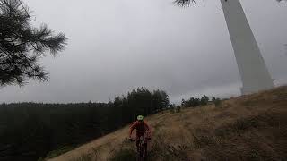
Fun, winding enduro trail in amongst the pine trees most of the way down. You can pedal back up to near the top of Louzanpark in about 20 or 30 minutes from the bottom, or ride other enduro tracks in the Gondramaz area.

Tags
BermsRock gardens

Recent Activity on Trail

Past Week
  • 0 rides
  •  
6 Months
  • 0 rides
  •  
All
  • 1 rides
  • Last: Sep 7, 2025
update trails status or condition

T Floater Trail Reports

statusdatedescription
Oct 27, 2024 @ 8:33am
Oct 27, 2024
The first part is ok, sometimes hard to follow due to many different singletracks between the line of trees. Nevertheless the 2nd half is a mess...
more »
Status:
on Oct 27, 2024
Dry
no votes yet
Your vote: 0

view (9)
close
      Directions to t-floater trailhead (40.065350, -8.244340)

      Photos

      4 more »
      mtb
      58 |
      Oct 27, 2024 @ 8:34am
      Oct 27, 2024
      mtb
      62 |
      Oct 27, 2024 @ 8:34am
      Oct 27, 2024
      mtb
      47 |
      Oct 27, 2024 @ 8:33am
      Oct 27, 2024
      mtb
      54 |
      Oct 27, 2024 @ 8:33am
      Oct 27, 2024

      Videos

      1 more »
      Louzanpark - Antiga PEC1 Enduro Gondramaz / T...
      mtb
      4:27 | 263 | Feb 24, 2022 , Lousã

      1 Review & Comments

      JeanBernardCSn1W
      Nice easy trail. Not too clean. Hard way through the fire break to get back up

      We hope you've been enjoying Trailforks!

      Create a FREE account to view all trail reviews and much more.

      Nearby Trails

      • By mexicanoportugal & contributors
      • #511228 - 626 views

      Frequently Asked Questions

      ▼ Where is T Floater located?
      T Floater is located in Lousã, Portugal. It is part of the Lousã trail network. The trailhead is located at coordinates 40.06535, -8.24434.
      ▼ How hard is T Floater?
      T Floater is rated as Blue difficulty. The average grade is 13.7%.
      ▼ What is the elevation gain for T Floater?
      The trail has 658 ft of elevation descent. The elevation ranges from 2,330 ft to 2,990 ft.
      ▼ Is T Floater a point to point trail?
      T Floater is not a point to point trail. The direction is Downhill Primary. The trail type is singletrack.
      ▼ How long is T Floater?
      T Floater is 4,820 ft long. The trail type is singletrack.
      ▼ Are dogs allowed on T Floater?
      There is no information about dogs being allowed on T Floater. Check with local trail managers or the trail page for the latest access rules.
      ▼ How do I access T Floater? Where is the closest parking trailhead?
      The closest parking and trailhead locations to T Floater are: View all parking locations in the area.
      ▼ How long does it take to ride T Floater?
      The estimated time to ride T Floater is approximately 20 minutes. The trail is 4,820 ft long. Actual times will vary based on fitness level, conditions, and pace.
      ▼ How busy is T Floater?
      T Floater is a less popular trail with lighter traffic. There have been 9 recorded activities on this trail. The trail has received 9 check-ins. View recent activity on this trail.

      Hit the Trail

      Open in App

      Get this trail on your phone instantly.

      open trail in app

      Download Trail

      Save to wishlist, Garmin & download.
      save the trail

      Find Related Routes

      Find routes and users activities that include this trail.
      find routes for this trail

      You must enter a description before submitting.

