
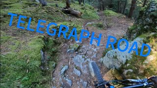
more stats
1.6 miles
Distance
-1,791 ft
Descent
00:08:02
Avg time
-1,791 ft
Altitude change
3,885 ft
Altitude min
5,676 ft
Altitude max
5,676 ft
Altitude start
3,885 ft
Altitude end
-21.4%
Grade
-64.9%
Grade max
-2.1%
Grade min
2 miles
Distance down
00:08:02
Avg time

telegraph road Details

  • Activities
    • Mountain Bike
    • E-Bike
    • Hike
    • Trail Running
  • Riding Area
    Valdisotto
    valdisotto
  • Ref Number
    #4
  • Difficulty Rating
  • Voted Difficulty
    Blue (1 vote)
  • Local Popularity
    100 in Mountain Biking heatmap [+]
    • 90 in E-Biking
    • 5 in Trail Running
    • 5 in Hiking
  • Global Ranking
    #2465 in Mountain Biking [+]
    • #21772 in E-Biking
    • #385816 in Trail Running
    • #381517 in Hiking
  • National Ranking
    #265 in Mountain Biking · Italy [+]
    • #2,494 in E-Biking
    • #15,709 in Trail Running
    • #15,488 in Hiking
  • Trail Type
    Singletrack
  • Bike Type
    DH, AM
  • Direction
    Downhill Primary
    Popular Direction Shown
  • Dogs Allowed
    Yes
  • eBike Allowed
    Yes up to Class 1

No community description for telegraph road trail has been added yet!

AI Generated Description

Telegraph road is a 3 km popular blue difficulty singletrack trail located near valdisotto. This mountain bike primary trail can be used downhill primary. On average it takes 8 minutes to complete this trail.

Tags

Recent Activity on Trail

Past Week
  • 0 rides
  •  
6 Months
  • 11 rides
  • 21 miles avg distance
All
  • 32 rides
  • Last: Sep 30, 2026
c1c2c3c4
January
February
March
April
May
June
July
August
September
October
November
December
update trails status or condition

telegraph road Trail Reports

Status:
on Aug 16, 2026
Ideal
Avg: 4.13 (1 votes)
Your vote: 0

view (61)
close
      Directions to telegraph-road trailhead (46.444590, 10.339620)

      Photos

      No photos have been added for telegraph road yet, add a photo.

      Videos

      1 more »
      NATURALE E DIVERTENTISSIMO! Telegraph Road -...
      mtb
      14:56 | 70 | Sep 3, 2025 , valdisotto
      5.0 ★★★★★
      1 Ratings
      5 ★ 100%
      4 ★
      3 ★
      2 ★
      1 ★

      2 Reviews & Comments

      alpinemattiyt
      Trail tutto sommato semplice nella parte alta. Nella parte centrale c'è solo un passaggio su rocce che arriva massimo a difficoltà rosso🔴. Al congiungimento con la strada di Calosio, dove si trova una fontanella con un tavolino non si capisce bene dove andare. Io ho seguito una strada sterrata per poi prendere dei sentierini che abbandonavano la strada ( rimanendo bene o male sulla traccia segnata ). Successivamente indica un pezzo di Trail che non c'è. Ho proseguito dritto sulla strada sterrata fino a giungere su un altro sentierino che arrivava poi a un cancello aperto. Poi una piccola risalita arrivando a della legna tagliata, dove indicava la traccia, ma guardando in alto ( dove era segnata la traccia di discesa) non c'era nulla. Ricongiungedomi poi alla traccia l'ho seguita fino alla fine. Tutto sommato molto divertente ( guardate il video che carico per capire bene che strada ho fatto ).
      Pinetto
      Bellissimo trail fondo pazzesco anche con pioggia facile e super flow con un piccolo tratto con qualche roccia paesaggio super

      We hope you've been enjoying Trailforks!

      Create a FREE account to view all trail reviews and much more.

      • By alesalTF Pro & contributors
      • #292456 - 646 views

      Frequently Asked Questions

      ▼ Where is telegraph road located?
      telegraph road is located in Valdisotto, valdisotto, Italy. It is part of the Valdisotto trail network. The trailhead is located at coordinates 46.44459, 10.33962.
      ▼ How hard is telegraph road?
      telegraph road is rated as Blue difficulty. The average grade is 21.4%.
      ▼ What is the elevation gain for telegraph road?
      The trail has 1,791 ft of elevation descent. The elevation ranges from 3,885 ft to 5,676 ft.
      ▼ Is telegraph road a point to point trail?
      telegraph road is not a point to point trail. The direction is Downhill Primary. The trail type is singletrack.
      ▼ How long is telegraph road?
      telegraph road is 1.6 miles long. The trail type is singletrack.
      ▼ Are dogs allowed on telegraph road?
      Yes, dogs are allowed on telegraph road. Please keep dogs on a leash where required and clean up after them.
      ▼ How long does it take to ride telegraph road?
      Based on recorded activities, it takes an average of 8 minutes to ride telegraph road. The trail is 1.6 miles long. Actual times will vary based on fitness level, conditions, and pace. View recent activity logs for more details.
      ▼ How busy is telegraph road?
      telegraph road is a very popular trail. There have been 61 recorded activities on this trail. The trail has received 61 check-ins. View recent activity on this trail.

      Hit the Trail

      Open in App

      Get this trail on your phone instantly.

      open trail in app

      Download Trail

      Save to wishlist, Garmin & download.
      save the trail

      Find Related Routes

      Find routes and users activities that include this trail.
      find routes for this trail

      You must enter a description before submitting.

