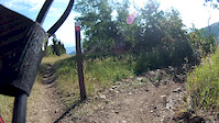
more stats
1.5 miles
Distance
456 ft
Climb
-6 ft
Descent
00:18:38
Avg time
450 ft
Altitude change
8,244 ft
Altitude min
8,695 ft
Altitude max
8,245 ft
Altitude start
8,694 ft
Altitude end
5.7%
Grade
-8.2%
Grade max
41%
Grade min
1 mile
Distance climb
486 ft
Distance down
190 ft
Distance flat
00:18:38
Avg time

Tommys Two Step Details

  • Activities
    • Mountain Bike
    • Adaptive Bike
    • Hike
    • Trail Running
  • Riding Area
    Park City Mountain Resort
    Park City, Utah
  • Difficulty Rating
  • Voted Difficulty
    Green (2 votes)
  • Local Popularity
    100 in Mountain Biking heatmap [+]
    • 75 in Trail Running
    • 80 in Hiking
    • 80 in Adaptive Biking
  • Global Ranking
    #132833 in Mountain Biking [+]
    • #159134 in Trail Running
    • #157154 in Hiking
    • #338 in Adaptive Biking
  • State Ranking
    #2,483 in Mountain Biking · Utah [+]
    • #3,813 in Trail Running
    • #3,920 in Hiking
    • #49 in Adaptive Biking
  • Trail Type
    Singletrack
  • Bike Type
    DH, AM, XC, Fat, Adaptive MTB
  • Direction
    Uphill Only[+]
    Popular Direction Shown
    • Uphill Only for Adaptive Biking
  • Climb Difficulty
    Blue
  • Physical Rating
    Moderate
  • Dogs Allowed
    Yes
  • eBike Allowed
  • TTFs on Trail
    Berm

Modern up-hill only climbing trail which can be a good alternative to the old-school Steps trail. There are a couple tight switch backs, but rolls pretty fast otherwise.

Disclaimer

New for 2019, this is UPHILL ONLY for riders!

Adaptive Bike Info
aMTB Blue Rating: Intermediate features and steeper terrain.

Generally 24 - 38” wide. A couple of off-camber moments combined with narrowness. No technical moves. Great uphill for adaptive riders.

Tags
Berms

Local Trail Association

Traditionally Indigenous Territory

Recent Activity on Trail

Past Week
  • 2 rides
  • 17 miles average
6 Months
  • 914 rides
  • 16 miles avg distance
All
  • 3,205 rides
  • Last: Nov 13, 2026
c1c2c3c4
January
February
March
April
May
June
July
August
September
October
November
December
Status:
on Nov 11, 2026
Ideal
Avg: 4.33 (21 votes)
Your vote: 0

view (19,970)
close
      Directions to tommys-two-step trailhead (40.630090, -111.513770)

      Photos

      18 more »
      mtb
      63 |
      Oct 1, 2023 @ 3:45pm
      Oct 1, 2023
      mtb
      53 |
      Oct 1, 2023 @ 3:45pm
      Oct 1, 2023
      mtb
      88 |
      Sep 12, 2023 @ 9:33pm
      Sep 12, 2023
      mtb
      102 |
      Jul 1, 2020 @ 5:51am
      Jul 1, 2020

      Videos

      2 more »
      youtuber Tommys Two Step | Park City, Utah
      mtb
      8:32 | 614 | Oct 8, 2018 , Park City
      Tommy Two Step Down
      mtb
      7:27 | 224 | Sep 29, 2014 , Park City

      Trail Lists

      Routes with this trail

      more »
      ★ 3.5 • 12 miles • 2,071 ft • 6 •
      Up Jenni's > Mid Moutain > Tommy Two Steps to the Yurt. Down Silver Queen > Mid Mountain >...
      ★ 2.0 • 31 miles • 3,859 ft • 13 • Shuttled •
      The Wasatch Crest is a popular shuttle run, but some it is too short for a weekend ride. This route is a...
      23 miles • 3,241 ft • 9 • Loop •
      Smooth easy climbs to fast descents featuring new intermediate jump lines Cyn City & Seldom Seen. A...
      4.5 ★★★★★
      21 Ratings
      5 ★ 57%
      4 ★ 33%
      3 ★ 5%
      2 ★ 5%
      1 ★

      2 Reviews & Comments

      twardo twardo
      Clear & Dry except for two small sections crossing the ski run / fire road. 5/9/2026

      We hope you've been enjoying Trailforks!

      Create a FREE account to view all trail reviews and much more.

      • By toddTF Pro Trailforks & contributors
      • #11683 - 5,334 views

      Frequently Asked Questions

      ▼ Where is Tommys Two Step located?
      Tommys Two Step is located in Park City Mountain Resort, Park City, Utah, United States. It is part of the Park City Mountain Resort trail network. The trailhead is located at coordinates 40.63009, -111.51377.
      ▼ How hard is Tommys Two Step?
      Tommys Two Step is rated as Blue difficulty. The physical rating is Moderate. The average grade is 5.7%. The climb difficulty is rated Blue.
      ▼ What is the elevation gain for Tommys Two Step?
      Tommys Two Step has 456 ft of elevation gain. The trail has 6 ft of elevation descent. The elevation ranges from 8,244 ft to 8,695 ft.
      ▼ Is Tommys Two Step a point to point trail?
      Yes, Tommys Two Step is a point to point trail. The direction is Uphill Only. The trail type is singletrack.
      ▼ How long is Tommys Two Step?
      Tommys Two Step is 1.5 miles long. The trail type is singletrack.
      ▼ Are dogs allowed on Tommys Two Step?
      Yes, dogs are allowed on Tommys Two Step. Please keep dogs on a leash where required and clean up after them.
      ▼ How do I access Tommys Two Step? Where is the closest parking trailhead?
      The closest parking and trailhead locations to Tommys Two Step are: View all parking locations in the area.
      ▼ How long does it take to ride Tommys Two Step?
      Based on recorded activities, it takes an average of 19 minutes to ride Tommys Two Step. The trail is 1.5 miles long. Actual times will vary based on fitness level, conditions, and pace. View recent activity logs for more details.
      ▼ How busy is Tommys Two Step?
      Tommys Two Step is a very popular trail. There have been 20,032 recorded activities on this trail. The trail has received 19,970 check-ins. View recent activity on this trail.

      Hit the Trail

      Open in App

      Get this trail on your phone instantly.

      open trail in app

      Download Trail

      Save to wishlist, Garmin & download.
      save the trail

      Find Related Routes

      Find routes and users activities that include this trail.
      find routes for this trail

      You must enter a description before submitting.