
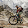
more stats
2,034 ft
Distance
-422 ft
Descent
00:07:21
Avg time
-422 ft
Altitude change
3,032 ft
Altitude min
3,455 ft
Altitude max
3,455 ft
Altitude start
3,031 ft
Altitude end
-20.8%
Grade
-43.2%
Grade max
-1.1%
Grade min
2,034 ft
Distance down
00:07:21
Avg time

Törl Trail Details

  • Activities
    • Mountain Bike
    • E-Bike
    • Hike
    • Trail Running
  • Riding Area
  • Ref Number
    S205
  • Difficulty Rating
  • Global Ranking
    #48494 in Mountain Biking [+]
    • #135899 in E-Biking
    • #330273 in Trail Running
    • #349482 in Hiking
  • National Ranking
    #417 in Mountain Biking · Austria [+]
    • #573 in E-Biking
    • #671 in Trail Running
    • #782 in Hiking
  • Trail Type
    Singletrack
  • Trail Visibility
    Always easy to follow
  • Alpine Trail
    Yes
  • Dogs Allowed
    Yes
  • eBike Allowed
    Yes up to Class 1

Shared Trail
Offiziell freigegeben in Kooperation mit Dachstein Salzkammergut, Bundesforste und Alpenverein.

Disclaimer

Wearing a helmet is compulsory. Be friendly to hikers. Ride at your own risk.

Tags
Alpine

Recent Activity on Trail

Past Week
  • 0 rides
  •  
6 Months
  • 5 rides
  • 114.4 km avg distance
All
  • 8 rides
  • Last: Jul 17, 2026
c1c2c3c4
January
February
March
April
May
June
July
August
September
October
November
December
update trails status or condition

Törl Trail Trail Reports

statusdatedescription
Mar 22, 2026 @ 11:47am (Europe/Vienna)
Mar 22, 2026
Wintersperre, aber soweit beim Radlschieben gesehen ist anfangs noch etwas Schnee im Trail, danach sehr viel Laub und lose Steine, dafür guter Grip.
Jun 6, 2025 @ 6:10am
Jun 6, 2025
Trail nun geöffnet - viel Spaß beim Fahren! Kooperation mit Salzkammergut Trophy. Gebaut von David Pekoll mit Team. Finanziert von den TVBs...
May 30, 2025 @ 1:47am
May 30, 2025
Trail wurde bei geshaped und muss sich nun ein paar Tage festigen. Bitte keinen Befahrungen in den nächsten Tagen. Trail ist abgesperrt.
Jul 19, 2024 @ 4:13am
Jul 19, 2024
ist wiede rgeöffnet
May 21, 2024 @ 4:02pm
May 21, 2024
Gesperrt wegen Forstarbeiten
more »
Status:
on Mar 22, 2026
Variable
Avg: 4.11 (2 votes)
Your vote: 0

view (34)
close
      Directions to torl-trail trailhead (47.663890, 13.642900)

      Photos

      14 more »
      mtb
      117 |
      Mar 23, 2026 @ 2:50am
      Mar 23, 2026
      mtb
      114 |
      Mar 23, 2026 @ 2:49am
      Mar 23, 2026
      mtb
      112 |
      Mar 23, 2026 @ 2:49am
      Mar 23, 2026
      mtb
      116 |
      Mar 23, 2026 @ 2:49am
      Mar 23, 2026

      Videos

      no videos have been added for Törl Trail yet, add a video.
      4.5 ★★★★★
      2 Ratings
      5 ★ 50%
      4 ★ 50%
      3 ★
      2 ★
      1 ★

      7 Reviews & Comments

      ktm-boy-69 ktm-boy-69
      Achtung: Weg wurde 2025 überarbeitet und etwas entschärft im unteren Abschnitt. Bitte beim Lesen der Kommentare und Reports bzw. Anschauen der Bilder beachten (aufs Datum schauen).
      ktm-boy-69 ktm-boy-69
      Wie geil, dass so ein Wegerl freigegeben wird. Recht geil zum Fahren wenn man die Skills hat (Bewertung schwarz passt). Natürlicher Weg mit ein paar Felsen drinnen, im Mittelteil kurz ein wenig steiler inkl. Spitzkehren.
      Aktuell wegen Forstarbeiten, bzw. Wegschäden vermutlich noch einmal ein wenig schwieriger als normal.

      We hope you've been enjoying Trailforks!

      Create a FREE account to view all trail reviews and much more.

      Frequently Asked Questions

      ▼ Where is Törl Trail located?
      Törl Trail is located in Bad Goisern, Austria. It is part of the Bad Goisern trail network. The trailhead is located at coordinates 47.66389, 13.6429.
      ▼ How hard is Törl Trail?
      Törl Trail is rated as Black difficulty. The average grade is 20.8%.
      ▼ What is the elevation gain for Törl Trail?
      The trail has 422 ft of elevation descent. The elevation ranges from 3,032 ft to 3,455 ft.
      ▼ How long is Törl Trail?
      Törl Trail is 2,034 ft long. The trail type is singletrack.
      ▼ Are dogs allowed on Törl Trail?
      Yes, dogs are allowed on Törl Trail. Please keep dogs on a leash where required and clean up after them.
      ▼ How do I access Törl Trail? Where is the closest parking trailhead?
      The closest parking and trailhead locations to Törl Trail are: View all parking locations in the area.
      ▼ How long does it take to ride Törl Trail?
      Based on recorded activities, it takes an average of 7 minutes to ride Törl Trail. The trail is 2,034 ft long. Actual times will vary based on fitness level, conditions, and pace. View recent activity logs for more details.
      ▼ How busy is Törl Trail?
      Törl Trail has limited popularity data available. There have been 32 recorded activities on this trail. The trail has received 34 check-ins. View recent activity on this trail.

      Hit the Trail

      Open in App

      Get this trail on your phone instantly.

      open trail in app

      Download Trail

      Save to wishlist, Garmin & download.
      save the trail

      Find Related Routes

      Find routes and users activities that include this trail.
      find routes for this trail

      You must enter a description before submitting.

