7.1 miles
Distance
588 ft
Climb
-2,519 ft
Descent
01:32:56
Avg time
Supporters, Builders, Maintainers & Land Managers of Torry Ridge Trail
USFSLand Manager
Torry Ridge Details
-
Activities
- Mountain Bike
- Hike
- Trail Running
-
Riding AreaSherando Lake Area
Sherando, Virginia -
AKATorrey Ridge
-
Difficulty Rating
-
Voted DifficultyBlack Diamond (2 votes)
-
Trail TypeSingletrack
-
Bike TypeAM
-
DirectionDownhill PrimaryPopular direction shown
-
Climb DifficultyBlack Diamond
-
Physical RatingHard
-
Dogs AllowedYes
-
TTFs on TrailRock Garden
-
Global Ranking#49712 in Mountain Biking
-
Local Popularity55 in Mountain Biking [+]
- 5 in Trail Running
- 5 in Hiking
Very challenging technical ridge ride with a couple of tough rock gardens. Punchy climbs with loose rocks mixed into a lot of downhill riding.
Local Trail Association
-

-

-
Please consider joining or donating to the local trail association to supportdonate to earn trail karma!
trail development & maintenance.
Traditionally Indigenous Territory
More Stats for Torry Ridge mountain bike trail trail
-
Altitude change-1,931 ft
-
Altitude min1,594 ft
-
Altitude max3,525 ft
-
Altitude start3,525 ft
-
Altitude end1,594 ft
-
Grade-5.1%
-
Grade max-56.3%
-
Grade min36.3%
-
Distance climb2 miles
-
Distance down5 miles
-
Distance flat1,722 ft
-
Avg time01:32:56
-
Avg reverse time02:36:57
- view trail stats
close
-
Layers w
- Map Content
- More Layers
- Pro
- Pro
- Pro
- Pro
- Pro
- Pro
- Pro
- Pro
-
Upgrade to

3D
Trail Conditions
- Unknown
- Snow Groomed
- Snow Packed
- Snow Covered
- Snow Cover Partial
- Freeze/thaw Cycle
- Icy
- Prevalent Mud
- Wet
- Variable
- Ideal
- Dry
- Very Dry
Trail Flow (Ridden Direction)
Trailforks scans users ridelogs to determine the most popular direction each trail is ridden. A good flowing trail network will have most trails flowing in a single direction according to their intension.
The colour categories are based on what percentage of riders are riding a trail in its intended direction.
The colour categories are based on what percentage of riders are riding a trail in its intended direction.
- > 96%
- > 90%
- > 80%
- > 70%
- > 50%
- < 50%
- bi-directional trail
- no data
Trail Last Ridden
Trailforks scans ridelogs to determine the last time a trail was ridden.
- < 2 days
- < 1 week
- < 2 weeks
- < 1 month
- < 6 months
- > 6 months
Trail Ridden Direction
The intended direction a trail should be ridden.
- Downhill Only
- Downhill Primary
- Both Directions
- Uphill Primary
- Uphill Only
- One Direction
Contribute Details
Colors indicate trail is missing specified detail.
- Description
- Photos
- Description & Photos
- Videos
Trail Popularity ?
Trailforks scans ridelogs to determine which trails are ridden the most in the last 9 months.
Trails are compared with nearby trails in the same city region with a possible 25 colour shades.
Think of this as a heatmap, more rides = more kinetic energy = warmer colors.
- most popular
- popular
- less popular
- not popular
ATV/ORV/OHV Filter
Max Vehicle Width
inches
US Cell Coverage
Legend

Radar Time
x
Activity Recordings
Trailforks users anonymized public ridelogs from the past 6 months.
- mountain biking recent
- mountain biking (>6 month)
- hiking (1 year)
- moto (1 year)
Activity Recordings
Trailforks users anonymized public skilogs from the past 12 months.
- Downhill Ski
- Backcountry Ski
- Nordic Ski
- Snowmobile
Winter Trails
Warning
A routing network for winter maps does not exist. Selecting trails using the winter trails layer has been disabled.
x
Missing Trails
Most Popular
Least Popular
Trails are colored based on popularity. The more popular a trail is, the more red. Less popular trails trend towards green.
Jump Magnitude Heatmap
Heatmap of where riders jump on trails. Zoom in to see individual jumps, click circles to view jump details.
Trails Deemphasized
Trails are shown in grey.
Only show trails with NO bikes.
Save the current map location and zoom level as your default home location whenever this page is loaded.
Save
Directions to torry-ridge trailhead
(37.917460, -79.062420)
update trails status or condition
Torry Ridge Trail Reports
view all reports »
Recent Ridelog Activity on Trail
Past Week
- 1 rides
- 21.8 km avg distance
6 Months
- 9 rides
- 27.0 km avg distance
All
- 97 rides
- Last: May 12, 2024
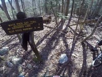
Photos
more »
4 Reviews & Comments
We hope you've been enjoying Trailforks!
Create a FREE account to view trail comments and much more.
Videos
more »
youtuber
![SHE'S NOT AFRAID TO GO FAST | Mountain Biking...]()

13:11 |
296 |
Jan 10, 2022 , Sherando

10:28 |
799 |
Sep 27, 2020 , Sherando
1:42 |
640 |
Apr 9, 2018 , Sherando
Nearby Trails
- Mill Creek Trail 3,153 ft
- Bald Mountain Jeep Trail 1 mile
- Slacks Access 1 mile
- Slacks Trail 2 miles
- Slacks Access Lower 3 miles
- By brettn13
 CAMBC & contributors
 - #84326 - 4,885 views
- follow/subscribe
- login to download gpx or kml files.
You must enter a description before submitting.