

more stats
1,552 ft
Distance
-213 ft
Descent
00:01:50
Avg time
-212 ft
Altitude change
630 ft
Altitude min
843 ft
Altitude max
843 ft
Altitude start
633 ft
Altitude end
-13.6%
Grade
-47.7%
Grade max
17%
Grade min
135 ft
Distance climb
978 ft
Distance down
381 ft
Distance flat
00:01:50
Avg time

TTApeworm Details

  • Activities
    • Mountain Bike
    • E-Bike
  • Riding Area
    Pitmedden
    Auchtermuchty
  • Difficulty Rating
  • Local Popularity
    90 in Mountain Biking [+]
    • 90 in E-Biking
  • Global Ranking
    #6315 in Mountain Biking [+]
    • #19425 in E-Biking
  • National Ranking
    #181 in Mountain Biking · United Kingdom [+]
    • #1,040 in E-Biking
  • Trail Type
    Singletrack
  • Bike Type
    AM, XC
  • Direction
    One Direction
    Popular Direction Shown
  • Climb Difficulty
    Green
  • Physical Rating
    Easy
  • Trail Visibility
    Always easy to follow
  • eBike Allowed
    Yes up to Class 1
  • TTFs on Trail
    Berm, Drop, Jump, Gap Jump, Rock Garden
  • Ride in Rain
    Yes
  • Year Opened
    2022
  • Land Owner
    Forestry And Land Scotland

An awkward climb on the connector trail leads you to a short natural and loamy steep singletrack descent which has been re-routed to cross the forest road more safely. The next section is a fast hard surfaced trail with many features. the bottom has been re-routed to add about 100m on to its length and avoid a dangerous exit on to the forest road. This last section is of a "natural" pump track style . The work was carried out by the Tayside Trail Association

This trail is unsanctioned.

Tags

Recent Activity on Trail

Past Week
  • 0 rides
  •  
6 Months
  • 20 rides
  • 10 miles avg distance
All
  • 86 rides
  • Last: Oct 18, 2026
c1c2c3c4
January
February
March
April
May
June
July
August
September
October
November
December
update trails status or condition

TTApeworm Trail Reports

Status:
on May 27, 2026
Dry
Avg: 4.21 (3 votes)
Your vote: 0

view (1,285)
close
      Directions to ttapeworm trailhead (56.310840, -3.308800)

      Photos

      No photos have been added for TTApeworm yet, add a photo.

      Videos

      4 more »
      Pitmedden lived up to the Hype! First time...
      mtb
      15:22 | 39 | Aug 7, 2026 , Auchtermuchty
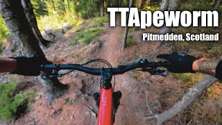
      TTApeworm - Pitmedden, Scotland
      mtb
      2:04 | 93 | Sep 13, 2025 , Auchtermuchty
      youtuber FIRST RIDE On The New E-Bike!
      mtb
      10:37 | 325 | Mar 4, 2024 , Auchtermuchty
      WORMHOLE Has Had An Upgrade! - Pitmedden Mtb Vlog
      mtb
      13:12 | 223 | Dec 27, 2022 , Auchtermuchty
      4.7 ★★★★★
      3 Ratings
      5 ★ 67%
      4 ★ 33%
      3 ★
      2 ★
      1 ★

      1 Review & Comments

      Elizabethj4ta2S
      Brilliant trail - so much more interesting than the previous 50/50. Love the loamy, rooty first section way more than the previous steep shoot where it was 50/50 if you hit the stump or not. Bottom section also awesome and doesn’t have the splodge at the bottom anymore. Brilliant work TTA.

      We hope you've been enjoying Trailforks!

      Create a FREE account to view all trail reviews and much more.

      • #585193 - 636 views

      Frequently Asked Questions

      ▼ Where is TTApeworm located?
      TTApeworm is located in Pitmedden, Auchtermuchty, United Kingdom. It is part of the Pitmedden trail network. The trailhead is located at coordinates 56.31084, -3.3088.
      ▼ How hard is TTApeworm?
      TTApeworm is rated as Black difficulty. The physical rating is Easy. The average grade is 13.6%. The climb difficulty is rated Green.
      ▼ What is the elevation gain for TTApeworm?
      The trail has 213 ft of elevation descent. The elevation ranges from 630 ft to 843 ft.
      ▼ Is TTApeworm a point to point trail?
      Yes, TTApeworm is a point to point trail. The direction is One Direction. The trail type is singletrack.
      ▼ How long is TTApeworm?
      TTApeworm is 1,552 ft long. The trail type is singletrack.
      ▼ Are dogs allowed on TTApeworm?
      There is no information about dogs being allowed on TTApeworm. Check with local trail managers or the trail page for the latest access rules.
      ▼ When is the best time of year to ride TTApeworm?
      Based on activity log data, the most popular months to ride TTApeworm are:
      • April (11 activities)
      • August (10 activities)
      • May (9 activities)
      Check the reports page for current trail conditions.
      ▼ How do I access TTApeworm? Where is the closest parking trailhead?
      The closest parking and trailhead locations to TTApeworm are: View all parking locations in the area.
      ▼ How long does it take to ride TTApeworm?
      Based on recorded activities, it takes an average of 2 minutes to ride TTApeworm. The trail is 1,552 ft long. Actual times will vary based on fitness level, conditions, and pace. View recent activity logs for more details.
      ▼ How busy is TTApeworm?
      TTApeworm is a very popular trail. There have been 920 recorded activities on this trail. The trail has received 1,285 check-ins. View recent activity on this trail.

      Hit the Trail

      Open in App

      Get this trail on your phone instantly.

      open trail in app

      Download Trail

      Save to wishlist, Garmin & download.
      save the trail

      Find Related Routes

      Find routes and users activities that include this trail.
      find routes for this trail

      You must enter a description before submitting.

