more stats
2,776 ft
Distance
19 ft
Climb
-210 ft
Descent
00:04:46
Avg time
-191 ft
Altitude change
1,217 ft
Altitude min
1,408 ft
Altitude max
1,408 ft
Altitude start
1,217 ft
Altitude end
-6.9%
Grade
-33.7%
Grade max
17%
Grade min
240 ft
Distance climb
2,087 ft
Distance down
446 ft
Distance flat
00:04:46
Avg time

Old Vanilla Details

  • Activities
    • Mountain Bike
    • E-Bike
    • Adaptive Bike
    • Hike
    • Trail Running
  • Riding Area
    Cumberland trail network
    Cumberland, British Columbia
  • Difficulty Rating
  • Voted Difficulty
    Blue (1 vote)
  • Local Popularity
    100 in Mountain Biking [+]
    • 95 in E-Biking
    • 55 in Trail Running
    • 90 in Hiking
    • 5 in Adaptive Biking
  • Global Ranking
    #166 in Mountain Biking [+]
    • #1747 in E-Biking
    • #48754 in Trail Running
    • #1435 in Hiking
  • Trail Type
    Singletrack
  • Bike Type
    DH, AM, XC, Adaptive MTB
  • Dogs Allowed
    Yes
  • eBike Allowed
  • TTFs on Trail
    Berm

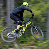
The orginal flow trail through the middle of the network joining from Truffle Shuffle to Short Line. Good for a broad range of riders, a few viewpoints and some fun berms.

Access Info

Take climb up to Truffle Shuffle. Find the entrance to Vanilla just before cresting the climb.

Adaptive Bike Info

This trail does not meet KASA’s aMTB trail standards but is rideable by some adaptive mountain bikers. This trail evaluation was tested by a local adaptive rider using a Bowhead RX.

Local Trail Association
Traditionally Indigenous Territory

Recent Activity on Trail

Past Week
  • 63 rides
  • 20.2 km average
6 Months
  • 1,633 rides
  • 21.0 km avg distance
All
  • 9,758 rides
  • Last: Sep 18, 2026
c1c2c3c4
January
February
March
April
May
June
July
August
September
October
November
December
Status:
on Aug 19, 2026
Dry
Avg: 4.57 (98 votes)
Your vote: 0

view (36,341)
close
      Directions to old-vanilla trailhead (49.591670, -125.042510)

      Photos

      54 more »
      mtb
      821 |
      Jun 23, 2017 @ 1:25pm
      Jun 23, 2017
      mtb
      587 |
      Jun 23, 2017 @ 1:25pm
      Jun 23, 2017
      mtb
      292 |
      Jul 30, 2020 @ 1:57pm
      Jul 30, 2020
      mtb
      247 |
      Jan 12, 2020 @ 5:23pm
      Jan 12, 2020

      Videos

      25 more »
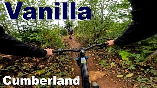
      youtuber Old Vanilla - Cumberland, BC
      mtb
      3:54 | 405 | Jan 14, 2024 , Cumberland
      youtuber Vanilla with Mhairi - Cumberland 2025
      mtb
      12:09 | 122 | Dec 13, 2025 , Cumberland
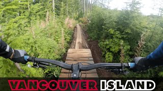
      The Wonderful Wooden Features of Vancouver...
      mtb
      22:15 | 107 | Jan 12, 2025 , Cumberland
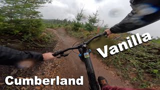
      Vanilla - Cumberland 2024
      mtb
      13:01 | 48 | Nov 18, 2024 , Cumberland

      Trail Lists

      Routes with this trail

      3.3 11 miles 1,571 ft 14 Loop
      Follow the main road (turn right after yellow gate) to signed Sobo No Michi climb trail and begin the...
      11 miles 1,562 ft 14 Loop
      Follow the main road (turn right after yellow gate) to signed Sobo No Michi climb trail and begin the...
      3 miles 159 ft 5
      UROC Fiver series presented by Fox and supported by our Comox Valley bike stores. All riders who complete...
      4.6
      98 Ratings
      5 70%
      4 21%
      3 7%
      2 1%
      1

      7 Reviews & Comments

      jbarlowbc2az
      Completely blown out berm a little bit before entering the clearcut. It’s in a sketchy place as it’s a bit of a blind corner if you’re going at speed. Wanted to mention it before the women’s enduro this weekend
      MashYeti MashYeti
      Fun and fast, tons of grip. One of my fav trails. A Cumberland classic.
      calum676 calum676
      Best trail ever.
      Nice birms, couple little jumps and super flowy

      We hope you've been enjoying Trailforks!

      Create a FREE account to view all trail reviews and much more.

      • By urchman & contributors
      • #52208 - 23,819 views

      Frequently Asked Questions

      Where is Old Vanilla located?
      Old Vanilla is located in Cumberland trail network, Cumberland, British Columbia, Canada. It is part of the Cumberland trail network trail network. The trailhead is located at coordinates 49.59167, -125.04251.
      How hard is Old Vanilla?
      Old Vanilla is rated as Blue difficulty. The average grade is 6.9%.
      What is the elevation gain for Old Vanilla?
      Old Vanilla has 19 ft of elevation gain. The trail has 210 ft of elevation descent. The elevation ranges from 1,217 ft to 1,408 ft.
      How long is Old Vanilla?
      Old Vanilla is 2,776 ft long. The trail type is singletrack.
      Are dogs allowed on Old Vanilla?
      Yes, dogs are allowed on Old Vanilla. Please keep dogs on a leash where required and clean up after them.
      How do I access Old Vanilla? Where is the closest parking trailhead?
      The closest parking and trailhead locations to Old Vanilla are: View all parking locations in the area.
      How long does it take to ride Old Vanilla?
      Based on recorded activities, it takes an average of 6 minutes to ride Old Vanilla. The trail is 2,776 ft long. Actual times will vary based on fitness level, conditions, and pace. View recent activity logs for more details.
      How busy is Old Vanilla?
      Old Vanilla is a very popular trail. There have been 37,040 recorded activities on this trail. The trail has received 36,341 check-ins. View recent activity on this trail.

      Hit the Trail

      Open in App

      Get this trail on your phone instantly.

      open trail in app

      Download Trail

      Save to wishlist, Garmin & download.
      save the trail

      Find Related Routes

      Find routes and users activities that include this trail.
      find routes for this trail

      You must enter a description before submitting.