
more stats
2,835 ft
Distance
-313 ft
Descent
00:04:30
Avg time
-313 ft
Altitude change
60 ft
Altitude min
373 ft
Altitude max
373 ft
Altitude start
59 ft
Altitude end
-11%
Grade
-55.3%
Grade max
2.2%
Grade min
177 ft
Distance climb
2,657 ft
Distance down
00:04:30
Avg time

Viper b-line Details

  • Activities
    • Mountain Bike
    • E-Bike
    • Hike
    • Trail Running
  • Riding Area
  • Difficulty Rating
  • Local Popularity
    80 in Mountain Biking heatmap [+]
    • 100 in E-Biking
    • 5 in Trail Running
    • 5 in Hiking
  • Trail Type
    Singletrack
  • Bike Type
    DH, AM, XC
  • Direction
    Downhill Primary
    Popular Direction Shown
  • Climb Difficulty
    Green
  • Physical Rating
    Easy
  • Trail Visibility
    Always easy to follow
  • Dogs Allowed
    Yes
  • eBike Allowed
    Yes up to Class 1
  • Ride in Rain
    Yes

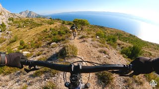
Beautiful but short natural singletrack. Alternative to the last part of the Viper trail.

Tags

Local Trail Association

Recent Activity on Trail

Past Week
  • 0 rides
  •  
6 Months
  • 0 rides
  •  
All
  • 26 rides
  • Last: Oct 31, 2026
c1c2c3c4
January
February
March
April
May
June
July
August
September
October
November
December
Status:
on Apr 29, 2026
Ideal
Avg: 4.29 (6 votes)
Your vote: 0

view (688)
close
      Directions to viper-bline trailhead (43.444730, 16.656980)

      Photos

      No photos have been added for Viper b-line yet, add a photo.

      Videos

      1 more »
      Omiš enduro trails on Perun - shuttle part 2/3
      mtb
      15:03 | 385 | Nov 29, 2021 , Split
      4.7 ★★★★★
      6 Ratings
      5 ★ 67%
      4 ★ 33%
      3 ★
      2 ★
      1 ★

      1 Review & Comments

      Milanomafiano
      Perfect last part of the viper. Don't forget to say "don't Dan" when you ride through the garden of the house...

      We hope you've been enjoying Trailforks!

      Create a FREE account to view all trail reviews and much more.

      • By CoastRiders & contributors
      • #222138 - 544 views

      Hit the Trail

      Open in App

      Get this trail on your phone instantly.

      open trail in app

      Download Trail

      Save to wishlist, Garmin & download.
      save the trail

      Find Related Routes

      Find routes and users activities that include this trail.
      find routes for this trail

      You must enter a description before submitting.

