
more stats
2.3 miles
Distance
266 ft
Climb
-264 ft
Descent
00:18:04
Avg time
1 ft
Altitude change
5,373 ft
Altitude min
5,531 ft
Altitude max
5,530 ft
Altitude start
5,531 ft
Altitude end
-21.4%
Grade max
18.4%
Grade min
3,392 ft
Distance climb
3,766 ft
Distance down
4,957 ft
Distance flat
00:18:04
Avg time

Wakara Details

  • Activities
    • Mountain Bike
    • E-Bike
    • Winter Fat Bike
    • Hike
    • Trail Running
    • Snowshoe
  • Riding Area
    Forebay
    Payson, Utah
  • AKA
    The Hawk
  • Difficulty Rating
  • Local Popularity
    100 in Mountain Biking [+]
    • 95 in E-Biking
    • 70 in Trail Running
    • 85 in Hiking
    • 5 in Snowshoeing
    • 5 in Winter Fat Biking
  • Global Ranking
    #13868 in Mountain Biking [+]
    • #98141 in E-Biking
    • #133561 in Trail Running
    • #111479 in Hiking
    • #26662 in Snowshoeing
    • #37895 in Winter Fat Biking
  • State Ranking
    #292 in Mountain Biking · Utah [+]
    • #1,114 in E-Biking
    • #2,945 in Trail Running
    • #2,489 in Hiking
    • #202 in Snowshoeing
    • #409 in Winter Fat Biking
  • Hiking SAC Scale
    T1 Hiking
  • Trail Exposure
    Normal
  • Trail Type
    Singletrack
  • Snow Grooming
    Backcountry
  • Bike Type
    AM, XC, Fat
  • Direction
    Both Directions[+]
    • Both Directions for Snowshoeing
    • Both Directions for Winter Fat Biking
  • Climb Difficulty
    Green
  • Physical Rating
    Moderate
  • Trail Visibility
    Always easy to follow
  • Season
    All year as long as it isn't muddy or raining.
  • eBike Allowed
    Yes up to Class 1
  • TTFs on Trail
    Berm, Bridge, Rock Garden
  • Lighting
    No
  • Year Opened
    2021
  • Land Owner
    Payson City

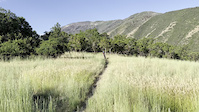
Short climbs and some tight turns. Expect spectacular views in the spring, fall and winter. In 2025 a new bridge and several berms were constructed to help with flow. A center shortcut was also added to allow Wakara to be ridden in a figure 8.

Local Trail Association

Traditionally Indigenous Territory

Recent Activity on Trail

Past Week
  • 2 rides
  • 7 miles average
6 Months
  • 100 rides
  • 11 miles avg distance
All
  • 398 rides
  • Last: Oct 26, 2026
c1c2c3c4
January
February
March
April
May
June
July
August
September
October
November
December
update trails status or condition

Wakara Trail Reports

statusdatedescription
Oct 17, 2026 @ 8:02pm (America/Denver)
Oct 17, 2026
reporter
Oct 16, 2026 @ 2:03pm (America/Los_Angeles)
Oct 16, 2026
Not approved
Oct 11, 2026 @ 7:38am (America/Denver)
Oct 11, 2026
reporter Prevalent Mud. Please respect the trail closure.
Oct 1, 2026 @ 1:53pm (America/Denver)
Oct 1, 2026
reporter
Sep 28, 2026 @ 2:03pm (America/Denver)
Sep 28, 2026
reporter You guessed it, muddy. Please respect the closure while we get the much needed moisture.
more »
Status:
on Oct 17, 2026
Ideal
Avg: 3.63 (6 votes)
Your vote: 0

view (2,289)
close
      Directions to wakara trailhead (39.990690, -111.692510)

      Photos

      19 more »
      mtb
      53 |
      Aug 26, 2024 @ 12:39pm
      Aug 26, 2024
      mtb
      59 |
      Jun 1, 2023 @ 1:25pm
      Jun 1, 2023
      mtb
      65 |
      May 19, 2023 @ 7:59am
      May 19, 2023
      mtb
      79 |
      Oct 27, 2022 @ 9:15am
      Oct 27, 2022

      Videos

      1 more »
      mtb
      0:08 | | Oct 27, 2022 , Payson

      Routes with this trail

      6 miles • 804 ft • 10 • Loop •
      Nebo goats 4 hour of Forebay main route
      6 miles • 824 ft • 8 •
      Route for the Nebo HS MTB Team Four Hours of Forebay Event
      3.5 ★★★★★
      6 Ratings
      5 ★ 50%
      4 ★ 17%
      3 ★
      2 ★
      1 ★ 33%

      5 Reviews & Comments

      UVcyclist
      For the trails I've ridden in south Utah Valley, this is THE best (IMO) if you are looking for an XC style trail and a place to train for that sort of racing or riding (it even has "time trial" signs along the way so you don't get confused with the menagerie of trials here). There are ups and downs, a couple short, steep climbs and downhills in a big loop with plenty of sometimes tight turns (some are nicely bermed). There are (at least right now), no jumps, drops, or any of that BMX style bike park stuff on the trail. If you like classic XC style trails, this one tops any here, or in Spanish Fork, or in Santaquin. I wish there were more trails like this around here to train for XC rather than all the bike park and downhill type trails everyone seems to like so much. This is my new favorite trail in the local south county maintained MTB trail systems. Let's get something like this in Spanish Fork!
      Slogflog
      Does this trail legally have equestrian use? I see damage form this on trail reports
      Parker1zvoij
      Tight turns kill the flow, but it’s a nice easy to intermediate trail. Roots are coming up in a lot of areas on the trail so don’t catch a pedal or tire. Nice views of the Forebay area.

      We hope you've been enjoying Trailforks!

      Create a FREE account to view all trail reviews and much more.

      • By 2perishableTF Pro & contributors
      • #437730 - 1,690 views

      Frequently Asked Questions

      ▼ Where is Wakara located?
      Wakara is located in Forebay, Payson, Utah, United States. It is part of the Forebay trail network. The trailhead is located at coordinates 39.99069, -111.69251.
      ▼ How hard is Wakara?
      Wakara is rated as Blue difficulty. The physical rating is Moderate. The climb difficulty is rated Green.
      ▼ What is the elevation gain for Wakara?
      Wakara has 266 ft of elevation gain. The trail has 264 ft of elevation descent. The elevation ranges from 5,373 ft to 5,531 ft.
      ▼ Is Wakara a point to point trail?
      Wakara is not a point to point trail. The direction is Both Directions. The trail type is singletrack.
      ▼ How long is Wakara?
      Wakara is 2.3 miles long. The trail type is singletrack.
      ▼ Are dogs allowed on Wakara?
      There is no information about dogs being allowed on Wakara. Check with local trail managers or the trail page for the latest access rules.
      ▼ When is the best time of year to ride Wakara?
      Wakara is best visited during: All year as long as it isn't muddy or raining..
      ▼ How do I access Wakara? Where is the closest parking trailhead?
      The closest parking and trailhead locations to Wakara are: View all parking locations in the area.
      ▼ How long does it take to ride Wakara?
      Based on recorded activities, it takes an average of 18 minutes to ride Wakara. The trail is 2.3 miles long. Actual times will vary based on fitness level, conditions, and pace. View recent activity logs for more details.
      ▼ How busy is Wakara?
      Wakara is a very popular trail. There have been 1,737 recorded activities on this trail. The trail has received 2,289 check-ins. View recent activity on this trail.

      Hit the Trail

      Open in App

      Get this trail on your phone instantly.

      open trail in app

      Download Trail

      Save to wishlist, Garmin & download.
      save the trail

      Find Related Routes

      Find routes and users activities that include this trail.
      find routes for this trail

      You must enter a description before submitting.

