


more stats
2.5 miles
Distance
8 ft
Climb
-1,208 ft
Descent
00:17:02
Avg time
-1,200 ft
Altitude change
2,231 ft
Altitude min
3,430 ft
Altitude max
3,430 ft
Altitude start
2,231 ft
Altitude end
-9.1%
Grade
-35.1%
Grade max
6.5%
Grade min
144 ft
Distance climb
2 miles
Distance down
689 ft
Distance flat
00:17:02
Avg time

Wildcat Details

  • Activities
    • Mountain Bike
    • Hike
    • Trail Running
    • Backcountry Ski
  • Riding Area
    Manastash Ridge Trails
    Ellensburg, Washington
  • Difficulty Rating
  • Local Popularity
    80 in Mountain Biking heatmap [+]
    • 85 in Trail Running
    • 85 in Hiking
    • 5 in Backcountry Skiing
  • Global Ranking
    #18815 in Mountain Biking [+]
    • #111935 in Trail Running
    • #43011 in Hiking
    • #7214 in Backcountry Skiing
  • State Ranking
    #343 in Mountain Biking · Washington [+]
    • #3,483 in Trail Running
    • #1,777 in Hiking
    • #328 in Backcountry Skiing
  • Trail Type
    Singletrack
  • Bike Type
    DH, AM
  • Direction
    Downhill Primary
    Popular Direction Shown
  • Climb Difficulty
    Black Diamond
  • Physical Rating
    Extreme
  • Trail Visibility
    Always easy to follow
  • Dogs Allowed
    Yes
  • eBike Allowed
  • TTFs on Trail
    Jump
  • Land Owner
    Melinda Hughes, WDFW Wenas Wildlife Area Manager

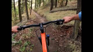
From the ridge, there are a few bermed curves and a gap jump on the left. Don't send it without scouting it (911 tree after the landing). Berms give way to a fast, flowy old school blue run at the point where Short Pants enters. A few flat corners and some off camber tread, but over all a fast and fun trail. There are a few bumps to hit along the way and the trail surface is smooth with no roots and only a coulpe of sections with small basalt cobble.

This trail is unsanctioned.

Tags
BermsFlowyJumps

Traditionally Indigenous Territory

Recent Activity on Trail

Past Week
  • 0 rides
  •  
6 Months
  • 5 rides
  • 11 miles avg distance
All
  • 104 rides
  • Last: Nov 8, 2026
c1c2c3c4
January
February
March
April
May
June
July
August
September
October
November
December
update trails status or condition

Wildcat Trail Reports

statusdatedescription
Sep 3, 2026 @ 1:08pm (America/Los_Angeles)
Sep 3, 2026
Running great after the rain last night. Trail has been reestablished below short pants where the logging damaged the trail. Do not go looking for...
Aug 23, 2026 @ 1:26pm (America/Los_Angeles)
Aug 23, 2026
Aug 23, 2026 @ 9:22am (America/Vancouver)
Aug 23, 2026
Running great. No issues. If climbing up imby to access, take the crossover. Not worth starting at the top off the road.
Mar 24, 2026 @ 9:51pm (America/Los_Angeles)
Mar 24, 2026
Running great, all clear. Great dirt today.
Nov 12, 2025 @ 3:26pm (America/Los_Angeles)
Nov 12, 2025
more »
Status:
on Sep 3, 2026
Ideal
Avg: 3.76 (10 votes)
Your vote: 0

view (382)
close
      Directions to wildcat-433488 trailhead (46.950190, -120.675920)

      Photos

      9 more »
      mtb
      158 |
      Oct 24, 2023 @ 12:33pm
      Oct 24, 2023
      mtb
      136 |
      Oct 24, 2023 @ 12:33pm
      Oct 24, 2023
      mtb
      141 |
      Oct 24, 2023 @ 12:32pm
      Oct 24, 2023
      mtb
      124 |
      Oct 24, 2023 @ 12:32pm
      Oct 24, 2023

      Videos

      3 more »
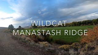
      Wildcat - Manastash Ridge - Ellensburg,...
      mtb
      9:49 | 318 | Oct 26, 2023 , Ellensburg
      Wildcat Trail Jace L
      mtb
      289 | Sep 17, 2022 , Ellensburg
      Wildcat Trail
      mtb
      18:13 | 279 | May 28, 2022 , Ellensburg
      3.9 ★★★★★
      10 Ratings
      5 ★ 30%
      4 ★ 50%
      3 ★ 10%
      2 ★
      1 ★ 10%

      4 Reviews & Comments

      hopzuki hopzuki
      FB comment on the Kittitas MTB Forum today (4/24/2025):
      "Current forest restoration efforts in the observatory area and upper wildcat trail areas are under way. We are temporarily closing access to the wildcat trail area for public safety and the safety of the forest workers. You will probably see and hear forest restoration operations in the area. There will be large equipment actively working."
      rAVadgFf
      Ok, so the trail is dry right now but the first five minutes is basically a road. Lots of machinery, not sure what is planned. It does seem like the trail has been impacted by horses, lots of little potholes. The trail needs some TLC from some trail workers, it'll jitter your bones right now.
      schwinning schwinning
      Really fun trail. This is a any time, any mood trail. An ideal blue. What all blue trails wish they were. The senders are on point. Wish the climb wasn't so long.

      We hope you've been enjoying Trailforks!

      Create a FREE account to view all trail reviews and much more.

      • #433488 - 2,500 views

      Frequently Asked Questions

      ▼ Where is Wildcat located?
      Wildcat is located in Manastash Ridge Trails, Ellensburg, Washington, United States. It is part of the Manastash Ridge Trails trail network. The trailhead is located at coordinates 46.95019, -120.67592.
      ▼ How hard is Wildcat?
      Wildcat is rated as Blue difficulty. The physical rating is Extreme. The average grade is 9.1%. The climb difficulty is rated Black Diamond.
      ▼ What is the elevation gain for Wildcat?
      Wildcat has 8 ft of elevation gain. The trail has 1,208 ft of elevation descent. The elevation ranges from 2,231 ft to 3,430 ft.
      ▼ Is Wildcat a point to point trail?
      Wildcat is not a point to point trail. The direction is Downhill Primary. The trail type is singletrack.
      ▼ How long is Wildcat?
      Wildcat is 2.5 miles long. The trail type is singletrack.
      ▼ Are dogs allowed on Wildcat?
      Yes, dogs are allowed on Wildcat. Please keep dogs on a leash where required and clean up after them.
      ▼ When is the best time of year to ride Wildcat?
      Based on activity log data, the most popular months to ride Wildcat are:
      • October (18 activities)
      • September (13 activities)
      • August (11 activities)
      Check the reports page for current trail conditions.
      ▼ How do I access Wildcat? Where is the closest parking trailhead?
      The closest parking and trailhead locations to Wildcat are: View all parking locations in the area.
      ▼ How long does it take to ride Wildcat?
      Based on recorded activities, it takes an average of 17 minutes to ride Wildcat. The trail is 2.5 miles long. Actual times will vary based on fitness level, conditions, and pace. View recent activity logs for more details.
      ▼ How busy is Wildcat?
      Wildcat is a very popular trail. There have been 373 recorded activities on this trail. The trail has received 382 check-ins. View recent activity on this trail.

      Hit the Trail

      Open in App

      Get this trail on your phone instantly.

      open trail in app

      Download Trail

      Save to wishlist, Garmin & download.
      save the trail

      Find Related Routes

      Find routes and users activities that include this trail.
      find routes for this trail

      You must enter a description before submitting.

