

more stats
1.6 miles
Distance
152 ft
Climb
-149 ft
Descent
00:15:16
Avg time
1 ft
Altitude change
798 ft
Altitude min
881 ft
Altitude max
877 ft
Altitude start
879 ft
Altitude end
-16.3%
Grade max
20.1%
Grade min
2,635 ft
Distance climb
3,205 ft
Distance down
2,730 ft
Distance flat
00:15:16
Avg time

Wildcat Details

  • Activities
    • Mountain Bike
    • E-Bike
    • Winter Fat Bike
    • Hike
    • Trail Running
    • Snowshoe
  • Riding Area
    Marquette NTN North Trails
    Marquette, Michigan
  • Difficulty Rating
  • Local Popularity
    90 in Mountain Biking heatmap [+]
    • 65 in E-Biking
    • 70 in Trail Running
    • 70 in Hiking
    • 5 in Snowshoeing
    • 5 in Winter Fat Biking
  • Global Ranking
    #71281 in Mountain Biking [+]
    • #125315 in E-Biking
    • #133006 in Trail Running
    • #124473 in Hiking
    • #18128 in Snowshoeing
    • #31856 in Winter Fat Biking
  • State Ranking
    #776 in Mountain Biking · Michigan [+]
    • #653 in E-Biking
    • #1,655 in Trail Running
    • #1,836 in Hiking
    • #866 in Snowshoeing
    • #402 in Winter Fat Biking
  • Trail Type
    Singletrack
  • Snow Grooming
    Groomed Smooth
  • Bike Type
    AM, XC, Fat
  • Climb Difficulty
    Blue
  • Physical Rating
    Hard
  • Dogs Allowed
    Yes
  • eBike Allowed
    Yes up to Class 1
  • TTFs on Trail
    Drop, Rock Face, Rock Garden
  • Land Owner
    Noquemanon Trail Network

The trail starts with a few small rock gardens and rock slabs followed by a long smooth flowy descent filled with berms. a short climb brings to another flowy descent down to the lake with a beautiful view of the hill by which Pine Knob gets its name. A slow mellow climb brings you to the start of Mildcat or stay left to return the the start of the trail.

Recent Activity on Trail

Past Week
  • 1 rides
  • 16.8 km average
6 Months
  • 150 rides
  • 52.6 km avg distance
All
  • 684 rides
  • Last: Nov 17, 2026
c1c2c3c4
January
February
March
April
May
June
July
August
September
October
November
December
update trails status or condition

Wildcat Trail Reports

statusdatedescription
Sep 7, 2026 @ 9:30am (America/Menominee)
Sep 7, 2026
May 4, 2026 @ 5:50pm (America/Detroit)
May 4, 2026
Most of the downhill is clear but the climb has a couple significant patches of snow.
Oct 14, 2025 @ 7:59pm (America/Detroit)
Oct 14, 2025
Jun 15, 2025 @ 10:09am
Jun 15, 2025
Nov 27, 2024 @ 8:42am
Nov 27, 2024
tree down where the wildcat trails meet the bench at the lake. may not be official trail. cut across next to lake.
more »
Status:
on Sep 7, 2026
Ideal
Avg: 3.99 (7 votes)
Your vote: 0

view (5,431)
close
      Directions to wildcat-95075 trailhead (46.578440, -87.471630)

      Photos

      11 more »
      mtb
      41 |
      Sep 7, 2026 @ 11:35am
      Sep 7, 2026
      mtb
      167 |
      Jun 6, 2023 @ 6:53am
      Jun 6, 2023
      mtb
      198 |
      Aug 22, 2021 @ 7:07pm
      Aug 22, 2021
      mtb
      220 |
      Aug 22, 2021 @ 7:07pm
      Aug 22, 2021

      Videos

      2 more »
      Quick view of Wildcat North Marquette trails
      mtb
      5:06 | 337 | Aug 25, 2022 , Marquette
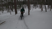
      Fat bike fail
      mtb
      0:08 | 78 | Feb 11, 2022 , Marquette

      Routes with this trail

      more »
      ★ 5.0 • 105 miles • 10,821 ft • 64 •
      Marji Gesick 100 2021 race course route
      40 miles • 3,025 ft • 20 •
      2024 Polar Roll EX route compliments of Adventure906.
      109 miles • 12,971 ft • 96 • Point to Point • Race •
      WELCOME TO DA MARJI (http://www.marjigesick.com) Test yourself against what Jeremiah Bishop called “The...
      4.2 ★★★★★
      7 Ratings
      5 ★ 43%
      4 ★ 43%
      3 ★
      2 ★ 14%
      1 ★

      1 Review & Comments

      trusstruss
      What a great loop! In doing a tour of the entire set of north trails I did two laps on this really fun section. The only part that was better was Ramblin Man. (The other time I did the whole North Trails loop we opted for Mildcat, which I recall also liking but definitely more wild with more tech.)

      We hope you've been enjoying Trailforks!

      Create a FREE account to view all trail reviews and much more.

      • By w8n2skiTF Pro NTN & contributors
      • #95075 - 3,901 views

      Frequently Asked Questions

      ▼ Where is Wildcat located?
      Wildcat is located in Marquette NTN North Trails, Marquette, Michigan, United States. It is part of the Marquette NTN North Trails trail network. The trailhead is located at coordinates 46.57844, -87.47163.
      ▼ How hard is Wildcat?
      Wildcat is rated as Blue difficulty. The physical rating is Hard. The climb difficulty is rated Blue.
      ▼ What is the elevation gain for Wildcat?
      Wildcat has 152 ft of elevation gain. The trail has 149 ft of elevation descent. The elevation ranges from 798 ft to 881 ft.
      ▼ How long is Wildcat?
      Wildcat is 1.6 miles long. The trail type is singletrack.
      ▼ Are dogs allowed on Wildcat?
      Yes, dogs are allowed on Wildcat. Please keep dogs on a leash where required and clean up after them.
      ▼ When is the best time of year to ride Wildcat?
      Based on activity log data, the most popular months to ride Wildcat are:
      • September (128 activities)
      • June (58 activities)
      • July (52 activities)
      Check the reports page for current trail conditions.
      ▼ How do I access Wildcat? Where is the closest parking trailhead?
      The closest parking and trailhead locations to Wildcat are: View all parking locations in the area.
      ▼ How long does it take to ride Wildcat?
      Based on recorded activities, it takes an average of 15 minutes to ride Wildcat. The trail is 1.6 miles long. Actual times will vary based on fitness level, conditions, and pace. View recent activity logs for more details.
      ▼ How busy is Wildcat?
      Wildcat is a very popular trail. There have been 4,334 recorded activities on this trail. The trail has received 5,431 check-ins. View recent activity on this trail.

      Hit the Trail

      Open in App

      Get this trail on your phone instantly.

      open trail in app

      Download Trail

      Save to wishlist, Garmin & download.
      save the trail

      Find Related Routes

      Find routes and users activities that include this trail.
      find routes for this trail

      You must enter a description before submitting.

