more stats
4,334 ft
Distance
-635 ft
Descent
00:08:59
Avg time
-635 ft
Altitude change
2,419 ft
Altitude min
3,056 ft
Altitude max
3,054 ft
Altitude start
2,418 ft
Altitude end
-14.7%
Grade
-43.4%
Grade max
52 ft
Distance climb
4,281 ft
Distance down
00:08:59
Avg time

Zona Bloc Details

  • Activities
    • Mountain Bike
    • E-Bike
    • Hike
    • Trail Running
  • Riding Area
    Trenkabikers La Pobla
    La Pobla de Segur
  • Ref Number
    #81
  • Difficulty Rating
  • Local Popularity
    95 in Mountain Biking heatmap [+]
    • 90 in E-Biking
    • 50 in Trail Running
    • 5 in Hiking
  • Global Ranking
    #93299 in Mountain Biking [+]
    • #1696 in E-Biking
    • #137186 in Trail Running
    • #204640 in Hiking
  • National Ranking
    #6,712 in Mountain Biking · Spain [+]
    • #735 in E-Biking
    • #11,544 in Trail Running
    • #11,893 in Hiking
  • Trail Type
    Singletrack
  • Bike Type
    AM, XC
  • Direction
    Downhill Primary
    Popular Direction Shown
  • Climb Difficulty
    Blue
  • Physical Rating
    Moderate
  • Trail Visibility
    Sometimes hard to follow
  • Dogs Allowed
    Yes
  • eBike Allowed
    Yes up to Class 1

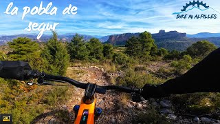
Festival de pedres i terra vermella. Trail salvatge amb passos tècnics i divertits, situat en la zona de trial de Claverol. El traçat, encara que ben definit, permet anar buscant les millors línies pels gustos de cada rider

Festival de piedras y suelo rojo. Trail salvaje con pasos técnicos y divertidos, situado en la zona de trial de Claverol. ¡El trazado, aunque bien definido, permite ir buscando las mejores líneas para los gustos de cada rider!

Festival of stones and red earth. Wild trail with technical and fun steps, located in the trial area of Claverol. The route, although well defined, allows you to look for the best lines for the tastes of each rider!

Tags
Faint trail

Local Trail Association

Recent Activity on Trail

Past Week
  • 1 rides
  • 4 miles average
6 Months
  • 19 rides
  • 24 miles avg distance
All
  • 167 rides
  • Last: Nov 16, 2026
c1c2c3c4
January
February
March
April
May
June
July
August
September
October
November
December
Status:
on Nov 16, 2026
Ideal
Avg: 4.41 (23 votes)
Your vote: 0

view (1,075)
close
      Directions to zona-bloc trailhead (42.240610, 1.000750)

      Photos

      34 more »
      mtb
      90 |
      May 26, 2026 @ 3:57am
      May 26, 2026
      mtb
      70 |
      Nov 5, 2024 @ 12:25pm
      Nov 5, 2024
      mtb
      69 |
      Nov 5, 2024 @ 12:25pm
      Nov 5, 2024
      mtb
      90 |
      Nov 5, 2024 @ 12:24pm
      Nov 5, 2024

      Videos

      3 more »
      youtuber 3a Raiers Enduro BTT - BUCARDO ENDURO BIKE -...
      mtb
      23:19 | 410 | Nov 17, 2022 , La Pobla de Segur
      Canarill trail et Zona Bloc Tremp
      ebike
      8:46 | 246 | Sep 21, 2025 , La Pobla de Segur
      La Pobla de Segur - Zona Bloc  - TC1 Raiers 2022
      ebike
      5:41 | 294 | Nov 8, 2022 , La Pobla de Segur

      Routes with this trail

      more »
      18 miles • 3,995 ft • 7 • Loop •
      CAT: Ruta per fer quasi tots els corriols de la zona de Claverol. Podràs gaudir de Canarill-Zona...
      22 miles • 4,625 ft • 8 • Loop •
      CAT: Cursa Bucardo 2022. Inicia en el tram final de Canarill, passant per Zona Bloc i Serpenti. Novament...
      27 miles • 5,330 ft • 8 • Loop •
      Sortida per la Pobla de Segur amb el CEG
      4.5 ★★★★★
      23 Ratings
      5 ★ 65%
      4 ★ 26%
      3 ★ 4%
      2 ★ 4%
      1 ★

      13 Reviews & Comments

      Matisavino Matisavino
      Fanático, trabado y fluido a la vez 🤗✨
      Muy recomendadon!
      zestyman zestyman
      A faire et refaire. Bien suivre les flèches sur les rochers.
      Eoinmacgearailt
      Brilliant trail on conglomerate slabs very technical and enjoyable

      We hope you've been enjoying Trailforks!

      Create a FREE account to view all trail reviews and much more.

      Frequently Asked Questions

      ▼ Where is Zona Bloc located?
      Zona Bloc is located in Trenkabikers La Pobla, La Pobla de Segur, Spain. It is part of the Trenkabikers La Pobla trail network. The trailhead is located at coordinates 42.24061, 1.00075.
      ▼ How hard is Zona Bloc?
      Zona Bloc is rated as Red difficulty. The physical rating is Moderate. The average grade is 14.7%. The climb difficulty is rated Blue.
      ▼ What is the elevation gain for Zona Bloc?
      The trail has 635 ft of elevation descent. The elevation ranges from 2,419 ft to 3,056 ft.
      ▼ Is Zona Bloc a point to point trail?
      Zona Bloc is not a point to point trail. The direction is Downhill Primary. The trail type is singletrack.
      ▼ How long is Zona Bloc?
      Zona Bloc is 4,334 ft long. The trail type is singletrack.
      ▼ Are dogs allowed on Zona Bloc?
      Yes, dogs are allowed on Zona Bloc. Please keep dogs on a leash where required and clean up after them.
      ▼ When is the best time of year to ride Zona Bloc?
      Based on activity log data, the most popular months to ride Zona Bloc are:
      • May (28 activities)
      • April (21 activities)
      • November (18 activities)
      Check the reports page for current trail conditions.
      ▼ How do I access Zona Bloc? Where is the closest parking trailhead?
      The closest parking and trailhead locations to Zona Bloc are: View all parking locations in the area.
      ▼ How long does it take to ride Zona Bloc?
      Based on recorded activities, it takes an average of 9 minutes to ride Zona Bloc. The trail is 4,334 ft long. Actual times will vary based on fitness level, conditions, and pace. View recent activity logs for more details.
      ▼ How busy is Zona Bloc?
      Zona Bloc is a very popular trail. There have been 1,072 recorded activities on this trail. The trail has received 1,075 check-ins. View recent activity on this trail.

      Hit the Trail

      Open in App

      Get this trail on your phone instantly.

      open trail in app

      Download Trail

      Save to wishlist, Garmin & download.
      save the trail

      Find Related Routes

      Find routes and users activities that include this trail.
      find routes for this trail

      You must enter a description before submitting.