BS Details
-
Activities
- Mountain Bike
- E-Bike
-
Riding AreaNeptune Creek
Rossland, British Columbia -
Difficulty Rating
-
Trail TypeSingletrack
-
Bike TypeDH, AM, Fat
-
DirectionDownhill OnlyPopular direction shown
-
Climb DifficultyBlue
-
Physical RatingModerate
-
Trail VisibilityAlways easy to follow
-
SeasonMay - Oct
-
Dogs AllowedYes
-
eBike AllowedYes up to Class 1
-
TTFs on TrailA-Frame, Bridge, Drop, Jump, Pump Track
-
Global Ranking#6398 in Mountain Biking
-
Local Popularity70 in Mountain Biking [+]
- 65 in E-Biking
-
OSM Way
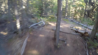
BS is a descent only trail which winds its way through the trees from Larch Ridge and connects to Monticola shortly before the Cola Coaster. The trail has multiple lines that weave through the trees which create a different riding experience on each lap as you can add in jumps and stunts as they suit you. The trail is peppered with a couple mandatory wooden features and many optional jumps which combine for a fast and flowy descent. Watch for the sign and co-ordinate with riding partners in the loop-de-loop 2/3rd of the way down the trail for a unique trail riding experience
Access Info
Park at the Larch Ridge Trail Head - Ride out 1.3km on Larch Ridge Trail and watch for the trailhead on your right marking the entrance to BS
At the bottom of BS, ride out Monticola's Cola Coaster then ascend back to the parking lot on COG
Local Trail Association
-

-

-
Please consider joining or donating to the local trail association to supportdonate to earn trail karma!
trail development & maintenance.
Traditionally Indigenous Territory
More Stats for BS mountain bike trail trail
-
Altitude change-533 ft
-
Altitude min4,329 ft
-
Altitude max4,862 ft
-
Altitude start4,862 ft
-
Altitude end4,327 ft
-
Grade-12%
-
Grade max-41.8%
-
Grade min2.6%
-
Distance climb23 ft
-
Distance down4,259 ft
-
Distance flat144 ft
-
Avg time00:07:02
-
Avg reverse time00:05:40
- view trail stats
-
Layers w
- Map Content
- More Layers
- Pro
- Pro
- Pro
- Pro
- Pro
- Pro
- Pro
- Pro
-
Upgrade to

- Unknown
- Snow Groomed
- Snow Packed
- Snow Covered
- Snow Cover Partial
- Freeze/thaw Cycle
- Icy
- Prevalent Mud
- Wet
- Variable
- Ideal
- Dry
- Very Dry
The colour categories are based on what percentage of riders are riding a trail in its intended direction.
- > 96%
- > 90%
- > 80%
- > 70%
- > 50%
- < 50%
- bi-directional trail
- no data
- < 2 days
- < 1 week
- < 2 weeks
- < 1 month
- < 6 months
- > 6 months
- Downhill Only
- Downhill Primary
- Both Directions
- Uphill Primary
- Uphill Only
- One Direction
- Description
- Photos
- Description & Photos
- Videos
- most popular
- popular
- less popular
- not popular

- mountain biking recent
- mountain biking (>6 month)
- hiking (1 year)
- moto (1 year)
- Downhill Ski
- Backcountry Ski
- Nordic Ski
- Snowmobile
Save the current map location and zoom level as your default home location whenever this page is loaded.
SaveBS Trail Reports
Recent Ridelog Activity on Trail
- 0 rides
- 0 rides
- 1,178 rides
- Last: Oct 6, 2023
Photos
Trail Lists
-
Epic Neptune Creek Ride
6 trails
Routes with this trail
Trail Products
Reviews / Comments
No reviews yet, be the first to write a review or ask a question.
Use trail reports to comment on trail conditions.
We hope you've been enjoying Trailforks!
Create a FREE account to view trail comments and much more.
Videos


Nearby Trails
- Iron Sights 856 ft
- Biathlon Loop East 928 ft
- George's Trail 1,086 ft
- Bullseye 1,093 ft
- Bullseye Access 2 1,325 ft
- By canadaka
 Trailforks & contributors
 - #2186 - 4,664 views
- follow/subscribe
- login to download gpx or kml files.
You must enter a description before submitting.