
Sierra Buttes Trail Stewardship


| Type | Trail Association |
|---|---|
| Activities |
|
| Website |
| Phone | 530-283-2426 |
|---|---|
| Geo | |
| Address |
550 Crescent Street
Quincy,
California
95971
United States

|
| Associated Group |
SBTS Sierra Buttes Trail Stewardship - Regional Admin Group
|
21
Formed in 2003, the Sierra Buttes Trail Stewardship is a volunteer driven non-profit whose primary goal is the maintenance and enhancement of the trail systems in and around Downieville, the Lakes Basin, Graeagle and Quincy.This small group has donated over 22,000 hours of volunteer labor to both the Plumas and Tahoe National Forests, maintaining over 30 trails, including the creation of 25 miles of new trails. While these trails see over 200,000 users per year, they continue to maintain a level A standing due to all the hard work of the Stewardship volunteers. This organization is not only a shining example of what a small group of dedicated, passionate people can do for an area, it is a demonstration of economic efficiency when no alternatives exist. All our product sponsors' and volunteer monies go directly to trail maintenance and development. We multiply all donations by over 1500% through organized volunteer labor in kind contributions.
Feed Posts
-
![Sierra Buttes Trail Stewardship logo]() Sierra Buttes Trail Stewardship posted an updateMother Nature has given us some generous precipitation. Brown Pow will be the main theme on trails this upcoming week. From tires to shoes to hoofs and everything in between, trail conditions will be epic. Yuba Expeditions is still running shuttles on Mt. Hough.high fives
-
![Sierra Buttes Trail Stewardship logo]() Sierra Buttes Trail Stewardship posted an update
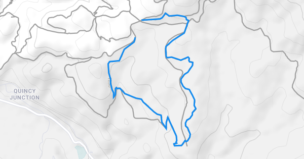 www.trailforks.comChandler Trail Trail at Mt. HoughChandler Trail is a fun rolling singletrack with several difficult rock features. There are not big drops or gaps but the natural rock formations have been used to create...1 high five
Edit Activity Log
Remove from feed
Hide Card
Follow user
Unfollow this
Follow this listing
Unfollow this listing
Mute this listing
Delete Post
Edit Post
Delete Post
Report Content
Report User
Block User
Delete Comment
Report Comment
Reply to a comment
Related Directory Listings
Riding Areas
| name | trails | total descent | highest trail | total distance |
|---|---|---|---|---|
| Beckwourth Peak Trails | 12 | -3,175 ft | 1 mile | 33 miles |
| Downieville Trail Network | 116 | -66,071 ft | 2 miles | 384 miles |
| Howland Flat Trails | 1 | -134 ft | 1 mile | 3 miles |
| Lakes Basin | 47 | -9,361 ft | 1 mile | 73 miles |
| Mills Peak | 28 | -8,269 ft | 2 miles | 56 miles |
| Mt. Hough | 67 | -31,558 ft | 1 mile | 185 miles |
| Plumas County Gravel Network | 83 | -44,523 ft | 2 miles | 515 miles |
| South Park | 17 | -4,306 ft | 4,153 ft | 27 miles |
Supported Regions
Past Events
Skillparks

Get Pro & Support This Trail Association
Get 30% off Trailforks Pro and send revenue to this trail association when you subscribe using their affiliate link.
Get 30% Off Trailforks Pro
Earn Trail Karma by Donating to the Local Trail Association
Help fund trail maintenance and development
Donate