-
DateFriday May 30, 2025toSunday June 1, 2025
past event -
TypeFestivalEnduro
-
ActivitiesMountain Bike E-Bike
-
LocationPort Gamble Forest Heritage Park United States
-
Route
-
AKACool Runnings Pro Invitational, Hot laps Enduro
-
Email
-
Website
-
RegistrationOpen Free
Festival Details:
 |
Hot Laps 2025
Location: Port Gamble, WA
Dates: May 30 - June 1, 2025
Duration: 3 Days
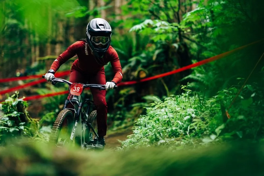
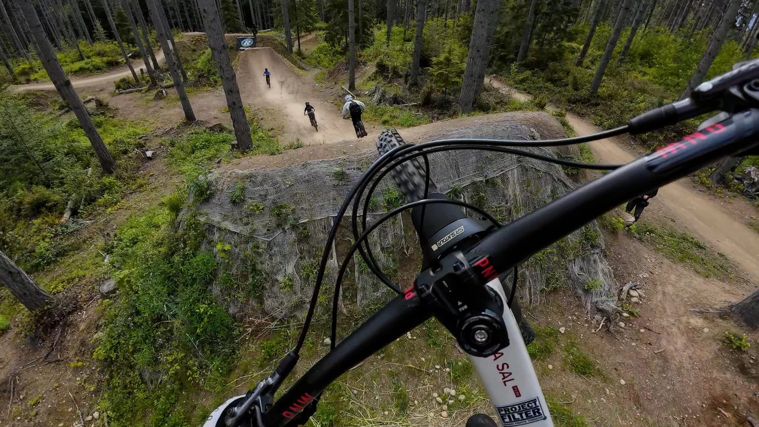
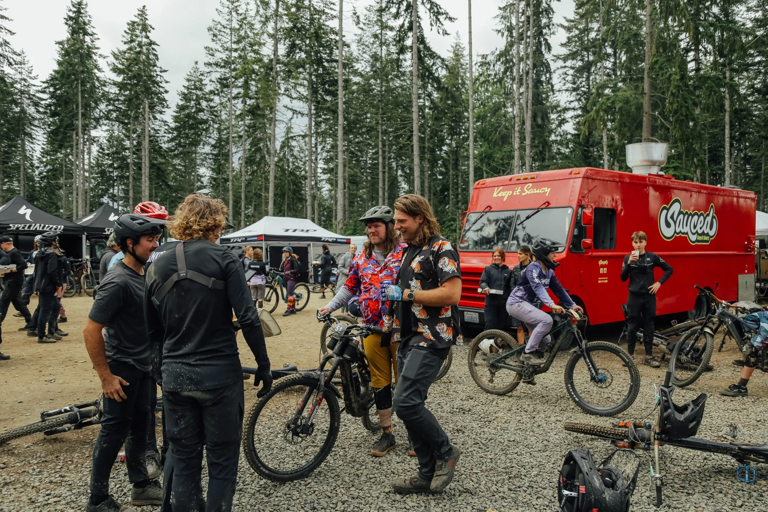
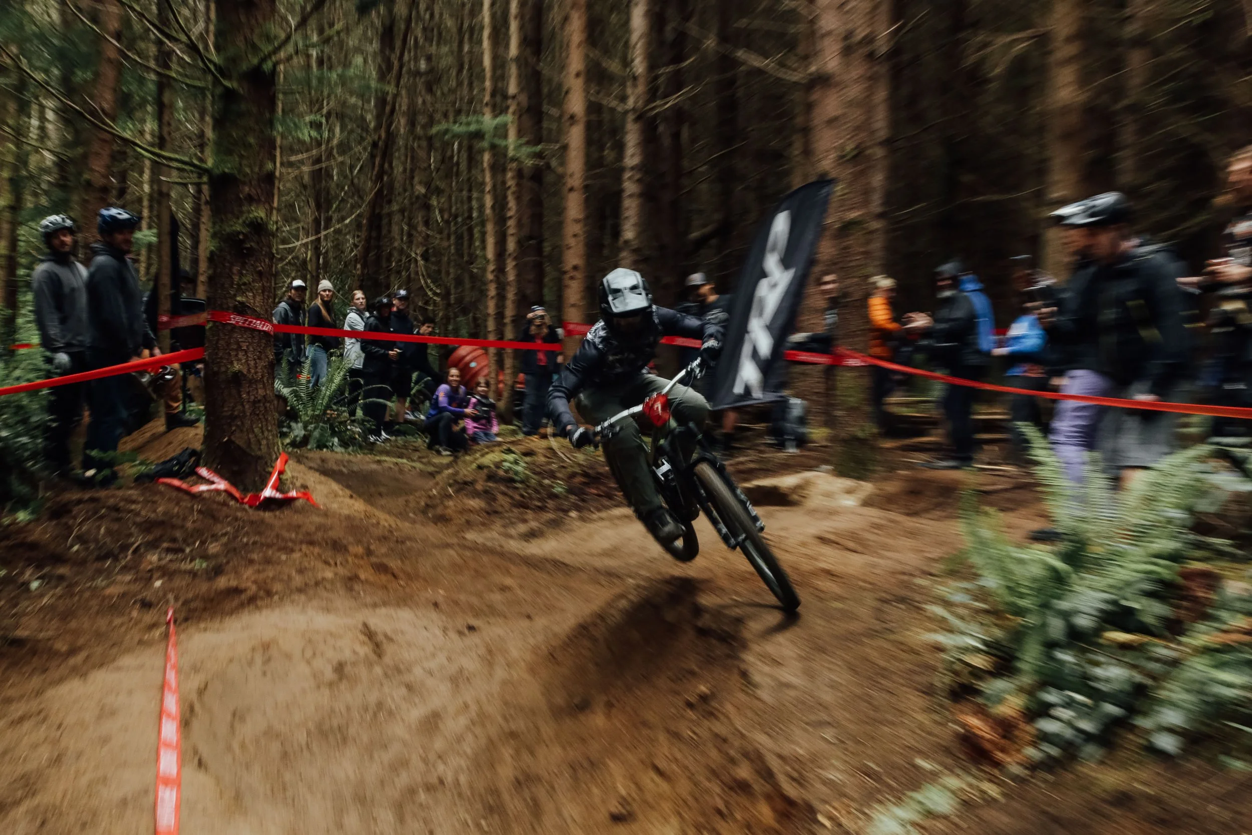
Hot Laps is the mountain bike weekend you won’t want to miss! With low-pressure "best of 3" race formats, skills sessions, jump jams, demos, and plenty of good vibes, this event is all about having fun on your bike and connecting with the community. Whether you’re sessioning stages in the Enduro trying to collect amazing stage prizes, watching top pros pin it down the Cool Runnings Slalom trail, or sending it at the Top Gun Jump Jam, Hot Laps has something for every rider, as well as Demo bikes, food trucks, and crazy raffles.
We’re not here for the stress, the suffering, or the nerves. Hot Laps is all about NO BAD TIMES—whether you’re crossing the finish line first or last, whether you’re racing hard or taking it easy. It’s about the people you ride with, the laughs you share, and the memories that stick with you long after the weekend’s over.
Event Created By:
Jill Kintner, Matt Orlando, Race Cascadia, & Co.
EVENT OFFERINGS
• Hot Laps ENDURO: Best of 3-run multi-stage Enduro. Only your best time counts.
• Cool Runnings PRO SLALOM Invitational: Best of 3 runs—single slalom, perfect for fans.
• Cool Runnings Amateur Open: Unlimited runs for 2 hours—best time wins! Categories 1-2+.
• Women’s Jump Session: Build skills, confidence, and camaraderie in this supportive session with Kat Sweet + Chelsea Kimball.
• Jump Jam: Open to all riders with a “Best Whip” contest. Free to the public!
• Demo & Vendor Row: Test bikes and gear on the park’s diverse trails.
• Food Trucks: Pizza, Filipino fusion, ice cream, coffee, and more to fuel your ride.
• Raffle: Win rad prizes and support trail building with the proceeds.
• Spectating Zones: Easy access to catch all the action.
• Camping: At nearby Kitsap Memorial State Park—just 5 miles away. Book your spot [here].
See you May 30-June 1, 2025
More info at www.hotlapsmtb.com
 |
 |
 |
Links:
Comments
Commenting is disabled for past events.
-
- Signup Link
- Download
- Subscribe
-
16interested
-
5going
Route
-
Hot Laps Pro/Open/Expert Course
close-
Layers w
- Weather Layers
- Pro
- Pro
- Pro
- Pro
- Pro
- Pro
- More Layers
- Pro
- Pro
- Pro
- Pro
-
Upgrade to

3DTrail Conditions- Unknown
- Snow Groomed
- Snow Packed
- Snow Covered
- Snow Cover Partial
- Freeze/thaw Cycle
- Icy
- Prevalent Mud
- Wet
- Variable
- Ideal
- Dry
- Very Dry
Trail Flow (Ridden Direction)Trailforks scans users ridelogs to determine the most popular direction each trail is ridden. A good flowing trail network will have most trails flowing in a single direction according to their intension.
The colour categories are based on what percentage of riders are riding a trail in its intended direction.- > 96%
- > 90%
- > 80%
- > 70%
- > 50%
- < 50%
- bi-directional trail
- no data
Trail Last RiddenTrailforks scans ridelogs to determine the last time a trail was ridden.- < 2 days
- < 1 week
- < 2 weeks
- < 1 month
- < 6 months
- > 6 months
Trail Ridden DirectionThe intended direction a trail should be ridden.- Downhill Only
- Downhill Primary
- Both Directions
- Uphill Primary
- Uphill Only
- One Direction
Contribute DetailsColors indicate trail is missing specified detail.- Description
- Photos
- Description & Photos
- Videos
Trail Popularity ?Trailforks scans ridelogs to determine which trails are ridden the most in the last 9 months. Trails are compared with nearby trails in the same city region with a possible 25 colour shades. Think of this as a heatmap, more rides = more kinetic energy = warmer colors.- most popular
- popular
- less popular
- not popular
ATV/ORV/OHV FilterMax Vehicle WidthinchesUS Cell CoverageLegend
Radar TimeActivity RecordingsTrailforks uses anonymized public activity data. ?Activity RecordingsTrailforks uses anonymized public activity data. ?Personal Heatmap▶ Activity Typesall / none▶ Options2Date range month–Winter TrailsWarning A routing network for winter maps does not exist. Selecting trails using the winter trails layer has been disabled.Missing TrailsMost PopularLeast PopularTrails are colored based on popularity. The more popular a trail is, the more red. Less popular trails trend towards green.Jump Magnitude HeatmapHeatmap of where riders jump on trails. Zoom in to see individual jumps, click circles to view jump details.BC Backroad Status
Service Road Atlas is a free to use, community-driven service for viewing and creating reports on the numerous back-country service roads around B.C. and Alberta.
![map legend]() Slope AspectDirection the slope facesTrails DeemphasizedTrails are shown in grey.Only show trails with no bike usage.Suggested LayersBased on selected activity type
Slope AspectDirection the slope facesTrails DeemphasizedTrails are shown in grey.Only show trails with no bike usage.Suggested LayersBased on selected activity typeSave the current map location and zoom level as your default home location whenever this page is loaded.
SaveTrail transparency- Singletrack
5.5 milesDistance1,030 ftClimb-1,034 ftDescent402 ftHigh Point-2 ftAltitude change117 ftAltitude min386 ftAltitude start384 ftAltitude end-54.8%Grade max32.2%Grade min3 milesDistance climb2 milesDistance down4,183 ftDistance flat -
