
-
DateSaturday June 27, 2026 at
9:00am to 2:00pm PDT
past event -
TypeRace
-
ActivitiesMountain Bike E-Bike
-
Location
-
Email
-
Website
-
RegistrationOpen Paid
-
Organizer
-
Series


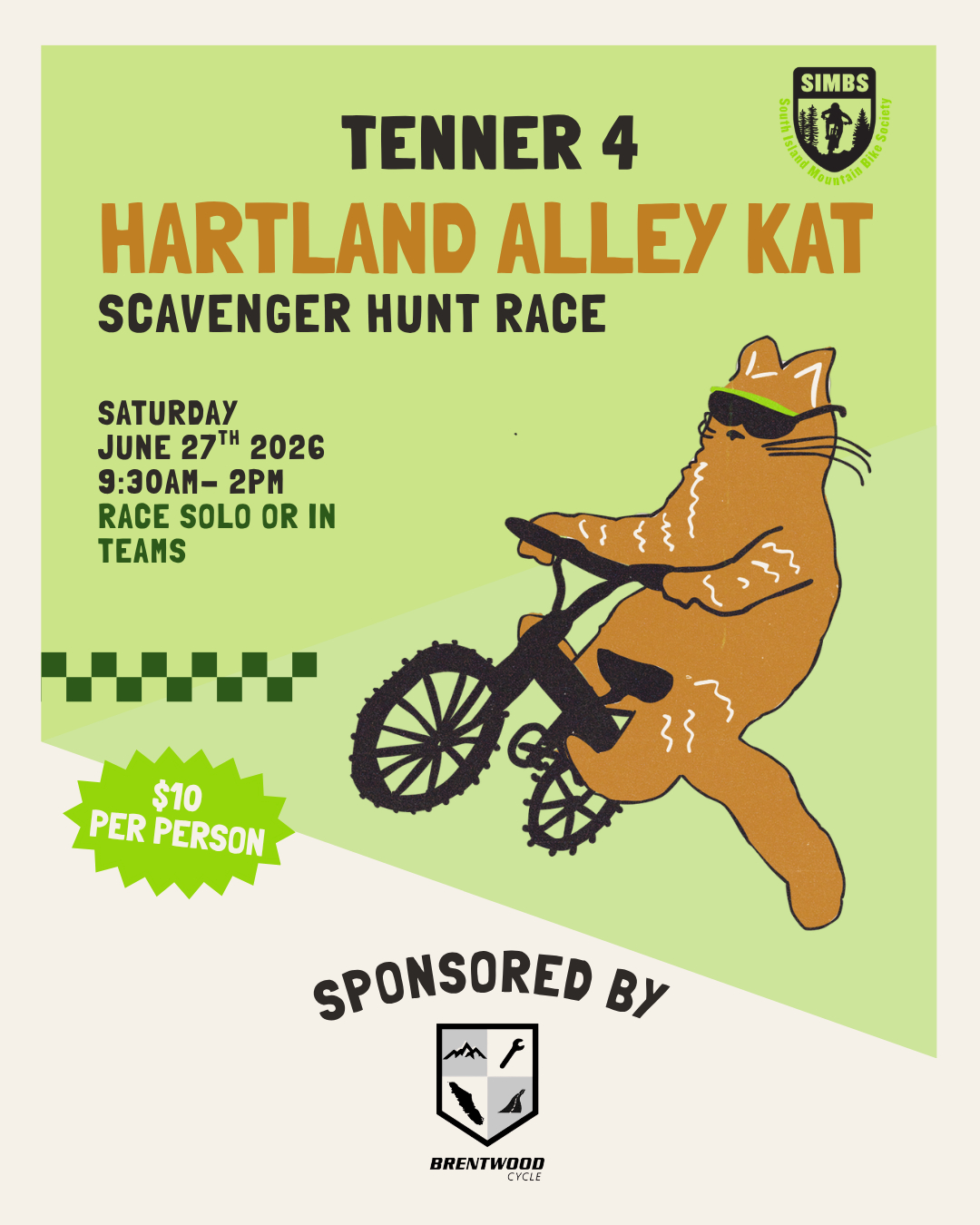
Tenner 4: Hartland Alley Kat
Come race, meet new friends, explore Hartland, and enjoy après on Saturday June 27th 2026 Sponsored by Brentwood Cycle
Want to be involved but can't race? We LOVE volunteers! Email [email protected] to let us know!
This Tenner is not your typical enduro race, it's an Alley Kat scavenger hunt style race! No route will be released prior to the event, and you will receive your check point manifest on race day!
Here is how it works:
Riders will arrive and check in. At race start all riders will be given a manifest listing all required checkpoints located throughout the Hartland Mountain Bike Park.
Racers will have 5 minutes to plan their ideal route to get to each checkpoint. Knowing the park well acts as a big advantage!
Volunteers stationed at each checkpoint will mark your progress
You can race alone or in teams. If you are racing in a team, each team member registers individually. Just make sure you all use the same team name when signing up!
Choose your adventure: Short Course (3 checkpoints) or Long Course (5 checkpoints)
What to bring:
A mountain bike: full suspension or hardtail. No gravel bikes, checkpoints are on mountain bike trails!
A phone with Trailforks downloaded — helpful if you get turned around! Download free here
Water + snacks
Schedule:
9:00am - 9:30am — Check in & registration in technical training area (TTA)
9:30am - 9:35am — Pre-race briefing
9:35am — Manifests handed out & race clock starts! ⏱️
5 minutes to plan, then riders go
10:00am - 1:00pm — RACE
11:00am - 1:00pm — Après & podiums
Parking: Parking in the Hartland Mountain Bike Park parking lots and registration in the TTA
We acknowledge and respect the W̱SÁNEĆ Peoples, on whose traditional territories we live, ride, and gather. We recognize their historic and ongoing relationship to these lands, and we are grateful to share in the places that nourish our bodies, minds, spirits, and community. You can find resources for settlers here.
Après Post race pizza celebration in the Hartland lot, sponsored by our friends at Brentwood Cycle! Riders exchange their racing bibs for food tickets at the lot.
What is a Tenner?
A Tenner is a $10 community focused race — an awesome series to get introduced to racing, meet fellow community members, and ride some of the South Island's best trails! Entry fee covers your racing cost and includes post-race food (meat, veggie, and vegan options available, gluten free on request).
Tenner registration requires an active SIMBS membership — check your status or sign up here
Comments
-
- Download
- Subscribe
-
0interested
-
0going
- Unknown
- Snow Groomed
- Snow Packed
- Snow Covered
- Snow Cover Partial
- Freeze/thaw Cycle
- Icy
- Prevalent Mud
- Wet
- Variable
- Ideal
- Dry
- Very Dry
The colour categories are based on what percentage of users are riding a trail in its intended direction.
- > 96%
- > 90%
- > 80%
- > 70%
- > 50%
- < 50%
- bi-directional trail
- no data
- < 2 days
- < 1 week
- < 2 weeks
- < 1 month
- < 6 months
- > 6 months
- Downhill Only
- Downhill Primary
- Both Directions
- Uphill Primary
- Uphill Only
- One Direction
- Description
- Photos
- Description & Photos
- Videos
- most popular
- popular
- less popular
- not popular

Service Road Atlas is a free to use, community-driven service for viewing and creating reports on the numerous back-country service roads around B.C. and Alberta.

Save the current map location and zoom level as your default home location whenever this page is loaded.
Save
 Salt Creek 24
 West Coast Cycling 2025 Membership
