-
DateSaturday August 8, 2020toSunday August 9, 2020
past event -
TypeGroup RideFreeride
-
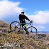
ActivitiesMountain Bike
-
Location
-
Route
-
Email
-
Website
-
Facebook
-
RegistrationOpen Paid
-
Organizer
The sunshine coast is a short (and scenic) ferry ride from Vancouver. Our first day’s ride will begin from Halfmoon Bay, only 45 minutes north of the Langdale ferry terminal;utilizing a combination of existing trail systems, deactivated forestry roads and single track trail, our route will take us (35 km-elevation gain of 700m) to Porpoise Bay. There will be festivities and overnight stay at Porpoise Bay Park (camping facilities only). Sunday, the ride will continue south out of Porpoise Bay (45 km -elevation gain is 1300 m) across Mt. Elphinstone, to Langdale and a finish-line celebration.
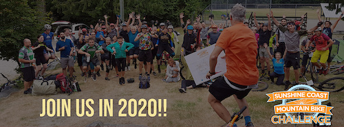
Previous participants have come from all around BC, including locals from the Sunshine Coast, and lower mainland, but also from across Canada even Europe! Ages ranged from 8 years (congrats Ben!) to a 79 year old who had 3 generations riding. Amazing! This ride has been hailed as the best point to point ride in BC!
What’s Included in the Cost of Your Trip?
INCLUDED IN REGULAR TRIP
2 nights camping (Halfmoon Bay & Porpoise Bay Park)
Breakfasts & lunches (Saturday and Sunday)
Salmon BBQ on Saturday night (w/ live music!)
Well-stocked rest stops with food and refreshments
Transportation of your overnight pack (sleeping bag, tent, change of clothes)
Commemorative T-shirt
Festivities en-route
Mechanical support
Sag service
Not Included
Mountain bike (please bring your own)
Register Early & Save!
Register by
Aug 18, 2019: $199 (for those who did it in 2019 and their friends!)
May 1, 2020: $239
Aug 1, 2020: $259
Aug 7, 2020: $279
Shuttle from Langdale to ride start (Halfmoon Bay) at CAD $20 pp:
– Friday 7:45 p.m. (Horseshoe Bay ferry departs at 7:05 pm)*
– Saturday 8:05 a.m. (Horseshoe Bay ferry departs at 7:25 am)*
*Time subject to changes (BC Ferries)
Comments
-
+ 1
 cyclenator
Aug 7, 2020 at 17:44
cyclenator
Aug 7, 2020 at 17:44
-
- Signup Link
- Download
- Subscribe
-
14interested
-
4going
Event Photos
Route
-
Sunshine Coast Trail
close-
Layers w
- Weather Layers
- Pro
- Pro
- Pro
- Pro
- Pro
- Pro
- More Layers
- Pro
- Pro
- Pro
- Pro
-
Upgrade to

3DTrail Conditions- Unknown
- Snow Groomed
- Snow Packed
- Snow Covered
- Snow Cover Partial
- Freeze/thaw Cycle
- Icy
- Prevalent Mud
- Wet
- Variable
- Ideal
- Dry
- Very Dry
Trail Flow (Ridden Direction)Trailforks scans users ridelogs to determine the most popular direction each trail is ridden. A good flowing trail network will have most trails flowing in a single direction according to their intension.
The colour categories are based on what percentage of riders are riding a trail in its intended direction.- > 96%
- > 90%
- > 80%
- > 70%
- > 50%
- < 50%
- bi-directional trail
- no data
Trail Last RiddenTrailforks scans ridelogs to determine the last time a trail was ridden.- < 2 days
- < 1 week
- < 2 weeks
- < 1 month
- < 6 months
- > 6 months
Trail Ridden DirectionThe intended direction a trail should be ridden.- Downhill Only
- Downhill Primary
- Both Directions
- Uphill Primary
- Uphill Only
- One Direction
Contribute DetailsColors indicate trail is missing specified detail.- Description
- Photos
- Description & Photos
- Videos
Trail Popularity ?Trailforks scans ridelogs to determine which trails are ridden the most in the last 9 months. Trails are compared with nearby trails in the same city region with a possible 25 colour shades. Think of this as a heatmap, more rides = more kinetic energy = warmer colors.- most popular
- popular
- less popular
- not popular
ATV/ORV/OHV FilterMax Vehicle WidthinchesUS Cell CoverageLegend
Radar TimeActivity RecordingsTrailforks uses anonymized public activity data. ?Activity RecordingsTrailforks uses anonymized public activity data. ?Personal Heatmap▶ Activity Typesall / none▶ Options2Date range month–Winter TrailsWarning A routing network for winter maps does not exist. Selecting trails using the winter trails layer has been disabled.Missing TrailsMost PopularLeast PopularTrails are colored based on popularity. The more popular a trail is, the more red. Less popular trails trend towards green.Jump Magnitude HeatmapHeatmap of where riders jump on trails. Zoom in to see individual jumps, click circles to view jump details.BC Backroad Status
Service Road Atlas is a free to use, community-driven service for viewing and creating reports on the numerous back-country service roads around B.C. and Alberta.
![map legend]() Slope AspectDirection the slope facesTrails DeemphasizedTrails are shown in grey.Only show trails with no bike usage.Suggested LayersBased on selected activity type
Slope AspectDirection the slope facesTrails DeemphasizedTrails are shown in grey.Only show trails with no bike usage.Suggested LayersBased on selected activity typeSave the current map location and zoom level as your default home location whenever this page is loaded.
SaveTrail transparency- Singletrack
- Unpaved
20.2 milesDistance2,316 ftClimb-2,218 ftDescent986 ftHigh Point97 ftAltitude change90 ftAltitude min418 ftAltitude start515 ftAltitude end0.1%Grade-34.6%Grade max37.9%Grade min9 milesDistance climb10 milesDistance down2 milesDistance flat -
