-
DateFriday April 22, 2022 at 9:00am CESTtoTuesday May 31, 2022 at 6:00pm
past event -
TypeTrail Day
-
ActivitiesMountain Bike E-Bike Horse Hike Trail Running
-
Location
-
AKATCOYT
-
Email
-
Website
-
RegistrationOpen Free
-
Organizer
-
Series
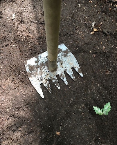
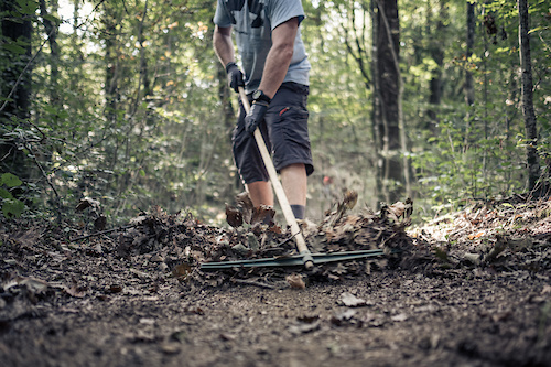
IMBA Europe è ancora una volta molto lieta di annunciare la campagna annuale “Take Care of Your Trails”, che si svolgerà dal 22 aprile al 31 maggio 2022.
La campagna “Take Care of Your Trails” di IMBA è il più grande sforzo paneuropeo di riparazione, pulizia e costruzione di sentieri. La campagna annuale TCoYT è diventata un movimento comunitario di squadre di appassionati che contribuiscono con innumerevoli ore di volontariato nel preservare i loro sentieri locali e l’ambiente naturale.
Anche se l’edizione 2021 di TCoYT è caduta durante i tempi difficili delle restrizioni covid e dei blocchi, i nostri fantastici volontari in tutta Europa hanno contribuito a 92 eventi di manutenzione, costruzione e pulizia dei sentieri in 15 paesi europei.
Più di 1000 volontari hanno contribuito a oltre 6700 ore di lavoro sui sentieri per mantenere in forma i loro sentieri locali e liberarli dai rifiuti. Un ottimo risultato viste le circostanze e le precauzioni extra che molti gruppi locali hanno dovuto adottare per rendere i loro eventi sicuri e a prova di corona virus.
L’edizione 2022 della campagna TCoYT si concentrerà sul mantenere la gli eventi locali ed inclusivi, con particolare attenzione sulla conservazione e protezione degli ambienti naturali in cui stai lavorando.
Per maggiori informazioni su come organizzare un evento TCOYT è possibile contattare IMBA Italia all'indirizzo email [email protected]
 miss-goodlife
May 8, 2022 at 4:01
miss-goodlife
May 8, 2022 at 4:01
-
- Download
- Subscribe
-
9interested
-
6going
-
Layers w
- Weather Layers
- Pro
- Pro
- Pro
- Pro
- Pro
- Pro
- More Layers
- Pro
- Pro
- Pro
- Pro
-
Upgrade to

- Unknown
- Snow Groomed
- Snow Packed
- Snow Covered
- Snow Cover Partial
- Freeze/thaw Cycle
- Icy
- Prevalent Mud
- Wet
- Variable
- Ideal
- Dry
- Very Dry
The colour categories are based on what percentage of riders are riding a trail in its intended direction.
- > 96%
- > 90%
- > 80%
- > 70%
- > 50%
- < 50%
- bi-directional trail
- no data
- < 2 days
- < 1 week
- < 2 weeks
- < 1 month
- < 6 months
- > 6 months
- Downhill Only
- Downhill Primary
- Both Directions
- Uphill Primary
- Uphill Only
- One Direction
- Description
- Photos
- Description & Photos
- Videos
- most popular
- popular
- less popular
- not popular

Service Road Atlas is a free to use, community-driven service for viewing and creating reports on the numerous back-country service roads around B.C. and Alberta.

Save the current map location and zoom level as your default home location whenever this page is loaded.
SaveEvent Photos