
-
DateSaturday February 25, 2023 at
9:00am to 7:00pm NZDT
past event -
TypeRace
-
ActivitiesMountain Bike E-Bike
-
Location
-
Website
-
RegistrationOpen Paid
-
Organizer

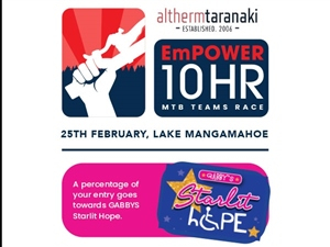
Get your entries in for the Empower 10 hour.
WHY?
Because every dollar raised will brighten someone’s day through GABBY’s STARLIT HOPE random acts of kindness.
Not everyone has the benefit of a healthy start to life so go on, get entered and support a great cause.
Details;
* Course: 4km loop that will suit all levels of riders.
* Grade 2 & 3 trails, and forestry gravel roads
* Categories:
* Solo
* 2-3-4-5 person teams
* E-Bike; any number of e-bikes puts the team in this category
*Over the 10 hour period your team rides as many laps of the course as you are able. The individual or team who completes the most laps are the winners. Emphasis is on fun
* Entry Fee:
$50 (Individual),$100 (2 person team), $150 (3 person team), $200 (4 person team), $250 (5 person team)
All proceeds go towards Gabby's Starlit Hope
Comments
-
- Signup Link
- Download
- Subscribe
-
0interested
-
0going
-
Layers w
- Weather Layers
- Pro
- Pro
- Pro
- Pro
- Pro
- Pro
- More Layers
- Pro
- Pro
- Pro
- Pro
-
Upgrade to

- Unknown
- Snow Groomed
- Snow Packed
- Snow Covered
- Snow Cover Partial
- Freeze/thaw Cycle
- Icy
- Prevalent Mud
- Wet
- Variable
- Ideal
- Dry
- Very Dry
The colour categories are based on what percentage of users are riding a trail in its intended direction.
- > 96%
- > 90%
- > 80%
- > 70%
- > 50%
- < 50%
- bi-directional trail
- no data
- < 2 days
- < 1 week
- < 2 weeks
- < 1 month
- < 6 months
- > 6 months
- Downhill Only
- Downhill Primary
- Both Directions
- Uphill Primary
- Uphill Only
- One Direction
- Description
- Photos
- Description & Photos
- Videos
- most popular
- popular
- less popular
- not popular

Service Road Atlas is a free to use, community-driven service for viewing and creating reports on the numerous back-country service roads around B.C. and Alberta.

Save the current map location and zoom level as your default home location whenever this page is loaded.
Save