Najlepsze szutry i ścieżki pod gravela w Gdańsku.
- Mountain Bike
Login to see your progress towards riding all the trails and routes in this list.
Trails
| title | riding area | rating | distance | completed | |||
|---|---|---|---|---|---|---|---|
| 1 | Altona | 2,333 ft | |||||
| 2 | Do Kamiennej Twarzy | 2,575 ft | |||||
| 3 | Do Oliwy | 797 ft | |||||
| 4 | Do VII Dworu | 1 mile | |||||
| 5 | Droga Marnych Mostów | 1 mile | |||||
| 6 | Droga Rynarzewska | 3 miles | |||||
| 7 | Droga Węglowa | 1 mile | |||||
| 8 | Droga Zielona | 1 mile | |||||
| 9 | Filolożka | 1,634 ft | |||||
| 10 | Finisz Barda | 2,740 ft | |||||
| 11 | Góra Szubieniczna | 1,857 ft | |||||
| 12 | Huzarskie Manowce | 3,707 ft | |||||
| 13 | Klesza Droga | 2 miles | |||||
| 14 | Manowce | 2 miles | |||||
| 15 | Matemblewska | 1,640 ft | |||||
| 16 | Na Pachołek | 1 mile | |||||
| 17 | Nino Szuter | 1 mile | |||||
| 18 | Orzeszki | 3,478 ft | |||||
| 19 | Posępny Dziad | 2,136 ft | |||||
| 20 | Przez Wężową Dolinę | 4,918 ft | |||||
| 21 | Przy Starszych Panach | 2,257 ft | |||||
| 22 | Skrót przy Szwedzkiej Grobli | 1,383 ft | |||||
| 23 | Starsi Panowie Dwaj | 3,015 ft | |||||
| 24 | Szwedzka Grobla Dół | 2 miles | |||||
| 25 | Szwedzka Grobla Góra | 3,297 ft | |||||
| 26 | Tatanka | 2 miles | |||||
| 27 | Tunel Pod Słowackiego | 2,418 ft | |||||
| 28 | Wąwóz Huzarów 1 | 2,172 ft | |||||
| 29 | Wąwóz Huzarów 2 | 1,496 ft | |||||
| 30 | Żółwik | 2,231 ft |
Displaying 30
Videos
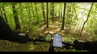
40:55 |
113 |
May 14, 2024 , Gdańsk
45:41 |
89 |
May 14, 2024 , Gdańsk
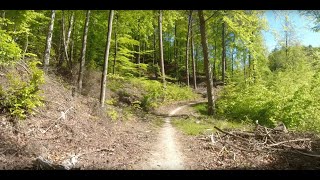
![[TPK] Tatanka](https://ev1.pinkbike.org/tf/vt/1/yvt-176804-4.jpg)
6:08 |
107 |
Aug 18, 2023 , Gdańsk
Recent Trail Reports
| status | trail | date | condition | |
|---|---|---|---|---|
| Na Pachołek | Jun 12, 2026 @ 2:17pm (Europe/Kaliningrad) Jun 12, 2026 | view | ||
| Skrót przy Szwedzkiej Grobli | Jun 6, 2026 @ 11:55am (Europe/Kaliningrad) Jun 6, 2026 | view | ||
| Szwedzka Grobla Dół | Jun 6, 2026 @ 11:55am (Europe/Kaliningrad) Jun 6, 2026 | view | ||
| Wąwóz Huzarów 2 | May 31, 2026 @ 2:06pm (Europe/Kaliningrad) May 31, 2026 | view | ||
| Przy Starszych Panach | May 31, 2026 @ 2:06pm (Europe/Kaliningrad) May 31, 2026 | view |
Total Trails
30
Total Distance
26 miles
Total Descent
-2,875 ft
Total Climb
1,774 ft
close
-
Layers w
- Weather Layers
- Pro
- Pro
- Pro
- Pro
- Pro
- Pro
- More Layers
- Pro
- Pro
- Pro
- Pro
-
Upgrade to

3D
Trail Conditions
- Unknown
- Snow Groomed
- Snow Packed
- Snow Covered
- Snow Cover Partial
- Freeze/thaw Cycle
- Icy
- Prevalent Mud
- Wet
- Variable
- Ideal
- Dry
- Very Dry
Trail Flow (Ridden Direction)
Trailforks scans users ridelogs to determine the most popular direction each trail is ridden. A good flowing trail network will have most trails flowing in a single direction according to their intension.
The colour categories are based on what percentage of riders are riding a trail in its intended direction.
The colour categories are based on what percentage of riders are riding a trail in its intended direction.
- > 96%
- > 90%
- > 80%
- > 70%
- > 50%
- < 50%
- bi-directional trail
- no data
Trail Last Ridden
Trailforks scans ridelogs to determine the last time a trail was ridden.
- < 2 days
- < 1 week
- < 2 weeks
- < 1 month
- < 6 months
- > 6 months
Trail Ridden Direction
The intended direction a trail should be ridden.
- Downhill Only
- Downhill Primary
- Both Directions
- Uphill Primary
- Uphill Only
- One Direction
Contribute Details
Colors indicate trail is missing specified detail.
- Description
- Photos
- Description & Photos
- Videos
Trail Popularity ?
Trailforks scans ridelogs to determine which trails are ridden the most in the last 9 months.
Trails are compared with nearby trails in the same city region with a possible 25 colour shades.
Think of this as a heatmap, more rides = more kinetic energy = warmer colors.
- most popular
- popular
- less popular
- not popular
ATV/ORV/OHV Filter
Max Vehicle Width
inches
US Cell Coverage
Legend

Radar Time
Activity Recordings
Trailforks uses anonymized public activity data.
?
Activity Recordings
Trailforks uses anonymized public activity data.
?
Personal Heatmap
▶
Activity Types
all
/
none
▶
Options
2
Date range
month
–
Winter Trails
Warning
A routing network for winter maps does not exist. Selecting trails using the winter trails layer has been disabled.
Missing Trails
Most Popular
Least Popular
Trails are colored based on popularity. The more popular a trail is, the more red. Less popular trails trend towards green.
Jump Magnitude Heatmap
Heatmap of where riders jump on trails. Zoom in to see individual jumps, click circles to view jump details.
BC Backroad Status
![map legend]()
Service Road Atlas is a free to use, community-driven service for viewing and creating reports on the numerous back-country service roads around B.C. and Alberta.

Slope Aspect
Direction the slope faces
Trails Deemphasized
Trails are shown in grey.
Only show trails with no bike usage.
Suggested Layers
Based on selected activity type
Save the current map location and zoom level as your default home location whenever this page is loaded.
Save
Trail transparency
Average difficulty
Trails and Routes in List - Distance by Difficulty
Trails and Routes in List - Difficulty Totals
- By kajetan1
 TRAILFORKS Poland ELFY
 - #2022 - 557 views