Raccolta di Trail che comprende tutti i trail della Tangher Area, zona di riding del Dosso di Segonzano che prende il nome dal soprannome degli abitanti di Segonzano, i Tangheri
- Mountain Bike
- E-Bike
Login to see your progress towards riding all the trails and routes in this list.
Trails
| title | riding area | rating | distance | completed | |||
|---|---|---|---|---|---|---|---|
| 1 | Tangher | 1 mile | |||||
| 2 | Terra Bruciata | 3,307 ft | |||||
| 3 | Bus Trail #2 | 3,720 ft | |||||
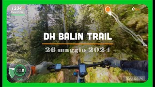
| 4 | Balin | 3,248 ft | |||||
| 5 | Caiane | 3,173 ft | |||||
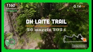
| 6 | Laite Trail | 4,990 ft | |||||
| 7 | Venticcia Trail | 2,448 ft | |||||
| 8 | Frainasa Trail | 3,537 ft | |||||
| 9 | Piz Comboni Trail | 2,644 ft | |||||
| 10 | Cuc Trail | 2,461 ft | |||||
| 11 | Busa Bassa Trail | 3,789 ft | |||||
| 12 | Gaggio - Madonna dell'Aiuto | 3,871 ft | |||||
| 13 | Marteri Trail | 3,222 ft |
Displaying 13
Videos
7:37 |
101 |
Jun 9, 2024 , Baselga di Pine'
8:22 |
99 |
Jun 9, 2024 , Baselga di Pine'
2:09 |
212 |
Apr 11, 2023 , Baselga di Pine'
Recent Trail Reports
| status | trail | date | condition | |
|---|---|---|---|---|
| Gaggio - Madonna dell'Aiuto | May 17, 2026 @ 9:41am (Europe/Vaduz) May 17, 2026 | view | ||
| Busa Bassa Trail | May 17, 2026 @ 9:41am (Europe/Vaduz) May 17, 2026 | view | ||
| Caiane | May 6, 2026 @ 4:39pm (Europe/Vaduz) May 6, 2026 | view | ||
| Piz Comboni Trail | Apr 27, 2026 @ 4:18pm (Europe/Rome) Apr 27, 2026 | view | ||
| Frainasa Trail | Apr 27, 2026 @ 4:17pm (Europe/Rome) Apr 27, 2026 | view |
Total Trails
13
Total Distance
9 miles
Total Descent
-8,376 ft
Total Climb
551 ft
close
-
Layers w
- Weather Layers
- Pro
- Pro
- Pro
- Pro
- Pro
- Pro
- More Layers
- Pro
- Pro
- Pro
- Pro
-
Upgrade to

3D
Trail Conditions
- Unknown
- Snow Groomed
- Snow Packed
- Snow Covered
- Snow Cover Partial
- Freeze/thaw Cycle
- Icy
- Prevalent Mud
- Wet
- Variable
- Ideal
- Dry
- Very Dry
Trail Flow (Ridden Direction)
Trailforks scans users ridelogs to determine the most popular direction each trail is ridden. A good flowing trail network will have most trails flowing in a single direction according to their intension.
The colour categories are based on what percentage of riders are riding a trail in its intended direction.
The colour categories are based on what percentage of riders are riding a trail in its intended direction.
- > 96%
- > 90%
- > 80%
- > 70%
- > 50%
- < 50%
- bi-directional trail
- no data
Trail Last Ridden
Trailforks scans ridelogs to determine the last time a trail was ridden.
- < 2 days
- < 1 week
- < 2 weeks
- < 1 month
- < 6 months
- > 6 months
Trail Ridden Direction
The intended direction a trail should be ridden.
- Downhill Only
- Downhill Primary
- Both Directions
- Uphill Primary
- Uphill Only
- One Direction
Contribute Details
Colors indicate trail is missing specified detail.
- Description
- Photos
- Description & Photos
- Videos
Trail Popularity ?
Trailforks scans ridelogs to determine which trails are ridden the most in the last 9 months.
Trails are compared with nearby trails in the same city region with a possible 25 colour shades.
Think of this as a heatmap, more rides = more kinetic energy = warmer colors.
- most popular
- popular
- less popular
- not popular
ATV/ORV/OHV Filter
Max Vehicle Width
inches
US Cell Coverage
Legend

Radar Time
Activity Recordings
Trailforks uses anonymized public activity data.
?
Activity Recordings
Trailforks uses anonymized public activity data.
?
Personal Heatmap
▶
Activity Types
all
/
none
▶
Options
2
Date range
month
–
Winter Trails
Warning
A routing network for winter maps does not exist. Selecting trails using the winter trails layer has been disabled.
Missing Trails
Most Popular
Least Popular
Trails are colored based on popularity. The more popular a trail is, the more red. Less popular trails trend towards green.
Jump Magnitude Heatmap
Heatmap of where riders jump on trails. Zoom in to see individual jumps, click circles to view jump details.
BC Backroad Status
![map legend]()
Service Road Atlas is a free to use, community-driven service for viewing and creating reports on the numerous back-country service roads around B.C. and Alberta.

Slope Aspect
Direction the slope faces
Trails Deemphasized
Trails are shown in grey.
Only show trails with no bike usage.
Suggested Layers
Based on selected activity type
Save the current map location and zoom level as your default home location whenever this page is loaded.
Save
Trail transparency
Average difficulty
Trails and Routes in List - Distance by Difficulty
Trails and Routes in List - Difficulty Totals
- By micheletraversi
 SGREBENZONE
 - #2096 - 159 views